
OHIO
Tanker
Current Trip
| Time Travelled | 2 days |
|---|---|
| Remaining Time | --- |
| Distance Travelled | 634.15 nm |
| Remaining Distance | --- |
| AVG Speed | 10.9 Knots |
| MAX Speed | 16.8 Knots |
| AVG Wind | 18.8 knots |
| MAX Wind | 35 knots |
| MIN Temp | 4°C / 39.2°F |
| MAX Temp | 9.7°C / 49.46°F |
| Dybgang | 11.2 m |
| Position Modtaget | 2 d siden |
Current Position
| Longitude | -125.09904° |
|---|---|
| Latitude | 46.19268° |
| Status | Under way using engine |
| Fart | 11.7 Knots |
| Kurs | 267.6° |
| Område | North Pacific Ocean |
| Station | T-AIS |
| Position Modtaget | 2 d siden |
Info
Information
The current position of OHIO is in North Pacific Ocean with coordinates 46.19268° / -125.09904° as reported on 2026-01-07 06:47 by AIS to our vessel tracker app. The vessel's current speed is 11.7 Knots and is heading at the port of HOMER. The estimated time of arrival as calculated by MyShipTracking vessel tracking app is 2026-01-10 12:00 LT
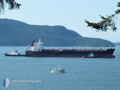
The vessel OHIO (IMO: 9704776, MMSI: 338227000) is a Tanker It's sailing under the flag of [US] USA.
In this page you can find informations about the vessels current position, last detected port calls, and current voyage information. If the vessels is not in coverage by AIS you will find the latest position.
The current position of OHIO is detected by our AIS receivers and we are not responsible for the reliability of the data. The last position was recorded while the vessel was in Coverage by the Ais receivers of our vessel tracking app.
The current draught of OHIO as reported by AIS is 11.2 meters
Weather
| Temperature | 8.7°C / 47.66°F |
|---|---|
| Wind Speed | 34 knots |
| Direction | 178° S |
| Pressure | 999.3 hPa |
| Humidity | 91.9 % |
| Cloud Coverage | 100 % |
Featured Company
Last Port Calls
| Port | Arrival | Departure | Time In Port |
|---|---|---|---|
| 2026-01-05 15:47 | 2026-01-06 12:05 | 20 h | |
| 2025-12-28 09:19 | 2026-01-01 23:07 | 4 d | |
| 2025-12-23 16:05 | 2025-12-24 00:08 | 8 h | |
| 2025-12-20 23:34 | 2025-12-23 12:23 | 2 d | |
| 2025-12-19 03:41 | 2025-12-20 19:30 | 1 d | |
| 2025-12-11 20:03 | 2025-12-14 08:55 | 2 d | |
| 2025-12-03 11:39 | 2025-12-04 18:20 | 1 d | |
| 2025-12-01 07:10 | 2025-12-01 23:55 | 16 h | |
| 2025-11-30 17:19 | 2025-12-01 03:13 | 9 h | |
| 2025-11-26 12:11 | 2025-11-28 01:53 | 1 d |
Most Visited Ports (Last year)
| Port | Arrivals | |
|---|---|---|
| 14 | ||
| 14 | ||
| 12 | ||
| 7 | ||
| 6 | ||
| 3 |
Last Trips
| Origin | Departure | Destination | Arrival | Distance | |
|---|---|---|---|---|---|
| 2026-01-01 23:07 | 2026-01-05 15:47 | 1107.49 nm | |||
| 2025-12-24 00:08 | 2025-12-28 09:19 | 1200.83 nm | |||
| 2025-12-23 12:23 | 2025-12-23 16:05 | 42.98 nm | |||
| 2025-12-20 19:30 | 2025-12-20 23:34 | 41.25 nm | |||
| 2025-12-14 08:55 | 2025-12-19 03:41 | 1377.24 nm | |||
| 2025-12-04 18:20 | 2025-12-11 20:03 | 1521.41 nm | |||
| 2025-12-01 23:55 | 2025-12-03 11:39 | 435.07 nm | |||
| 2025-12-01 03:13 | 2025-12-01 07:10 | 41.66 nm | |||
| 2025-11-28 01:53 | 2025-11-30 17:19 | 848.03 nm | |||
| 2025-11-24 12:22 | 2025-11-26 12:11 | 501.16 nm |
Events
| Tid | Hændelsen | Detaljer | Position / Dest | Info |
|---|---|---|---|---|
| 2026-01-07 06:55 | Status er ændret | Default Under way using engine |
46.19227 / -125.13663
HOMER
|
Fart: 11.7 kn Kurs: 267.6° |
| 2026-01-07 06:47 | Udenfor Dækning |
46.19268 / -125.09904
North Pacific Ocean
HOMER
|
Fart: 11.7 kn Kurs: 267.6° |
|
| 2026-01-06 20:05 | Afsejlet fra sidste havn |
|
45.65080 / -122.76694
HOMER
|
Fart: 8 kn Kurs: 30° |
| 2026-01-06 19:17 | START Sejllads |
45.56973 / -122.73518
[US] PORTLAND
|
Fart: 3.1 kn Kurs: 311° |
|
| 2026-01-06 19:00 | Dybgangen er ændret | 11.2 8.1 |
45.56701 / -122.73723
[US] PORTLAND
|
Fart: Kurs: 229° |
| 2026-01-06 19:00 | Destination er ændret | HOMER COLUMBIA RIVER |
45.56701 / -122.73723
[US] PORTLAND
|
Fart: Kurs: 229° |
| 2026-01-06 19:00 | ETA er ændret | 2026/01/10 21:00 2026/01/05 12:00 |
45.56701 / -122.73723
[US] PORTLAND
|
Fart: Kurs: 229° |
| 2026-01-06 18:55 | Dybgangen er ændret | 8.1 11.2 |
45.56700 / -122.73723
[US] PORTLAND
|
Fart: Kurs: 229° |
| 2026-01-06 18:55 | Destination er ændret | COLUMBIA RIVER HOMER |
45.56700 / -122.73723
[US] PORTLAND
|
Fart: Kurs: 229° |
| 2026-01-06 18:55 | ETA er ændret | 2026/01/05 12:00 2026/01/10 21:00 |
45.56700 / -122.73723
[US] PORTLAND
|
Fart: Kurs: 229° |