
ONUR G A
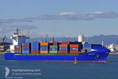
Container Ship
Current Trip
| Time Travelled | 16 h, 6 mins |
|---|---|
| Remaining Time | 10 h, 38 mins |
| Distance Travelled | 175.87 nm |
| Remaining Distance | 152.99 nm |
| AVG Speed | 12.8 Knots |
| MAX Speed | 15.3 Knots |
| AVG Wind | 16.4 knots |
| MAX Wind | 24 knots |
| MIN Temp | 3.2°C / 37.76°F |
| MAX Temp | 8.3°C / 46.94°F |
| Dybgang | 8.8 m |
| Position Modtaget | 1 h, 57 m siden |
Current Position
| Longitude | 25.59202° |
|---|---|
| Latitude | 39.54760° |
| Status | Under way using engine |
| Fart | 13.7 Knots |
| Kurs | 204.9° |
| Område | Aegean Sea |
| Station | T-AIS |
| Position Modtaget | 1 h, 57 m siden |
Info
Information
The current position of ONUR G A is in Aegean Sea with coordinates 39.54760° / 25.59202° as reported on 2025-02-05 21:17 by AIS to our vessel tracker app. The vessel's current speed is 13.7 Knots and is heading at the port of PIRAEUS. The estimated time of arrival as calculated by MyShipTracking vessel tracking app is 2025-02-06 09:53 LT
The vessel ONUR G A (IMO: 9238076, MMSI: 215424000) is a Container Ship that was built in 2001 ( 24 år gamle ). It's sailing under the flag of [MT] Malta.
In this page you can find informations about the vessels current position, last detected port calls, and current voyage information. If the vessels is not in coverage by AIS you will find the latest position.
The current position of ONUR G A is detected by our AIS receivers and we are not responsible for the reliability of the data. The last position was recorded while the vessel was in Coverage by the Ais receivers of our vessel tracking app.
The current draught of ONUR G A as reported by AIS is 8.8 meters
Weather
| Temperature | 8.1°C / 46.58°F |
|---|---|
| Wind Speed | 25 knots |
| Direction | 39° NE |
| Pressure | 1030 hPa |
| Humidity | 57.8 % |
| Cloud Coverage | 77 % |
Featured Company
Last Port Calls
| Port | Arrival | Departure | Time In Port |
|---|---|---|---|
| 2025-02-04 22:06 | 2025-02-05 07:09 | 9 h | |
| 2025-02-01 13:53 | 2025-02-02 09:17 | 19 h | |
| 2025-01-30 14:41 | 2025-01-31 20:13 | 1 d | |
| 2025-01-27 10:50 | 2025-01-27 23:29 | 12 h | |
| 2025-01-23 14:01 | 2025-01-25 04:45 | 1 d | |
| 2025-01-13 12:21 | 2025-01-14 17:21 | 1 d | |
| 2025-01-11 06:49 | 2025-01-12 18:12 | 1 d | |
| 2025-01-07 23:14 | 2025-01-08 13:28 | 14 h | |
| 2025-01-06 15:40 | 2025-01-06 23:23 | 7 h | |
| 2025-01-03 16:54 | 2025-01-05 13:35 | 1 d |
Last Trips
| Origin | Departure | Destination | Arrival | Distance | |
|---|---|---|---|---|---|
| 2025-02-02 12:17 | 2025-02-05 01:06 | 447.13 nm | |||
| 2025-02-01 00:13 | 2025-02-01 16:53 | 246.60 nm | |||
| 2025-01-28 02:29 | 2025-01-30 18:41 | 637.61 nm | |||
| 2025-01-25 06:45 | 2025-01-27 13:50 | 369.16 nm | |||
| 2025-01-14 20:21 | 2025-01-23 16:01 | 975.57 nm | |||
| 2025-01-12 22:12 | 2025-01-13 15:21 | 246.67 nm | |||
| 2025-01-08 16:28 | 2025-01-11 10:49 | 648.99 nm | |||
| 2025-01-07 02:23 | 2025-01-08 02:14 | 11.21 nm | |||
| 2025-01-05 15:35 | 2025-01-06 18:40 | 357.24 nm | |||
| 2024-12-26 00:56 | 2025-01-03 18:54 | 1034.40 nm |
Events
| Tid | Hændelsen | Detaljer | Position / Dest | Info |
|---|---|---|---|---|
| 2025-02-05 21:20 | Status er ændret | Default Under way using engine |
39.53840 / 25.58628
GR PIR
|
Fart: 13.7 kn Kurs: 204.9° |
| 2025-02-05 21:17 | Udenfor Dækning |
39.54760 / 25.59202
Aegean Sea
GR PIR
|
Fart: 13.7 kn Kurs: 204.9° |
|
| 2025-02-05 21:07 | Status er ændret | Under way using engine Default |
39.58428 / 25.61531
GR PIR
|
Fart: 13.8 kn Kurs: 207° |
| 2025-02-05 20:57 | Status er ændret | Default Under way using engine |
39.61791 / 25.63756
GR PIR
|
Fart: 13.9 kn Kurs: 206.8° |
| 2025-02-05 20:10 | Status er ændret | Under way using engine Default |
39.77777 / 25.74620
GR PIR
|
Fart: 13.9 kn Kurs: 213° |
| 2025-02-05 20:05 | Status er ændret | Default Under way using engine |
39.79402 / 25.75994
GR PIR
|
Fart: 13.8 kn Kurs: 208.1° |
| 2025-02-05 19:53 | Ændre havområde | Greek part of the Aegean Sea Turkish part of the Aegean Sea |
39.83472 / 25.78921
Aegean Sea
GR PIR
|
Fart: 13.9 kn Kurs: 210.1° |
| 2025-02-05 19:53 | Status er ændret | Under way using engine Default |
39.83472 / 25.78921
GR PIR
|
Fart: 14.4 kn Kurs: 219° |
| 2025-02-05 19:53 | Indenfor Dækning |
39.83472 / 25.78921
Aegean Sea
GR PIR
|
Fart: 13.9 kn Kurs: 210.1° |
|
| 2025-02-05 18:25 | Udenfor Dækning |
40.02458 / 26.14582
Aegean Sea
GR PIR
|
Fart: 14.9 kn Kurs: 265.4° |