
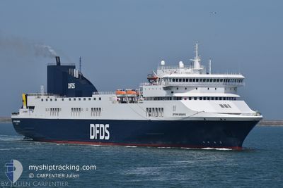
OPTIMA SEAWAYS
Ro-Ro/Passenger Ship
Current Trip
| Time Travelled | 22 h, 34 mins |
|---|---|
| Remaining Time | 47 mins |
| Distance Travelled | 411.40 nm |
| Remaining Distance | 67.48 nm |
| AVG Speed | 20 Knots |
| MAX Speed | 23.4 Knots |
| AVG Wind | 18 knots |
| MAX Wind | 25.9 knots |
| MIN Temp | 4.8°C / 40.64°F |
| MAX Temp | 8.5°C / 47.3°F |
| Dybgang | 6.4 m |
| Position Modtaget | 4 h, 58 m siden |
Current Position
| Longitude | -5.95060° |
|---|---|
| Latitude | 50.62923° |
| Status | Under way using engine |
| Fart | 17.5 Knots |
| Kurs | 353.4° |
| Område | Celtic Sea |
| Station | T-AIS |
| Position Modtaget | 4 h, 58 m siden |
Info
Information
The current position of OPTIMA SEAWAYS is in Celtic Sea with coordinates 50.62923° / -5.95060° as reported on 2025-02-09 21:45 by AIS to our vessel tracker app. The vessel's current speed is 17.5 Knots and is heading at the port of ROSSLARE. The estimated time of arrival as calculated by MyShipTracking vessel tracking app is 2025-02-10 03:30 LT
The vessel OPTIMA SEAWAYS (IMO: 9188427, MMSI: 277339000) is a Ro-Ro/Passenger Ship that was built in 1999 ( 26 år gamle ). It's sailing under the flag of [LT] Lithuania.
In this page you can find informations about the vessels current position, last detected port calls, and current voyage information. If the vessels is not in coverage by AIS you will find the latest position.
The current position of OPTIMA SEAWAYS is detected by our AIS receivers and we are not responsible for the reliability of the data. The last position was recorded while the vessel was in Coverage by the Ais receivers of our vessel tracking app.
The current draught of OPTIMA SEAWAYS as reported by AIS is 6.4 meters
Weather
| Temperature | 7.5°C / 45.5°F |
|---|---|
| Wind Speed | 23 knots |
| Direction | 58° ENE |
| Pressure | 1030.3 hPa |
| Humidity | 80.5 % |
| Cloud Coverage | 100 % |
Featured Company
Last Port Calls
| Port | Arrival | Departure | Time In Port |
|---|---|---|---|
| 2025-02-08 22:14 | 2025-02-09 04:09 | 5 h | |
| 2025-02-07 06:59 | 2025-02-07 23:01 | 16 h | |
| 2025-02-06 02:28 | 2025-02-06 08:04 | 5 h | |
| 2025-02-04 21:31 | 2025-02-05 02:47 | 5 h | |
| 2025-02-03 01:08 | 2025-02-03 20:42 | 19 h | |
| 2025-02-01 19:39 | 2025-02-02 00:30 | 4 h | |
| 2025-01-31 04:06 | 2025-01-31 20:41 | 16 h | |
| 2025-01-29 23:35 | 2025-01-30 06:07 | 6 h | |
| 2025-01-26 23:46 | 2025-01-28 23:06 | 1 d | |
| 2025-01-25 19:39 | 2025-01-26 00:14 | 4 h |
Last Trips
| Origin | Departure | Destination | Arrival | Distance | |
|---|---|---|---|---|---|
| 2025-02-07 23:01 | 2025-02-08 23:14 | 471.68 nm | |||
| 2025-02-06 09:04 | 2025-02-07 06:59 | 460.24 nm | |||
| 2025-02-05 02:47 | 2025-02-06 03:28 | 472.33 nm | |||
| 2025-02-03 21:42 | 2025-02-04 21:31 | 460.90 nm | |||
| 2025-02-02 00:30 | 2025-02-03 02:08 | 470.78 nm | |||
| 2025-01-31 21:41 | 2025-02-01 19:39 | 459.13 nm | |||
| 2025-01-30 06:07 | 2025-01-31 05:06 | 472.09 nm | |||
| 2025-01-29 00:06 | 2025-01-29 23:35 | 459.32 nm | |||
| 2025-01-26 00:14 | 2025-01-27 00:46 | 471.11 nm | |||
| 2025-01-24 15:14 | 2025-01-25 19:39 | 458.75 nm |
Events
| Tid | Hændelsen | Detaljer | Position / Dest | Info |
|---|---|---|---|---|
| 2025-02-09 21:51 | Status er ændret | Default Under way using engine |
50.66029 / -5.95609
ROSSLARE
|
Fart: 17.5 kn Kurs: 353.4° |
| 2025-02-09 21:45 | Status er ændret | Under way using engine Default |
50.62923 / -5.95060
ROSSLARE
|
Fart: 17.3 kn Kurs: 354° |
| 2025-02-09 21:45 | Udenfor Dækning |
50.62923 / -5.95060
Celtic Sea
ROSSLARE
|
Fart: 17.5 kn Kurs: 353.4° |
|
| 2025-02-09 21:43 | Status er ændret | Default Under way using engine |
50.62152 / -5.94918
ROSSLARE
|
Fart: 17.3 kn Kurs: 354° |
| 2025-02-09 19:33 | Ændre havområde | United Kingdom part of the Celtic Sea United Kingdom part of the English Channel |
49.99493 / -5.84657
Celtic Sea
ROSSLARE
|
Fart: 19.2 kn Kurs: 291.2° |
| 2025-02-09 19:33 | Status er ændret | Under way using engine Default |
49.99493 / -5.84657
ROSSLARE
|
Fart: 19.2 kn Kurs: 291° |
| 2025-02-09 18:47 | Status er ændret | Default Under way using engine |
49.95166 / -5.47170
ROSSLARE
|
Fart: 17.7 kn Kurs: 278.4° |
| 2025-02-09 18:41 | Status er ændret | Under way using engine Default |
49.94665 / -5.41656
ROSSLARE
|
Fart: 17.6 kn Kurs: 277° |
| 2025-02-09 18:19 | Status er ændret | Default Under way using engine |
49.93341 / -5.25533
ROSSLARE
|
Fart: 18.6 kn Kurs: 269.4° |
| 2025-02-09 12:21 | Status er ændret | Under way using engine Default |
50.29820 / -2.13755
ROSSLARE
|
Fart: 22.9 kn Kurs: 260° |