
OREGON HIGHWAY
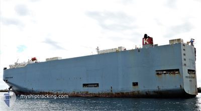
Vehicles Carrier
Current Trip
| Time Travelled | 1 day |
|---|---|
| Remaining Time | --- |
| Distance Travelled | 795.38 nm |
| Remaining Distance | --- |
| AVG Speed | 17.7 Knots |
| MAX Speed | 19.5 Knots |
| AVG Wind | 6.5 knots |
| MAX Wind | 11.5 knots |
| MIN Temp | 16.8°C / 62.24°F |
| MAX Temp | 28.5°C / 83.3°F |
| Dybgang | 8.5 m |
| Position Modtaget | 13 h, 0 m siden |
Current Position
| Longitude | -110.73071° |
|---|---|
| Latitude | 22.56794° |
| Status | Under way using engine |
| Fart | 17.8 Knots |
| Kurs | 305° |
| Område | North Pacific Ocean |
| Station | T-AIS |
| Position Modtaget | 13 h, 0 m siden |
Info
Information
The current position of OREGON HIGHWAY is in North Pacific Ocean with coordinates 22.56794° / -110.73071° as reported on 2025-03-01 00:27 by AIS to our vessel tracker app. The vessel's current speed is 17.8 Knots and is heading at the port of BENICIA. The estimated time of arrival as calculated by MyShipTracking vessel tracking app is 2025-03-04 00:00 LT
The vessel OREGON HIGHWAY (IMO: 9381665, MMSI: 352929000) is a Vehicles Carrier that was built in 2007 ( 18 år gamle ). It's sailing under the flag of [PA] Panama.
In this page you can find informations about the vessels current position, last detected port calls, and current voyage information. If the vessels is not in coverage by AIS you will find the latest position.
The current position of OREGON HIGHWAY is detected by our AIS receivers and we are not responsible for the reliability of the data. The last position was recorded while the vessel was in Coverage by the Ais receivers of our vessel tracking app.
The current draught of OREGON HIGHWAY as reported by AIS is 8.5 meters
Weather
| Temperature | 16.8°C / 62.24°F |
|---|---|
| Wind Speed | 11 knots |
| Direction | 325° NW |
| Pressure | 1014.1 hPa |
| Humidity | 79 % |
| Cloud Coverage | 100 % |
Featured Company
Last Port Calls
| Port | Arrival | Departure | Time In Port |
|---|---|---|---|
| 2025-02-26 11:43 | 2025-02-27 16:36 | 1 d | |
| 2025-02-21 21:18 | 2025-02-23 17:04 | 1 d | |
| 2025-02-01 19:31 | 2025-02-02 06:29 | 10 h |
Most Visited Ports (Last year)
| Port | Arrivals | |
|---|---|---|
| 4 | ||
| 4 | ||
| 3 | ||
| 2 | ||
| 2 | ||
| 2 |
Events
| Tid | Hændelsen | Detaljer | Position / Dest | Info |
|---|---|---|---|---|
| 2025-03-01 00:31 | Status er ændret | Default Under way using engine |
22.57854 / -110.74612
USBNC
|
Fart: 17.8 kn Kurs: 305° |
| 2025-03-01 00:27 | Udenfor Dækning |
22.56794 / -110.73071
North Pacific Ocean
USBNC
|
Fart: 17.8 kn Kurs: 305° |
|
| 2025-03-01 00:10 | Status er ændret | Under way using engine Default |
22.51694 / -110.65484
USBNC
|
Fart: 18.2 kn Kurs: 305° |
| 2025-02-28 23:46 | Status er ændret | Default Under way using engine |
22.44693 / -110.55013
USBNC
|
Fart: 17.4 kn Kurs: 305° |
| 2025-02-28 23:37 | Status er ændret | Under way using engine Default |
22.42206 / -110.51334
USBNC
|
Fart: 17.4 kn Kurs: 304° |
| 2025-02-28 23:23 | Status er ændret | Default Under way using engine |
22.38371 / -110.45274
USBNC
|
Fart: 17.6 kn Kurs: 303° |
| 2025-02-28 23:08 | Status er ændret | Under way using engine Default |
22.34066 / -110.38467
USBNC
|
Fart: 17.7 kn Kurs: 305° |
| 2025-02-28 23:08 | Indenfor Dækning |
22.34744 / -110.39514
North Pacific Ocean
USBNC
|
Fart: 17.6 kn Kurs: 304° |
|
| 2025-02-28 19:54 | Status er ændret | Default Under way using engine |
21.80416 / -109.51438
USBNC
|
Fart: 17.8 kn Kurs: 301.9° |
| 2025-02-28 19:47 | Udenfor Dækning |
21.78536 / -109.48328
North Pacific Ocean
USBNC
|
Fart: 17.8 kn Kurs: 301.9° |