
PANDA 002
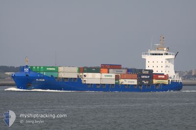
Container Ship
Current Trip
| Time Travelled | 2 days |
|---|---|
| Remaining Time | --- |
| Distance Travelled | 232.01 nm |
| Remaining Distance | --- |
| AVG Speed | 9.3 Knots |
| MAX Speed | 14.2 Knots |
| AVG Wind | 16.2 knots |
| MAX Wind | 25.3 knots |
| MIN Temp | 8.6°C / 47.48°F |
| MAX Temp | 16.1°C / 60.98°F |
| Dybgang | 5 m |
| Position Modtaget | 6 h, 49 m siden |
Current Position
| Longitude | 3.73562° |
|---|---|
| Latitude | 52.17525° |
| Status | At anchor |
| Fart | 0.3 Knots |
| Kurs | 205° |
| Område | North Sea |
| Station | T-AIS |
| Position Modtaget | 6 h, 49 m siden |
Information
The current position of PANDA 002 is in North Sea with coordinates 52.17525° / 3.73562° as reported on 2025-06-05 11:26 by AIS to our vessel tracker app. The vessel's current speed is 0.3 Knots
The vessel PANDA 002 (IMO: 9328053, MMSI: 255805843) is a Container Ship that was built in 2007 ( 18 år gamle ). It's sailing under the flag of [PT] Portugal.
In this page you can find informations about the vessels current position, last detected port calls, and current voyage information. If the vessels is not in coverage by AIS you will find the latest position.
The current position of PANDA 002 is detected by our AIS receivers and we are not responsible for the reliability of the data. The last position was recorded while the vessel was in Coverage by the Ais receivers of our vessel tracking app.
The current draught of PANDA 002 as reported by AIS is 5 meters
Weather
| Temperature | 14.4°C / 57.92°F |
|---|---|
| Wind Speed | 18 knots |
| Direction | 218° SW |
| Pressure | 1003.4 hPa |
| Humidity | 84.5 % |
| Cloud Coverage | 76 % |
Featured Company
Last Port Calls
| Port | Arrival | Departure | Time In Port |
|---|---|---|---|
| 2025-06-02 20:01 | 2025-06-03 05:47 | 9 h | |
| 2025-06-02 04:26 | 2025-06-02 05:12 | 45 m | |
| 2025-05-31 03:56 | 2025-05-31 20:57 | 17 h | |
| 2025-05-29 22:22 | 2025-05-29 22:26 | 4 m | |
| 2025-05-28 09:05 | 2025-05-29 06:06 | 21 h | |
| 2025-05-27 06:04 | 2025-05-27 19:42 | 13 h | |
| 2025-05-25 19:04 | 2025-05-26 03:37 | 8 h | |
| 2025-05-23 21:35 | 2025-05-24 07:04 | 9 h | |
| 2025-05-22 00:44 | 2025-05-22 15:34 | 14 h | |
| 2025-05-21 08:10 | 2025-05-21 13:24 | 5 h |
Most Visited Ports (Last year)
| Port | Arrivals | |
|---|---|---|
| 23 | ||
| 22 | ||
| 6 | ||
| 6 | ||
| 6 | ||
| 6 |
Last Trips
| Origin | Departure | Destination | Arrival | Distance | |
|---|---|---|---|---|---|
| 2025-06-02 05:12 | 2025-06-02 20:01 | 126.09 nm | |||
| 2025-05-31 20:57 | 2025-06-02 04:26 | 413.35 nm | |||
| 2025-05-29 22:26 | 2025-05-31 03:56 | 410.77 nm | |||
| 2025-05-29 06:06 | 2025-05-29 22:22 | 91.03 nm | |||
| 2025-05-27 19:42 | 2025-05-28 09:05 | 116.31 nm | |||
| 2025-05-26 03:37 | 2025-05-27 06:04 | 303.16 nm | |||
| 2025-05-24 07:04 | 2025-05-25 19:04 | 365.51 nm | |||
| 2025-05-22 15:34 | 2025-05-23 21:35 | 429.18 nm | |||
| 2025-05-21 13:24 | 2025-05-22 00:44 | 93.36 nm | |||
| 2025-05-20 09:29 | 2025-05-21 08:10 | 253.85 nm |
Events
| Tid | Hændelsen | Detaljer | Position / Dest | Info |
|---|---|---|---|---|
| 2025-06-05 11:29 | Status er ændret | Default At anchor |
52.17486 / 3.73613
NLRTM
|
Fart: 0.3 kn Kurs: 205° |
| 2025-06-05 11:26 | Status er ændret | At anchor Default |
52.17525 / 3.73562
NLRTM
|
Fart: 0.4 kn Kurs: 243° |
| 2025-06-05 11:26 | Udenfor Dækning |
52.17525 / 3.73562
North Sea
|
Fart: 0.3 kn Kurs: 260° |
|
| 2025-06-05 11:11 | Indenfor Dækning |
52.17525 / 3.73562
North Sea
|
Fart: 0.3 kn Kurs: 260° |
|
| 2025-06-04 06:30 | STOP Sejllads | 17.74 nm, North West of MAASVLAKTE - ROTTERDAM |
52.17345 / 3.73489
NLRTM
|
Fart: 0.3 kn Kurs: 245° |
| 2025-06-03 16:22 | Status er ændret | Default Under way using engine |
53.60760 / 5.24816
NLRTM
|
Fart: 8.3 kn Kurs: 250.7° |
| 2025-06-03 16:16 | Udenfor Dækning |
53.61200 / 5.27107
North Sea
NLRTM
|
Fart: 8.3 kn Kurs: 250.7° |
|
| 2025-06-03 14:27 | Status er ændret | Under way using engine Default |
53.70114 / 5.66967
NLRTM
|
Fart: 8.2 kn Kurs: 248° |
| 2025-06-03 14:22 | Status er ændret | Default Under way using engine |
53.70580 / 5.68872
NLRTM
|
Fart: 8.3 kn Kurs: 247.2° |
| 2025-06-03 14:09 | Status er ændret | Under way using engine Default |
53.71698 / 5.73437
NLRTM
|
Fart: 8 kn Kurs: 248° |