
PANKGRAF
Wing in ground
Current Trip
| Time Travelled | 4 days |
|---|---|
| Remaining Time | --- |
| Distance Travelled | 131.67 nm |
| Remaining Distance | --- |
| AVG Speed | 6.2 Knots |
| MAX Speed | 8.9 Knots |
| AVG Wind | 9.8 knots |
| MAX Wind | 12 knots |
| MIN Temp | 2.8°C / 37.04°F |
| MAX Temp | 9.3°C / 48.74°F |
| Dybgang | 2.4 m |
| Position Modtaget | 21 h, 2 m siden |
Current Position
| Longitude | 9.10392° |
|---|---|
| Latitude | 52.54093° |
| Status | Under way using engine |
| Fart | 6.8 Knots |
| Kurs | 356.8° |
| Område | North Sea |
| Station | T-AIS |
| Position Modtaget | 21 h, 2 m siden |
Info
Information
The current position of PANKGRAF is in North Sea with coordinates 52.54093° / 9.10392° as reported on 2025-12-14 11:31 by AIS to our vessel tracker app. The vessel's current speed is 6.8 Knots
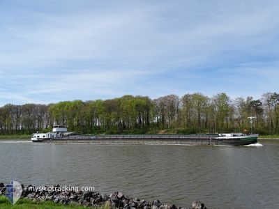
The vessel PANKGRAF (MMSI: 211500300) is a Wing in ground It's sailing under the flag of [DE] Germany.
In this page you can find informations about the vessels current position, last detected port calls, and current voyage information. If the vessels is not in coverage by AIS you will find the latest position.
The current position of PANKGRAF is detected by our AIS receivers and we are not responsible for the reliability of the data. The last position was recorded while the vessel was in Coverage by the Ais receivers of our vessel tracking app.
The current draught of PANKGRAF as reported by AIS is 2.4 meters
Weather
| Temperature | 6.7°C / 44.06°F |
|---|---|
| Wind Speed | 10 knots |
| Direction | 210° SSW |
| Pressure | 1024.7 hPa |
| Humidity | 79 % |
| Cloud Coverage | 60 % |
Featured Company
Last Port Calls
| Port | Arrival | Departure | Time In Port |
|---|---|---|---|
| 2025-12-10 13:48 | 2025-12-11 07:01 | 17 h | |
| 2025-12-07 17:57 | 2025-12-10 07:40 | 2 d | |
| 2025-12-06 09:57 | 2025-12-07 08:22 | 22 h | |
| 2025-11-29 09:49 | 2025-11-29 12:01 | 2 h | |
| 2025-11-29 07:44 | 2025-11-29 07:55 | 10 m | |
| 2025-11-28 20:08 | 2025-11-29 06:16 | 10 h | |
| 2025-11-18 19:31 | 2025-11-19 06:01 | 10 h | |
| 2025-11-18 07:57 | 2025-11-18 14:58 | 7 h | |
| 2025-11-17 18:08 | 2025-11-18 06:10 | 12 h | |
| 2025-11-17 15:48 | 2025-11-17 17:07 | 1 h |
Last Trips
| Origin | Departure | Destination | Arrival | Distance | |
|---|---|---|---|---|---|
| 2025-12-10 07:40 | 2025-12-10 13:48 | 46.11 nm | |||
| 2025-12-07 08:22 | 2025-12-07 17:57 | 64.68 nm | |||
| 2025-11-29 12:01 | 2025-12-06 09:57 | 178.54 nm | |||
| 2025-11-29 07:55 | 2025-11-29 09:49 | 6.35 nm | |||
| 2025-11-29 06:16 | 2025-11-29 07:44 | 6.30 nm | |||
| 2025-11-19 06:01 | 2025-11-28 20:08 | 384.14 nm | |||
| 2025-11-18 14:58 | 2025-11-18 19:31 | 27.22 nm | |||
| 2025-11-18 06:10 | 2025-11-18 07:57 | 8.21 nm | |||
| 2025-11-17 17:07 | 2025-11-17 18:08 | 3.41 nm | |||
| 2025-11-05 14:11 | 2025-11-17 15:48 | 487.31 nm |
Events
| Tid | Hændelsen | Detaljer | Position / Dest | Info |
|---|---|---|---|---|
| 2025-12-14 11:31 | Udenfor Dækning |
52.54093 / 9.10392
North Sea
NIENBURG
|
Fart: 6.8 kn Kurs: 356.8° |
|
| 2025-12-14 10:58 | Indenfor Dækning |
52.50257 / 9.09406
North Sea
NIENBURG
|
Fart: 5.9 kn Kurs: 318.1° |
|
| 2025-12-14 06:58 | Udenfor Dækning |
52.31331 / 8.92010
North Sea
NIENBURG
|
Fart: 4.3 kn Kurs: 3.5° |
|
| 2025-12-14 06:58 | Indenfor Dækning |
52.31331 / 8.92010
North Sea
NIENBURG
|
Fart: 4.3 kn Kurs: 3.5° |
|
| 2025-12-13 15:54 | Udenfor Dækning |
52.30247 / 8.96989
North Sea
NIENBURG
|
Fart: 4.9 kn Kurs: 287.4° |
|
| 2025-12-13 09:39 | Indenfor Dækning |
52.40869 / 9.73689
North Sea
NIENBURG
|
Fart: 5.1 kn Kurs: 296.4° |
|
| 2025-12-11 14:58 | Udenfor Dækning |
53.21288 / 10.49466
North Sea
NIENBURG
|
Fart: 4.9 kn Kurs: 170.5° |
|
| 2025-12-11 14:01 | START Sejllads | 5.32 nm, South of ARTLENBURG |
53.29044 / 10.48784
NIENBURG
|
Fart: 3.2 kn Kurs: 181.7° |
| 2025-12-11 13:41 | Status er ændret | Under way using engine Moored |
53.29241 / 10.48838
NIENBURG
|
Fart: Kurs: 511° |
| 2025-12-11 13:38 | Status er ændret | Moored Under way using engine |
53.29248 / 10.48819
NIENBURG
|
Fart: 0.8 kn Kurs: 511° |