

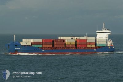
PHOENIX J
Container Ship

Current Trip
GEPTI
| Time Travelled | 5 h, 9 mins |
|---|---|
| Remaining Time | --- |
| Distance Travelled | 10.21 nm |
| Remaining Distance | --- |
| AVG Speed | 12.2 Knots |
| MAX Speed | 12.6 Knots |
| AVG Wind | 7.9 knots |
| MAX Wind | 8.4 knots |
| MIN Temp | 18.8°C / 65.84°F |
| MAX Temp | 20.4°C / 68.72°F |
| Dybgang | 7.4 m |
| Position Modtaget | 6 d siden |
Current Position
| Longitude | 29.71526° |
|---|---|
| Latitude | 41.43821° |
| Status | Under way using engine |
| Fart | 15 Knots |
| Kurs | 74.6° |
| Område | Black Sea |
| Station | T-AIS |
| Position Modtaget | 6 d siden |
Information
The current position of PHOENIX J is in Black Sea with coordinates 41.43821° / 29.71526° as reported on 2025-05-27 15:06 by AIS to our vessel tracker app. The vessel's current speed is 15 Knots
The vessel PHOENIX J (IMO: 9504047, MMSI: 305648000) is a Container Ship that was built in 2010 ( 15 år gamle ). It's sailing under the flag of [AG] Antigua Barbuda.
In this page you can find informations about the vessels current position, last detected port calls, and current voyage information. If the vessels is not in coverage by AIS you will find the latest position.
The current position of PHOENIX J is detected by our AIS receivers and we are not responsible for the reliability of the data. The last position was recorded while the vessel was in Coverage by the Ais receivers of our vessel tracking app.
The current draught of PHOENIX J as reported by AIS is 7.4 meters
Weather
| Temperature | 18.6°C / 65.48°F |
|---|---|
| Wind Speed | 8 knots |
| Direction | 266° W |
| Pressure | 1018.3 hPa |
| Humidity | 80.3 % |
| Cloud Coverage | 100 % |


Featured Company
Last Port Calls
| Port | Arrival | Departure | Time In Port |
|---|---|---|---|
| 2025-06-01 05:38 | 2025-06-02 14:46 | 1 d | |
| 2025-05-25 23:12 | 2025-05-26 16:16 | 17 h | |
| 2025-05-12 01:02 | 2025-05-23 18:32 | 11 d | |
| 2025-04-28 12:41 | 2025-05-11 23:45 | 13 d | |
| 2025-04-23 17:58 | 2025-04-24 08:06 | 14 h | |
| 2025-04-19 07:34 | 2025-04-19 19:29 | 11 h | |
| 2025-04-15 05:43 | 2025-04-16 08:14 | 1 d | |
| 2025-04-14 19:33 | 2025-04-15 03:24 | 7 h | |
| 2025-04-12 02:37 | 2025-04-12 22:10 | 19 h | |
| 2025-04-08 19:43 | 2025-04-10 00:42 | 1 d |
Most Visited Ports (Last year)
| Port | Arrivals | |
|---|---|---|
| 17 | ||
| 15 | ||
| 9 | ||
| 9 | ||
| 9 | ||
| 9 |
Last Trips
| Origin | Departure | Destination | Arrival | Distance | |
|---|---|---|---|---|---|
| 2025-05-26 16:16 | 2025-06-01 05:38 | 638.17 nm | |||
| 2025-05-23 18:32 | 2025-05-25 23:12 | 53.56 nm | |||
| 2025-05-11 23:45 | 2025-05-12 01:02 | 0.72 nm | |||
| 2025-04-24 08:06 | 2025-04-28 12:41 | 1240.57 nm | |||
| 2025-04-19 19:29 | 2025-04-23 17:58 | 847.29 nm | |||
| 2025-04-16 08:14 | 2025-04-19 07:34 | 591.11 nm | |||
| 2025-04-15 03:24 | 2025-04-15 05:43 | 23.18 nm | |||
| 2025-04-12 22:10 | 2025-04-14 19:33 | 549.64 nm | |||
| 2025-04-10 00:42 | 2025-04-12 02:37 | 581.14 nm | |||
| 2025-04-08 17:19 | 2025-04-08 19:43 | 23.14 nm |
Events
| Tid | Hændelsen | Detaljer | Position / Dest | Info |
|---|---|---|---|---|
| 2025-06-02 10:46 | Afsejlet fra sidste havn |
|
42.16800 / 41.63533
GEPTI
|
Fart: 7.7 kn Kurs: 310° |
| 2025-06-02 10:42 | START Sejllads |
42.16167 / 41.64515
[GE] POTI
|
Fart: 7.7 kn Kurs: 310° |
|
| 2025-06-01 02:02 | STOP Sejllads |
42.15417 / 41.66267
[GE] POTI
|
Fart: 0.3 kn Kurs: 53° |
|
| 2025-06-01 01:38 | Skibe i havn |
|
42.15850 / 41.64817
[GE] POTI
|
Fart: 4.6 kn Kurs: 123° |
| 2025-06-01 00:55 | START Sejllads | 2.76 nm, North West of POTI |
42.18567 / 41.60117
GEPTI
|
Fart: 7.3 kn Kurs: 206° |
| 2025-05-29 06:15 | STOP Sejllads | 2.85 nm, North West of POTI |
42.19301 / 41.60789
GEPTI
|
Fart: 0.2 kn Kurs: 170° |
| 2025-05-27 15:11 | Status er ændret | Default Under way using engine |
41.44363 / 29.74210
GEPTI
|
Fart: 15 kn Kurs: 74.6° |
| 2025-05-27 15:06 | Udenfor Dækning |
41.43821 / 29.71526
Black Sea
GEPTI
|
Fart: 15 kn Kurs: 74.6° |
|
| 2025-05-27 14:59 | Status er ændret | Under way using engine Default |
41.43092 / 29.67923
GEPTI
|
Fart: 14.9 kn Kurs: 74° |
| 2025-05-27 14:42 | Status er ændret | Default Under way using engine |
41.41213 / 29.58964
GEPTI
|
Fart: 15 kn Kurs: 73.8° |