

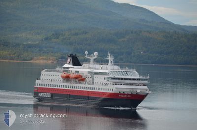
POLARLYS
Ro-Ro/Passenger Ship

Current Trip
| Trip Time | 2 h, 38 mins |
|---|---|
| Trip Distance | 36.79 nm |
| AVG Speed | 13 Knots |
| MAX Speed | 15.2 Knots |
| Dybgang | 5.1 m |
| AVG Wind | 18.3 knots |
| MAX Wind | 18.9 knots |
| MIN Temp | 5.6°C / 42.08°F |
| MAX Temp | 6.9°C / 44.42°F |
| Position Modtaget | 1 m siden |
Current Position
| Longitude | 23.66488° |
|---|---|
| Latitude | 70.66805° |
| Status | Under way using engine |
| Fart | |
| Kurs | 62° |
| Område | Norwegian Sea |
| Station | T-AIS |
| Position Modtaget | 1 m siden |
Information
The current position of POLARLYS is in Norwegian Sea with coordinates 70.66805° / 23.66488° as reported on 2025-06-02 10:44 by AIS to our vessel tracker app. The vessel's current speed is 0 Knots and is currently inside the port of HAMMERFEST.
The vessel POLARLYS (IMO: 9107796, MMSI: 259322000) is a Ro-Ro/Passenger Ship that was built in 1996 ( 29 år gamle ). It's sailing under the flag of [NO] Norway.
In this page you can find informations about the vessels current position, last detected port calls, and current voyage information. If the vessels is not in coverage by AIS you will find the latest position.
The current position of POLARLYS is detected by our AIS receivers and we are not responsible for the reliability of the data. The last position was recorded while the vessel was in Coverage by the Ais receivers of our vessel tracking app.
The current draught of POLARLYS as reported by AIS is 5.1 meters
Weather
| Temperature | 6.9°C / 44.42°F |
|---|---|
| Wind Speed | 20 knots |
| Direction | 138° SE |
| Pressure | 999.6 hPa |
| Humidity | 85.9 % |
| Cloud Coverage | 100 % |


Featured Company
Last Port Calls
| Port | Arrival | Departure | Time In Port |
|---|---|---|---|
| 2025-06-02 11:10 | |||
| 2025-06-02 08:19 | 2025-06-02 08:32 | 12 m | |
| 2025-06-02 05:43 | 2025-06-02 06:18 | 35 m | |
| 2025-06-02 03:16 | 2025-06-02 03:39 | 23 m | |
| 2025-06-02 01:10 | 2025-06-02 01:22 | 11 m | |
| 2025-06-01 22:08 | 2025-06-01 22:29 | 20 m | |
| 2025-06-01 19:52 | 2025-06-01 20:25 | 32 m | |
| 2025-06-01 15:58 | 2025-06-01 17:02 | 1 h | |
| 2025-06-01 08:57 | 2025-06-01 12:36 | 3 h | |
| 2025-06-01 03:26 | 2025-06-01 03:46 | 20 m |
Last Trips
| Origin | Departure | Destination | Arrival | Distance | |
|---|---|---|---|---|---|
| 2025-06-02 08:32 | 2025-06-02 11:10 | 36.79 nm | |||
| 2025-06-02 06:18 | 2025-06-02 08:19 | 25.95 nm | |||
| 2025-06-02 03:39 | 2025-06-02 05:43 | 28.84 nm | |||
| 2025-06-02 01:22 | 2025-06-02 03:16 | 25.51 nm | |||
| 2025-06-01 22:29 | 2025-06-02 01:10 | 34.31 nm | |||
| 2025-06-01 20:25 | 2025-06-01 22:08 | 23.27 nm | |||
| 2025-06-01 17:02 | 2025-06-01 19:52 | 38.87 nm | |||
| 2025-06-01 12:36 | 2025-06-01 15:58 | 46.99 nm | |||
| 2025-06-01 03:46 | 2025-06-01 08:57 | 65.59 nm | |||
| 2025-06-01 00:21 | 2025-06-01 03:26 | 39.15 nm |
Events
| Tid | Hændelsen | Detaljer | Position / Dest | Info |
|---|---|---|---|---|
| 2025-06-02 09:15 | STOP Sejllads |
70.66800 / 23.66493
[NO] HAMMERFEST
|
Fart: 0.3 kn Kurs: 50° |
|
| 2025-06-02 09:10 | Skibe i havn |
|
70.66429 / 23.66002
[NO] HAMMERFEST
|
Fart: 9.3 kn Kurs: 68.4° |
| 2025-06-02 08:04 | Status er ændret | Under way using engine Default |
70.85267 / 23.97456
NO BGO
|
Fart: 14.1 kn Kurs: 226° |
| 2025-06-02 08:02 | Status er ændret | Default Under way using engine |
70.85828 / 23.99272
NO BGO
|
Fart: 13.8 kn Kurs: 227° |
| 2025-06-02 06:32 | START Sejllads | 0.89 nm, East of HAVOYSUND |
70.99537 / 24.70978
NO BGO
|
Fart: 13.4 kn Kurs: 81° |
| 2025-06-02 06:32 | Afsejlet fra sidste havn |
|
70.99537 / 24.70978
NO BGO
|
Fart: 5 kn Kurs: 86° |
| 2025-06-02 06:19 | STOP Sejllads |
70.99487 / 24.68831
[NO] HAVOYSUND
|
Fart: Kurs: 83° |
|
| 2025-06-02 06:19 | Skibe i havn |
|
70.99487 / 24.68831
[NO] HAVOYSUND
|
Fart: 1.8 kn Kurs: 339° |
| 2025-06-02 04:59 | Ændre havområde | Norwegian part of the Norwegian Sea Norwegian part of the Barentsz Sea |
70.94510 / 25.49226
Norwegian Sea
NO BGO
|
Fart: 11.3 kn Kurs: 317.8° |
| 2025-06-02 04:20 | Status er ændret | Under way using engine Default |
70.95674 / 25.90304
NO BGO
|
Fart: 13.4 kn Kurs: 216° |