
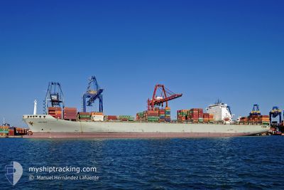
PORTO CHELI
Container Ship
Current Trip
| Time Travelled | 11 h, 37 mins |
|---|---|
| Remaining Time | 1 day |
| Distance Travelled | 103.39 nm |
| Remaining Distance | 458.53 nm |
| AVG Speed | 10.4 Knots |
| MAX Speed | 11.4 Knots |
| AVG Wind | 9.6 knots |
| MAX Wind | 11 knots |
| MIN Temp | 23.3°C / 73.94°F |
| MAX Temp | 23.9°C / 75.02°F |
| Dybgang | 10.9 m |
| Position Modtaget | 7 h, 52 m siden |
Current Position
| Longitude | -97.27016° |
|---|---|
| Latitude | 22.79360° |
| Status | Under way using engine |
| Fart | 11.4 Knots |
| Kurs | 38.3° |
| Område | Gulf of Mexico |
| Station | T-AIS |
| Position Modtaget | 7 h, 52 m siden |
Info
Information
The current position of PORTO CHELI is in Gulf of Mexico with coordinates 22.79360° / -97.27016° as reported on 2025-02-08 04:25 by AIS to our vessel tracker app. The vessel's current speed is 11.4 Knots and is heading at the port of HOUSTON. The estimated time of arrival as calculated by MyShipTracking vessel tracking app is 2025-02-10 00:08 LT
The vessel PORTO CHELI (IMO: 9221839, MMSI: 636020869) is a Container Ship that was built in 2001 ( 24 år gamle ). It's sailing under the flag of [LR] Liberia.
In this page you can find informations about the vessels current position, last detected port calls, and current voyage information. If the vessels is not in coverage by AIS you will find the latest position.
The current position of PORTO CHELI is detected by our AIS receivers and we are not responsible for the reliability of the data. The last position was recorded while the vessel was in Coverage by the Ais receivers of our vessel tracking app.
The current draught of PORTO CHELI as reported by AIS is 10.9 meters
Weather
| Temperature | 23.4°C / 74.12°F |
|---|---|
| Wind Speed | 12 knots |
| Direction | 151° SSE |
| Pressure | 1016.2 hPa |
| Humidity | 91.1 % |
| Cloud Coverage | --- |
Featured Company
Last Port Calls
| Port | Arrival | Departure | Time In Port |
|---|---|---|---|
| 2025-02-07 07:30 | 2025-02-08 00:40 | 17 h | |
| 2025-01-29 14:23 | 2025-01-30 13:04 | 22 h | |
| 2025-01-27 19:27 | 2025-01-28 02:31 | 7 h | |
| 2025-01-18 02:40 | 2025-01-18 20:26 | 17 h | |
| 2025-01-16 00:40 | 2025-01-16 12:40 | 11 h | |
| 2025-01-13 21:16 | 2025-01-14 22:03 | 1 d | |
| 2025-01-11 10:10 | 2025-01-12 02:51 | 16 h | |
| 2025-01-08 04:09 | 2025-01-10 05:48 | 2 d | |
| 2025-01-05 15:43 | 2025-01-07 02:37 | 1 d | |
| 2025-01-02 17:53 | 2025-01-05 05:05 | 2 d |
Last Trips
| Origin | Departure | Destination | Arrival | Distance | |
|---|---|---|---|---|---|
| 2025-01-30 08:04 | 2025-02-07 01:30 | 1525.91 nm | |||
| 2025-01-27 21:31 | 2025-01-29 09:23 | 177.17 nm | |||
| 2025-01-18 20:26 | 2025-01-27 14:27 | 3902.37 nm | |||
| 2025-01-16 13:40 | 2025-01-18 02:40 | 287.90 nm | |||
| 2025-01-14 23:03 | 2025-01-16 01:40 | 409.02 nm | |||
| 2025-01-12 03:51 | 2025-01-13 22:16 | 203.55 nm | |||
| 2025-01-10 06:48 | 2025-01-11 11:10 | 389.22 nm | |||
| 2025-01-07 03:37 | 2025-01-08 05:09 | 350.12 nm | |||
| 2025-01-05 06:05 | 2025-01-05 16:43 | 172.38 nm | |||
| 2024-12-30 00:31 | 2025-01-02 18:53 | 716.12 nm |
Events
| Tid | Hændelsen | Detaljer | Position / Dest | Info |
|---|---|---|---|---|
| 2025-02-08 04:30 | Status er ændret | Default Under way using engine |
22.80681 / -97.25877
USHOU
|
Fart: 11.4 kn Kurs: 38.3° |
| 2025-02-08 04:25 | Udenfor Dækning |
22.79360 / -97.27016
Gulf of Mexico
USHOU
|
Fart: 11.4 kn Kurs: 38.3° |
|
| 2025-02-08 04:06 | Status er ændret | Under way using engine Default |
22.75156 / -97.31180
USHOU
|
Fart: 11.2 kn Kurs: 52° |
| 2025-02-08 03:27 | Status er ændret | Default Under way using engine |
22.67451 / -97.41294
USHOU
|
Fart: 10.9 kn Kurs: 49.7° |
| 2025-02-08 03:00 | Status er ændret | Under way using engine Default |
22.62179 / -97.47912
USHOU
|
Fart: 10.5 kn Kurs: 49° |
| 2025-02-08 02:58 | Status er ændret | Default Under way using engine |
22.61727 / -97.48461
USHOU
|
Fart: 10.4 kn Kurs: 49.6° |
| 2025-02-08 00:40 | Afsejlet fra sidste havn |
|
22.48738 / -97.85653
USHOU
|
Fart: 7.5 kn Kurs: 89° |
| 2025-02-08 00:21 | START Sejllads |
22.47758 / -97.88609
[MX] ALTAMIRA
|
Fart: 3.2 kn Kurs: 347° |
|
| 2025-02-08 00:16 | Status er ændret | Under way using engine Moored |
22.47586 / -97.88491
[MX] ALTAMIRA
|
Fart: Kurs: 346° |
| 2025-02-07 23:42 | Dybgangen er ændret | 10.9 11 |
22.47584 / -97.88477
[MX] ALTAMIRA
|
Fart: 0.1 kn Kurs: 346° |