

PUNTA ALJIBE
Fishing

Current Trip
SANTA POLA
| Time Travelled | --- |
|---|---|
| Remaining Time | --- |
| Distance Travelled | 0.39 nm |
| Remaining Distance | --- |
| AVG Speed | --- |
| MAX Speed | --- |
| AVG Wind | 7.1 knots |
| MAX Wind | 18.7 knots |
| MIN Temp | 19.5°C / 67.1°F |
| MAX Temp | 26.4°C / 79.52°F |
| Dybgang | 0 m |
| Position Modtaget | 8 h, 4 m siden |
Current Position
| Longitude | -0.56079° |
|---|---|
| Latitude | 38.18638° |
| Status | Engaged in Fishing |
| Fart | |
| Kurs | --- |
| Område | Mediterranean Sea - Western Basin |
| Station | T-AIS |
| Position Modtaget | 8 h, 4 m siden |
Information
The current position of PUNTA ALJIBE is in Mediterranean Sea - Western Basin with coordinates 38.18638° / -0.56079° as reported on 2025-03-29 13:35 by AIS to our vessel tracker app. The vessel's current speed is 0 Knots
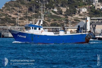
The vessel PUNTA ALJIBE (MMSI: 224074660) is a Fishing It's sailing under the flag of [ES] Spain.
In this page you can find informations about the vessels current position, last detected port calls, and current voyage information. If the vessels is not in coverage by AIS you will find the latest position.
The current position of PUNTA ALJIBE is detected by our AIS receivers and we are not responsible for the reliability of the data. The last position was recorded while the vessel was in Coverage by the Ais receivers of our vessel tracking app.
Weather
| Temperature | 20.8°C / 69.44°F |
|---|---|
| Wind Speed | 11 knots |
| Direction | 345° NNW |
| Pressure | 1015.3 hPa |
| Humidity | 32.5 % |
| Cloud Coverage | 5 % |


Featured Company
Last Port Calls
Most Visited Ports (Last year)
| Port | Arrivals | |
|---|---|---|
| 3 | ||
| 2 | ||
| 1 | ||
| 1 | ||
| 1 |
Last Trips
| Origin | Departure | Destination | Arrival | Distance |
|---|
Events
| Tid | Hændelsen | Detaljer | Position / Dest | Info |
|---|---|---|---|---|
| 2025-03-29 13:35 | Udenfor Dækning |
38.18638 / -.56079
Mediterranean Sea - Western Basin
|
Fart: Kurs: 145.7° |
|
| 2025-03-29 07:21 | Indenfor Dækning |
38.18633 / -.56081
Mediterranean Sea - Western Basin
|
Fart: Kurs: 225.4° |
|
| 2025-03-28 17:54 | Udenfor Dækning |
38.18645 / -.56085
Mediterranean Sea - Western Basin
|
Fart: Kurs: 8.5° |
|
| 2025-03-28 15:53 | STOP Sejllads | 8.71 nm, South of ALICANTE |
38.18664 / -.56118
SANTA POLA
|
Fart: 0.2 kn Kurs: 511° |
| 2025-03-28 15:41 | START Sejllads | 9.63 nm, South West of ALICANTE |
38.17566 / -.57890
SANTA POLA
|
Fart: 6.7 kn Kurs: 55.9° |
| 2025-03-28 13:47 | STOP Sejllads | 10.37 nm, South West of ALICANTE |
38.16541 / -.58823
SANTA POLA
|
Fart: 0.3 kn Kurs: 511° |
| 2025-03-28 13:19 | START Sejllads | 8.8 nm, South of ALICANTE |
38.18585 / -.56426
SANTA POLA
|
Fart: 8 kn Kurs: 256.3° |
| 2025-03-28 11:21 | STOP Sejllads | 8.72 nm, South of ALICANTE |
38.18619 / -.56071
SANTA POLA
|
Fart: 0.2 kn Kurs: 511° |
| 2025-03-28 09:48 | Indenfor Dækning |
38.00014 / -.41581
Mediterranean Sea - Western Basin
|
Fart: 8.7 kn Kurs: 327.1° |
|
| 2025-03-28 05:42 | Udenfor Dækning |
37.93586 / -.32718
Mediterranean Sea - Western Basin
|
Fart: 9.2 kn Kurs: 131.1° |