
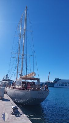
RHEA
Sailing
Current Trip
| Time Travelled | 7 days |
|---|---|
| Remaining Time | 1 h, 22 mins |
| Distance Travelled | 305.39 nm |
| Remaining Distance | 19.87 nm |
| AVG Speed | 6.9 Knots |
| MAX Speed | 11.7 Knots |
| AVG Wind | 17.2 knots |
| MAX Wind | 22 knots |
| MIN Temp | 24.4°C / 75.92°F |
| MAX Temp | 27.5°C / 81.5°F |
| Dybgang | 4.5 m |
| Position Modtaget | 1 m siden |
Current Position
| Longitude | -60.89653° |
|---|---|
| Latitude | 14.43724° |
| Status | At anchor |
| Fart | 0.1 Knots |
| Kurs | 62° |
| Område | Caribbean Sea |
| Station | T-AIS |
| Position Modtaget | 1 m siden |
Info
Information
The current position of RHEA is in Caribbean Sea with coordinates 14.43724° / -60.89653° as reported on 2025-02-15 00:58 by AIS to our vessel tracker app. The vessel's current speed is 0.1 Knots and is heading at the port of FORT DE FRANCE. The estimated time of arrival as calculated by MyShipTracking vessel tracking app is 2025-02-15 02:21 LT
The vessel RHEA (IMO: 982455200, MMSI: 244060297) is a Sailing It's sailing under the flag of [NL] Netherlands.
In this page you can find informations about the vessels current position, last detected port calls, and current voyage information. If the vessels is not in coverage by AIS you will find the latest position.
The current position of RHEA is detected by our AIS receivers and we are not responsible for the reliability of the data. The last position was recorded while the vessel was in Coverage by the Ais receivers of our vessel tracking app.
The current draught of RHEA as reported by AIS is 4.5 meters
Weather
| Temperature | 24.7°C / 76.46°F |
|---|---|
| Wind Speed | 16 knots |
| Direction | 72° ENE |
| Pressure | 1016.1 hPa |
| Humidity | 78.7 % |
| Cloud Coverage | 99 % |
Featured Company
Last Port Calls
| Port | Arrival | Departure | Time In Port |
|---|---|---|---|
| 2025-02-06 22:11 | 2025-02-07 15:08 | 16 h | |
| 2025-01-19 20:14 | 2025-01-20 13:49 | 17 h | |
| 2025-01-13 11:18 | 2025-01-13 11:28 | 9 m | |
| 2025-01-12 23:37 | 2025-01-13 10:39 | 11 h | |
| 2025-01-12 16:29 | 2025-01-12 19:29 | 2 h | |
| 2025-01-08 20:34 | 2025-01-09 13:32 | 16 h | |
| 2025-01-03 05:33 | 2025-01-04 13:48 | 1 d |
Most Visited Ports (Last year)
| Port | Arrivals | |
|---|---|---|
| 6 | ||
| 6 | ||
| 5 | ||
| 5 | ||
| 5 | ||
| 4 |
Last Trips
| Origin | Departure | Destination | Arrival | Distance | |
|---|---|---|---|---|---|
| 2025-01-20 09:49 | 2025-02-06 18:11 | 572.83 nm | |||
| 2025-01-13 07:28 | 2025-01-19 16:14 | 251.58 nm | |||
| 2025-01-13 06:39 | 2025-01-13 07:18 | 2.26 nm | |||
| 2025-01-12 15:29 | 2025-01-12 19:37 | 15.76 nm | |||
| 2025-01-09 09:32 | 2025-01-12 12:29 | 25.46 nm | |||
| 2025-01-04 09:48 | 2025-01-08 16:34 | 46.86 nm | |||
| 2024-11-29 08:30 | 2025-01-03 01:33 | 3070.45 nm |
Events
| Tid | Hændelsen | Detaljer | Position / Dest | Info |
|---|---|---|---|---|
| 2025-02-14 23:07 | Status er ændret | At anchor Under way using engine |
14.43691 / -60.89624
MARTINIQUE
|
Fart: 0.2 kn Kurs: 3° |
| 2025-02-14 23:06 | STOP Sejllads | 2.34 nm, South West of LE MARIN |
14.43684 / -60.89612
MARTINIQUE
|
Fart: 0.2 kn Kurs: 3° |
| 2025-02-14 18:47 | Dybgangen er ændret | 4.5 4 |
14.69751 / -61.22765
MARTINIQUE
|
Fart: 6.8 kn Kurs: 162.3° |
| 2025-02-14 18:47 | ETA er ændret | 2025/02/14 17:00 |
14.69751 / -61.22765
MARTINIQUE
|
Fart: 6.8 kn Kurs: 162.3° |
| 2025-02-14 16:07 | Ændre havområde | Guadeloupe and Martinique part of the Caribbean Sea Dominican part of the Caribbean Sea |
15.00185 / -61.36432
Caribbean Sea
|
Fart: 9 kn Kurs: 149.5° |
| 2025-02-14 15:18 | Dybgangen er ændret | 4 4.5 |
15.11199 / -61.40745
MARTINIQUE
|
Fart: 6.9 kn Kurs: 169° |
| 2025-02-14 15:18 | Destination er ændret | MARTINIQUE GUADELOUPE |
15.11199 / -61.40745
MARTINIQUE
|
Fart: 6.9 kn Kurs: 169° |
| 2025-02-14 10:37 | Indenfor Dækning |
15.54298 / -61.48682
Caribbean Sea
|
Fart: 7.2 kn Kurs: 190° |
|
| 2025-02-14 01:12 | Udenfor Dækning |
15.57775 / -61.46653
Caribbean Sea
|
Fart: 0.2 kn Kurs: 39.2° |
|
| 2025-02-14 01:00 | Indenfor Dækning |
15.57787 / -61.46647
Caribbean Sea
|
Fart: 0.2 kn Kurs: 186° |