

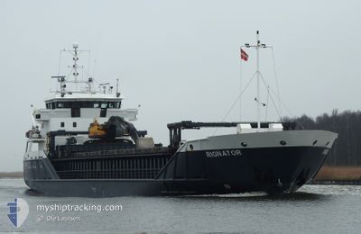
RIGNATOR
General Cargo

Current Trip
| Time Travelled | 1 day |
|---|---|
| Remaining Time | --- |
| Distance Travelled | 122.41 nm |
| Remaining Distance | --- |
| AVG Speed | 8.7 Knots |
| MAX Speed | 13.9 Knots |
| AVG Wind | 5.5 knots |
| MAX Wind | 12 knots |
| MIN Temp | 2.6°C / 36.68°F |
| MAX Temp | 6.2°C / 43.16°F |
| Dybgang | 3.8 m |
| Position Modtaget | 4 m siden |
Current Position
| Longitude | 19.02174° |
|---|---|
| Latitude | 69.70093° |
| Status | Moored |
| Fart | |
| Kurs | 187° |
| Område | Norwegian Sea |
| Station | T-AIS |
| Position Modtaget | 4 m siden |
Information
The current position of RIGNATOR is in Norwegian Sea with coordinates 69.70093° / 19.02174° as reported on 2025-06-01 10:05 by AIS to our vessel tracker app. The vessel's current speed is 0 Knots
The vessel RIGNATOR (IMO: 9224116, MMSI: 257798800) is a General Cargo that was built in 2001 ( 24 år gamle ). It's sailing under the flag of [NO] Norway.
In this page you can find informations about the vessels current position, last detected port calls, and current voyage information. If the vessels is not in coverage by AIS you will find the latest position.
The current position of RIGNATOR is detected by our AIS receivers and we are not responsible for the reliability of the data. The last position was recorded while the vessel was in Coverage by the Ais receivers of our vessel tracking app.
The current draught of RIGNATOR as reported by AIS is 3.8 meters
Weather
| Temperature | 3.8°C / 38.84°F |
|---|---|
| Wind Speed | 4 knots |
| Direction | 80° E |
| Pressure | 1010.8 hPa |
| Humidity | 88.8 % |
| Cloud Coverage | 100 % |


Featured Company
Last Port Calls
| Port | Arrival | Departure | Time In Port |
|---|---|---|---|
| 2025-05-31 01:10 | 2025-05-31 02:29 | 1 h | |
| 2025-05-27 19:53 | 2025-05-27 20:06 | 12 m | |
| 2025-05-19 15:22 | 2025-05-19 22:41 | 7 h | |
| 2025-05-19 03:45 | 2025-05-19 11:44 | 7 h | |
| 2025-05-16 16:43 | 2025-05-17 15:03 | 22 h | |
| 2025-05-15 01:51 | 2025-05-15 09:03 | 7 h | |
| 2025-05-13 04:37 | 2025-05-13 11:39 | 7 h | |
| 2025-05-09 04:21 | 2025-05-09 11:34 | 7 h | |
| 2025-05-07 06:09 | 2025-05-08 15:46 | 1 d | |
| 2025-05-03 09:53 | 2025-05-05 22:59 | 2 d |
Last Trips
| Origin | Departure | Destination | Arrival | Distance | |
|---|---|---|---|---|---|
| 2025-05-27 20:06 | 2025-05-31 01:10 | 391.61 nm | |||
| 2025-05-19 22:41 | 2025-05-27 19:53 | 1031.18 nm | |||
| 2025-05-19 11:44 | 2025-05-19 15:22 | 32.12 nm | |||
| 2025-05-17 15:03 | 2025-05-19 03:45 | 215.10 nm | |||
| 2025-05-15 09:03 | 2025-05-16 16:43 | 70.52 nm | |||
| 2025-05-13 11:39 | 2025-05-15 01:51 | 117.54 nm | |||
| 2025-05-09 11:34 | 2025-05-13 04:37 | 507.84 nm | |||
| 2025-05-08 15:46 | 2025-05-09 04:21 | 96.20 nm | |||
| 2025-05-05 22:59 | 2025-05-07 06:09 | 302.39 nm | |||
| 2025-04-28 21:14 | 2025-05-03 09:53 | 404.03 nm |
Events
| Tid | Hændelsen | Detaljer | Position / Dest | Info |
|---|---|---|---|---|
| 2025-06-01 09:52 | Dybgangen er ændret | 3.8 3 |
69.70096 / 19.02167
NO TOS
|
Fart: Kurs: 187° |
| 2025-06-01 09:52 | ETA er ændret | 2025/06/01 02:00 |
69.70096 / 19.02167
NO TOS
|
Fart: Kurs: 187° |
| 2025-06-01 09:46 | Dybgangen er ændret | 3 3.8 |
69.70092 / 19.02169
NO TOS
|
Fart: Kurs: 187° |
| 2025-06-01 09:40 | Dybgangen er ændret | 3.8 3 |
69.70093 / 19.02171
NO TOS
|
Fart: Kurs: 187° |
| 2025-06-01 09:40 | ETA er ændret | 2025/06/01 02:00 |
69.70093 / 19.02171
NO TOS
|
Fart: Kurs: 187° |
| 2025-06-01 09:34 | Dybgangen er ændret | 3 3.8 |
69.70092 / 19.02171
NO TOS
|
Fart: Kurs: 187° |
| 2025-06-01 09:28 | Dybgangen er ændret | 3.8 3 |
69.70092 / 19.02175
NO TOS
|
Fart: Kurs: 186° |
| 2025-06-01 09:28 | ETA er ændret | 2025/06/01 02:00 |
69.70092 / 19.02175
NO TOS
|
Fart: Kurs: 186° |
| 2025-06-01 09:16 | Dybgangen er ændret | 3 3.8 |
69.70092 / 19.02175
NO TOS
|
Fart: Kurs: 187° |
| 2025-06-01 09:10 | Dybgangen er ændret | 3.8 3 |
69.70093 / 19.02168
NO TOS
|
Fart: Kurs: 186° |