

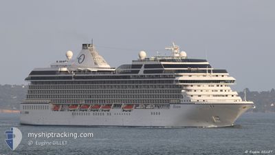
RIVIERA
Passengers Ship

Current Trip
| Time Travelled | 1 day |
|---|---|
| Remaining Time | 12 mins |
| Distance Travelled | 600.42 nm |
| Remaining Distance | 6.80 nm |
| AVG Speed | 14.6 Knots |
| MAX Speed | 19.7 Knots |
| AVG Wind | 14.5 knots |
| MAX Wind | 33.3 knots |
| MIN Temp | 8.3°C / 46.94°F |
| MAX Temp | 15.7°C / 60.26°F |
| Dybgang | 7.2 m |
| Position Modtaget | 4 h, 48 m siden |
Current Position
| Longitude | -132.33251° |
|---|---|
| Latitude | 54.43727° |
| Status | Under way using engine |
| Fart | 11.4 Knots |
| Kurs | 5.9° |
| Område | The Coastal Waters of Southeast Alaska and British Columbia |
| Station | T-AIS |
| Position Modtaget | 4 h, 48 m siden |
Information
The current position of RIVIERA is in The Coastal Waters of Southeast Alaska and British Columbia with coordinates 54.43727° / -132.33251° as reported on 2025-05-31 10:30 by AIS to our vessel tracker app. The vessel's current speed is 11.4 Knots and is heading at the port of KLAWOCK. The estimated time of arrival as calculated by MyShipTracking vessel tracking app is 2025-05-31 07:31 LT
The vessel RIVIERA (IMO: 9438078, MMSI: 538004353) is a Passengers Ship that was built in 2012 ( 13 år gamle ). It's sailing under the flag of [MH] Marshall Is.
In this page you can find informations about the vessels current position, last detected port calls, and current voyage information. If the vessels is not in coverage by AIS you will find the latest position.
The current position of RIVIERA is detected by our AIS receivers and we are not responsible for the reliability of the data. The last position was recorded while the vessel was in Coverage by the Ais receivers of our vessel tracking app.
The current draught of RIVIERA as reported by AIS is 7.2 meters
Weather
| Temperature | 8.6°C / 47.48°F |
|---|---|
| Wind Speed | 15 knots |
| Direction | 241° WSW |
| Pressure | 1016 hPa |
| Humidity | 95.7 % |
| Cloud Coverage | 100 % |


Featured Company
Last Port Calls
| Port | Arrival | Departure | Time In Port |
|---|---|---|---|
| 2025-05-29 05:20 | 2025-05-29 18:12 | 12 h | |
| 2025-05-27 06:53 | 2025-05-27 16:53 | 10 h | |
| 2025-05-27 06:21 | 2025-05-27 06:33 | 12 m | |
| 2025-05-24 06:32 | 2025-05-24 16:52 | 10 h | |
| 2025-05-17 06:20 | 2025-05-17 18:12 | 11 h | |
| 2025-05-16 10:00 | 2025-05-16 23:12 | 13 h | |
| 2025-05-13 06:10 | 2025-05-13 19:16 | 13 h | |
| 2025-05-07 07:32 | 2025-05-07 16:24 | 8 h | |
| 2025-05-06 12:16 | 2025-05-06 20:48 | 8 h | |
| 2025-04-30 06:45 | 2025-04-30 15:39 | 8 h |
Last Trips
| Origin | Departure | Destination | Arrival | Distance | |
|---|---|---|---|---|---|
| 2025-05-27 16:53 | 2025-05-29 05:20 | 465.75 nm | |||
| 2025-05-27 06:33 | 2025-05-27 06:53 | 1.30 nm | |||
| 2025-05-24 16:52 | 2025-05-27 06:21 | 627.61 nm | |||
| 2025-05-17 18:12 | 2025-05-24 06:32 | 1608.47 nm | |||
| 2025-05-16 23:12 | 2025-05-17 06:20 | 97.96 nm | |||
| 2025-05-13 19:16 | 2025-05-16 10:00 | 874.44 nm | |||
| 2025-05-07 16:24 | 2025-05-13 06:10 | 1674.43 nm | |||
| 2025-05-06 20:48 | 2025-05-07 07:32 | 151.14 nm | |||
| 2025-04-30 15:39 | 2025-05-06 12:16 | 2772.81 nm | |||
| 2025-04-29 17:02 | 2025-04-30 06:45 | 213.93 nm |
Events
| Tid | Hændelsen | Detaljer | Position / Dest | Info |
|---|---|---|---|---|
| 2025-05-31 10:36 | Status er ændret | Default Under way using engine |
54.44726 / -132.35234
KLAWOCK US
|
Fart: 11.4 kn Kurs: 5.9° |
| 2025-05-31 10:30 | Udenfor Dækning |
54.43727 / -132.33251
The Coastal Waters of Southeast Alaska and British Columbia
KLAWOCK US
|
Fart: 11.4 kn Kurs: 5.9° |
|
| 2025-05-31 10:29 | Status er ændret | Under way using engine Default |
54.43215 / -132.33495
KLAWOCK US
|
Fart: 13.5 kn Kurs: 74° |
| 2025-05-31 10:25 | Status er ændret | Default Under way using engine |
54.42408 / -132.35219
KLAWOCK US
|
Fart: 13.6 kn Kurs: 78.2° |
| 2025-05-31 10:24 | Status er ændret | Under way using engine Default |
54.42369 / -132.35480
KLAWOCK US
|
Fart: 14.1 kn Kurs: 110° |
| 2025-05-31 09:44 | Status er ændret | Default Under way using engine |
54.47758 / -132.31725
KLAWOCK US
|
Fart: 17.2 kn Kurs: 335.9° |
| 2025-05-31 09:14 | Status er ændret | Under way using engine Default |
54.42757 / -132.14598
KLAWOCK US
|
Fart: 15.7 kn Kurs: 254° |
| 2025-05-31 08:45 | Status er ændret | Default Under way using engine |
54.45984 / -131.93416
KLAWOCK US
|
Fart: 16.3 kn Kurs: 255.8° |
| 2025-05-31 08:21 | Ændre havområde | United States (Alaska) part of the The Coastal Waters of Southeast Alaska and British Columbia Canadian part of the The Coastal Waters of Southeast Alaska and British Columbia |
54.48308 / -131.75667
The Coastal Waters of Southeast Alaska and British Columbia
KLAWOCK US
|
Fart: 16.9 kn Kurs: 279.6° |
| 2025-05-31 04:49 | Status er ændret | Under way using engine Default |
53.55083 / -130.90774
KLAWOCK US
|
Fart: 18.3 kn Kurs: 341° |