

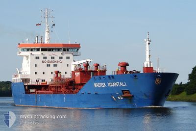
RUBIKON 78
Oil/Chemical Tanker

Current Trip
| Time Travelled | 7 h, 27 mins |
|---|---|
| Remaining Time | 1 day |
| Distance Travelled | 51.92 nm |
| Remaining Distance | 172.57 nm |
| AVG Speed | 8.6 Knots |
| MAX Speed | 11 Knots |
| AVG Wind | 15.1 knots |
| MAX Wind | 19.1 knots |
| MIN Temp | 11.5°C / 52.7°F |
| MAX Temp | 16.9°C / 62.42°F |
| Dybgang | 6.5 m |
| Position Modtaget | 1 m siden |
Current Position
| Longitude | 23.39634° |
|---|---|
| Latitude | 59.63366° |
| Status | Under way using engine |
| Fart | 4.5 Knots |
| Kurs | 254° |
| Område | Gulf of Finland |
| Station | T-AIS |
| Position Modtaget | 1 m siden |
Information
The current position of RUBIKON 78 is in Gulf of Finland with coordinates 59.63366° / 23.39634° as reported on 2025-06-07 20:36 by AIS to our vessel tracker app. The vessel's current speed is 4.5 Knots and is heading at the port of VENTSPILS. The estimated time of arrival as calculated by MyShipTracking vessel tracking app is 2025-06-08 23:16 LT
The vessel RUBIKON 78 (IMO: 9312078, MMSI: 255806404) is a Oil/Chemical Tanker that was built in 2005 ( 20 år gamle ). It's sailing under the flag of [PT] Portugal.
In this page you can find informations about the vessels current position, last detected port calls, and current voyage information. If the vessels is not in coverage by AIS you will find the latest position.
The current position of RUBIKON 78 is detected by our AIS receivers and we are not responsible for the reliability of the data. The last position was recorded while the vessel was in Coverage by the Ais receivers of our vessel tracking app.
The current draught of RUBIKON 78 as reported by AIS is 6.5 meters
Weather
| Temperature | 11.5°C / 52.7°F |
|---|---|
| Wind Speed | 18 knots |
| Direction | 213° SSW |
| Pressure | 1004.4 hPa |
| Humidity | 81.3 % |
| Cloud Coverage | 100 % |


Featured Company
Last Port Calls
| Port | Arrival | Departure | Time In Port |
|---|---|---|---|
| 2025-06-04 03:41 | 2025-06-07 13:11 | 3 d | |
| 2025-05-31 06:52 | 2025-06-01 18:11 | 1 d | |
| 2025-05-25 08:23 | 2025-05-27 12:55 | 2 d | |
| 2025-05-22 15:01 | 2025-05-24 03:20 | 1 d | |
| 2025-05-10 15:33 | 2025-05-12 00:53 | 1 d | |
| 2025-05-06 16:27 | 2025-05-10 05:21 | 3 d | |
| 2025-05-03 01:43 | 2025-05-05 13:23 | 2 d | |
| 2025-04-23 19:25 | 2025-04-30 21:24 | 7 d | |
| 2025-04-20 22:33 | 2025-04-22 05:01 | 1 d | |
| 2025-04-15 01:40 | 2025-04-17 18:12 | 2 d |
Last Trips
| Origin | Departure | Destination | Arrival | Distance | |
|---|---|---|---|---|---|
| 2025-06-01 20:11 | 2025-06-04 06:41 | 696.49 nm | |||
| 2025-05-27 14:55 | 2025-05-31 08:52 | 298.78 nm | |||
| 2025-05-24 05:20 | 2025-05-25 10:23 | 272.12 nm | |||
| 2025-05-12 02:53 | 2025-05-22 17:01 | 532.12 nm | |||
| 2025-05-10 07:21 | 2025-05-10 17:33 | 119.09 nm | |||
| 2025-05-05 15:23 | 2025-05-06 18:27 | 339.99 nm | |||
| 2025-04-30 23:24 | 2025-05-03 03:43 | 424.45 nm | |||
| 2025-04-22 07:01 | 2025-04-23 21:25 | 421.97 nm | |||
| 2025-04-17 20:12 | 2025-04-21 00:33 | 392.15 nm | |||
| 2025-04-13 22:45 | 2025-04-15 03:40 | 345.88 nm |
Events
| Tid | Hændelsen | Detaljer | Position / Dest | Info |
|---|---|---|---|---|
| 2025-06-07 18:15 | Status er ændret | Under way using engine Default |
59.67356 / 23.72954
LVVNT FOR ORDERS
|
Fart: 4.3 kn Kurs: 251° |
| 2025-06-07 18:15 | Status er ændret | Default Under way using engine |
59.67374 / 23.73116
LVVNT FOR ORDERS
|
Fart: 4.5 kn Kurs: 250° |
| 2025-06-07 15:58 | Ændre havområde | Finnish part of the Gulf of Finland Estonian part of the Gulf of Finland |
59.68359 / 24.17629
Gulf of Finland
LVVNT FOR ORDERS
|
Fart: 9 kn Kurs: 277.5° |
| 2025-06-07 14:00 | ETA er ændret | 2025/06/09 11:00 2025/06/09 09:00 |
59.62005 / 24.81002
LVVNT FOR ORDERS
|
Fart: 10.4 kn Kurs: 304.4° |
| 2025-06-07 13:15 | Status er ændret | Under way using engine Moored |
59.51255 / 24.96142
LVVNT FOR ORDERS
|
Fart: 11.2 kn Kurs: 341.9° |
| 2025-06-07 13:11 | Afsejlet fra sidste havn |
|
59.50229 / 24.95953
LVVNT FOR ORDERS
|
Fart: 8.6 kn Kurs: 30° |
| 2025-06-07 13:08 | START Sejllads |
59.49644 / 24.95580
[EE] MUUGA
|
Fart: 4.2 kn Kurs: 6° |
|
| 2025-06-07 12:06 | Dybgangen er ændret | 6.5 6.4 |
59.49446 / 24.95595
[EE] MUUGA
|
Fart: Kurs: 312° |
| 2025-06-07 12:06 | Destination er ændret | LVVNT FOR ORDERS EEMUU |
59.49446 / 24.95595
[EE] MUUGA
|
Fart: Kurs: 312° |
| 2025-06-07 12:06 | ETA er ændret | 2025/06/09 09:00 2025/06/04 03:00 |
59.49446 / 24.95595
[EE] MUUGA
|
Fart: Kurs: 312° |