
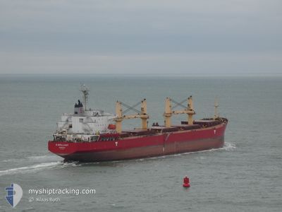
S-BRILLIANT
Bulk Carrier
Current Trip
| Time Travelled | 16 days |
|---|---|
| Remaining Time | --- |
| Distance Travelled | 3547.76 nm |
| Remaining Distance | --- |
| AVG Speed | 9.6 Knots |
| MAX Speed | 15.1 Knots |
| AVG Wind | 15.8 knots |
| MAX Wind | 40 knots |
| MIN Temp | 7.7°C / 45.86°F |
| MAX Temp | 30.4°C / 86.72°F |
| Dybgang | 11.4 m |
| Position Modtaget | 2 d siden |
Current Position
| Longitude | -29.89727° |
|---|---|
| Latitude | 39.88627° |
| Status | Under way using engine |
| Fart | 9.9 Knots |
| Kurs | 28.7° |
| Område | North Atlantic Ocean |
| Station | T-AIS |
| Position Modtaget | 2 d siden |
Information
The current position of S-BRILLIANT is in North Atlantic Ocean with coordinates 39.88627° / -29.89727° as reported on 2025-03-06 01:29 by AIS to our vessel tracker app. The vessel's current speed is 9.9 Knots and is heading at the port of AUGHINISH. The estimated time of arrival as calculated by MyShipTracking vessel tracking app is 2025-03-10 06:00 LT
The vessel S-BRILLIANT (IMO: 9275323, MMSI: 636017846) is a Bulk Carrier that was built in 2004 ( 21 år gamle ). It's sailing under the flag of [LR] Liberia.
In this page you can find informations about the vessels current position, last detected port calls, and current voyage information. If the vessels is not in coverage by AIS you will find the latest position.
The current position of S-BRILLIANT is detected by our AIS receivers and we are not responsible for the reliability of the data. The last position was recorded while the vessel was in Coverage by the Ais receivers of our vessel tracking app.
The current draught of S-BRILLIANT as reported by AIS is 11.4 meters
Weather
| Temperature | 10.5°C / 50.9°F |
|---|---|
| Wind Speed | 29 knots |
| Direction | 331° NNW |
| Pressure | 1016 hPa |
| Humidity | 56.5 % |
| Cloud Coverage | 100 % |
Featured Company
Last Port Calls
| Port | Arrival | Departure | Time In Port |
|---|---|---|---|
| 2025-02-17 21:25 | 2025-02-19 11:38 | 1 d | |
| 2025-02-05 20:36 | 2025-02-08 15:41 | 2 d | |
| 2025-01-28 17:14 | 2025-02-01 09:52 | 3 d |
Most Visited Ports (Last year)
| Port | Arrivals | |
|---|---|---|
| 2 | ||
| 1 | ||
| 1 | ||
| 1 | ||
| 1 | ||
| 1 |
Last Trips
| Origin | Departure | Destination | Arrival | Distance | |
|---|---|---|---|---|---|
| 2025-02-08 12:41 | 2025-02-17 18:25 | 1858.11 nm | |||
| 2025-02-01 06:52 | 2025-02-05 17:36 | 948.85 nm | |||
| 2024-12-20 15:45 | 2025-01-28 14:14 | 5714.52 nm |
Events
| Tid | Hændelsen | Detaljer | Position / Dest | Info |
|---|---|---|---|---|
| 2025-03-06 01:51 | Status er ændret | Default Under way using engine |
39.94062 / -29.86745
IE AUG
|
Fart: 9.9 kn Kurs: 28.7° |
| 2025-03-06 01:29 | Udenfor Dækning |
39.88627 / -29.89727
North Atlantic Ocean
IE AUG
|
Fart: 9.9 kn Kurs: 28.7° |
|
| 2025-03-05 19:03 | Status er ændret | Under way using engine Default |
38.92685 / -30.41537
IE AUG
|
Fart: 8.9 kn Kurs: 26° |
| 2025-03-05 18:50 | Status er ændret | Default Under way using engine |
38.89770 / -30.43230
IE AUG
|
Fart: 9.2 kn Kurs: 26.2° |
| 2025-03-05 18:33 | Status er ændret | Under way using engine Default |
38.85678 / -30.45368
IE AUG
|
Fart: 9.5 kn Kurs: 22° |
| 2025-03-05 17:47 | Status er ændret | Default Under way using engine |
38.73995 / -30.51505
IE AUG
|
Fart: 9.7 kn Kurs: 27.1° |
| 2025-03-05 17:36 | Status er ændret | Under way using engine Default |
38.71105 / -30.53046
IE AUG
|
Fart: 9.5 kn Kurs: 20° |
| 2025-03-05 17:36 | Indenfor Dækning |
38.71105 / -30.53046
North Atlantic Ocean
IE AUG
|
Fart: 9.7 kn Kurs: 27.1° |
|
| 2025-03-05 08:52 | Status er ændret | Default Under way using engine |
37.41441 / -31.14577
IE AUG
|
Fart: 10.6 kn Kurs: 18.8° |
| 2025-03-05 08:49 | Udenfor Dækning |
37.40705 / -31.14916
North Atlantic Ocean
IE AUG
|
Fart: 10.6 kn Kurs: 18.8° |