

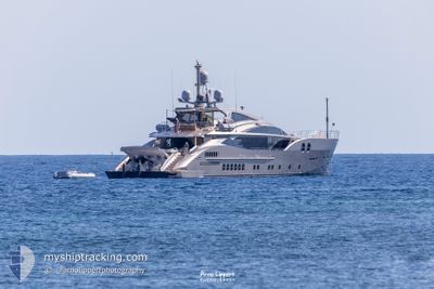
SANAM
Pleasure Craft

Current Trip
| Time Travelled | 3 days |
|---|---|
| Remaining Time | --- |
| Distance Travelled | 50.44 nm |
| Remaining Distance | --- |
| AVG Speed | 12.1 Knots |
| MAX Speed | 20.5 Knots |
| AVG Wind | 12.6 knots |
| MAX Wind | 30 knots |
| MIN Temp | 14.5°C / 58.1°F |
| MAX Temp | 21.4°C / 70.52°F |
| Dybgang | 2.1 m |
| Position Modtaget | 2 m siden |
Current Position
| Longitude | 7.34460° |
|---|---|
| Latitude | 43.69432° |
| Status | At anchor |
| Fart | 0.1 Knots |
| Kurs | 174° |
| Område | Mediterranean Sea - Western Basin |
| Station | T-AIS |
| Position Modtaget | 2 m siden |
Information
The current position of SANAM is in Mediterranean Sea - Western Basin with coordinates 43.69432° / 7.34460° as reported on 2025-05-24 17:52 by AIS to our vessel tracker app. The vessel's current speed is 0.1 Knots
The vessel SANAM (IMO: 1011525, MMSI: 248283000) is a Pleasure Craft It's sailing under the flag of [MT] Malta.
In this page you can find informations about the vessels current position, last detected port calls, and current voyage information. If the vessels is not in coverage by AIS you will find the latest position.
The current position of SANAM is detected by our AIS receivers and we are not responsible for the reliability of the data. The last position was recorded while the vessel was in Coverage by the Ais receivers of our vessel tracking app.
The current draught of SANAM as reported by AIS is 2.1 meters
Weather
| Temperature | 17.6°C / 63.68°F |
|---|---|
| Wind Speed | 3 knots |
| Direction | 171° S |
| Pressure | 1014.9 hPa |
| Humidity | 61.5 % |
| Cloud Coverage | 57 % |


Featured Company
Last Port Calls
| Port | Arrival | Departure | Time In Port |
|---|---|---|---|
| 2025-05-20 17:52 | 2025-05-21 12:50 | 18 h | |
| 2025-05-19 13:10 |
Most Visited Ports (Last year)
| Port | Arrivals | |
|---|---|---|
| 6 | ||
| 5 | ||
| 3 | ||
| 2 | ||
| 1 | ||
| 1 |
Last Trips
| Origin | Departure | Destination | Arrival | Distance | |
|---|---|---|---|---|---|
| 2025-05-19 13:10 | 2025-05-20 17:52 | 252.33 nm |
Events
| Tid | Hændelsen | Detaljer | Position / Dest | Info |
|---|---|---|---|---|
| 2025-05-23 16:10 | Status er ændret | At anchor Under way using engine |
43.69389 / 7.34426
CAP FERRAT
|
Fart: Kurs: 109° |
| 2025-05-23 16:00 | STOP Sejllads | 0.42 nm, North East of SAINTJEAN CAP FERRAT |
43.69387 / 7.34388
CAP FERRAT
|
Fart: 0.3 kn Kurs: 103° |
| 2025-05-23 15:46 | Destination er ændret | CAP FERRAT MONACO |
43.68349 / 7.36214
CAP FERRAT
|
Fart: 12 kn Kurs: 4.6° |
| 2025-05-23 15:03 | START Sejllads | 0.57 nm, South East of ANTIBES |
43.57860 / 7.13463
MONACO
|
Fart: 6.3 kn Kurs: 58.1° |
| 2025-05-23 14:57 | ETA er ændret | 2025/05/23 18:00 2025/05/23 17:15 |
43.57802 / 7.13236
MONACO
|
Fart: 0.5 kn Kurs: 225° |
| 2025-05-23 14:51 | Status er ændret | Under way using engine At anchor |
43.57807 / 7.13160
MONACO
|
Fart: 0.3 kn Kurs: 214° |
| 2025-05-23 13:56 | Dybgangen er ændret | 2.1 2 |
43.57802 / 7.13183
MONACO
|
Fart: 0.1 kn Kurs: 211° |
| 2025-05-23 13:56 | ETA er ændret | 2025/05/23 17:15 |
43.57802 / 7.13183
MONACO
|
Fart: 0.1 kn Kurs: 211° |
| 2025-05-23 13:50 | Destination er ændret | MONACO ANTIBES |
43.57803 / 7.13169
MONACO
|
Fart: 0.6 kn Kurs: 191° |
| 2025-05-23 13:02 | Dybgangen er ændret | 2 2.1 |
43.57791 / 7.13182
ANTIBES
|
Fart: 0.1 kn Kurs: 230° |