
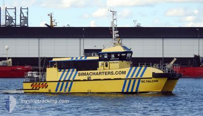
SC FALCON
Port Tender
Current Trip
| Time Travelled | 14 days |
|---|---|
| Remaining Time | --- |
| Distance Travelled | 95.49 nm |
| Remaining Distance | --- |
| AVG Speed | 8.8 Knots |
| MAX Speed | 8.8 Knots |
| AVG Wind | 9.2 knots |
| MAX Wind | 20.5 knots |
| MIN Temp | 0.8°C / 33.44°F |
| MAX Temp | 12°C / 53.6°F |
| Dybgang | 1.5 m |
| Position Modtaget | 2 m siden |
Current Position
| Longitude | 11.37345° |
|---|---|
| Latitude | 54.63845° |
| Status | Moored |
| Fart | |
| Kurs | 175° |
| Område | Baltic Sea |
| Station | T-AIS |
| Position Modtaget | 2 m siden |
Info
Information
The current position of SC FALCON is in Baltic Sea with coordinates 54.63845° / 11.37345° as reported on 2025-03-14 19:09 by AIS to our vessel tracker app. The vessel's current speed is 0 Knots
The vessel SC FALCON (MMSI: 246812000) is a Port Tender It's sailing under the flag of [NL] Netherlands.
In this page you can find informations about the vessels current position, last detected port calls, and current voyage information. If the vessels is not in coverage by AIS you will find the latest position.
The current position of SC FALCON is detected by our AIS receivers and we are not responsible for the reliability of the data. The last position was recorded while the vessel was in Coverage by the Ais receivers of our vessel tracking app.
The current draught of SC FALCON as reported by AIS is 1.5 meters
Weather
| Temperature | 2.3°C / 36.14°F |
|---|---|
| Wind Speed | 11 knots |
| Direction | 39° NE |
| Pressure | 1013.9 hPa |
| Humidity | 82.9 % |
| Cloud Coverage | 100 % |
Featured Company
Last Port Calls
| Port | Arrival | Departure | Time In Port |
|---|---|---|---|
| 2025-02-28 16:08 | 2025-02-28 18:18 | 2 h | |
| 2025-02-26 16:27 | 2025-02-27 10:01 | 17 h | |
| 2025-01-11 14:05 | 2025-02-26 15:36 | ||
| 2025-01-11 13:56 | 2025-01-11 14:03 | 7 m | |
| 2025-01-11 04:37 |
Most Visited Ports (Last year)
| Port | Arrivals | |
|---|---|---|
| 303 | ||
| 3 | ||
| 1 |
Last Trips
| Origin | Departure | Destination | Arrival | Distance | |
|---|---|---|---|---|---|
| 2025-02-27 10:01 | 2025-02-28 16:08 | 231.58 nm | |||
| 2025-02-26 15:36 | 2025-02-26 16:27 | 12.50 nm | |||
| 2025-01-11 14:03 | 2025-01-11 14:05 | 0.99 nm | |||
| 2025-01-11 04:37 | 2025-01-11 13:56 | 155.76 nm |
Events
| Tid | Hændelsen | Detaljer | Position / Dest | Info |
|---|---|---|---|---|
| 2025-03-14 16:04 | Status er ændret | Moored Under way using engine |
54.63847 / 11.37345
DK ROD
|
Fart: 0.1 kn Kurs: 176° |
| 2025-03-14 16:04 | STOP Sejllads | 1.22 nm, South East of RODBYHAVN |
54.63845 / 11.37350
DK ROD
|
Fart: 0.3 kn Kurs: 189° |
| 2025-03-14 16:02 | START Sejllads | 1.32 nm, South East of RODBYHAVN |
54.63862 / 11.37778
DK ROD
|
Fart: 6.2 kn Kurs: 217° |
| 2025-03-14 15:58 | STOP Sejllads | 1.37 nm, South East of RODBYHAVN |
54.63945 / 11.38080
DK ROD
|
Fart: 0.2 kn Kurs: 203° |
| 2025-03-14 15:55 | START Sejllads | 1.3 nm, South East of RODBYHAVN |
54.63817 / 11.37653
DK ROD
|
Fart: 5.8 kn Kurs: 43° |
| 2025-03-14 15:53 | Status er ændret | Under way using engine Moored |
54.63845 / 11.37347
DK ROD
|
Fart: Kurs: 175° |
| 2025-03-14 09:10 | Status er ændret | Moored Under way using engine |
54.63845 / 11.37345
DK ROD
|
Fart: 0.1 kn Kurs: 176° |
| 2025-03-14 09:10 | STOP Sejllads | 1.22 nm, South East of RODBYHAVN |
54.63845 / 11.37345
DK ROD
|
Fart: 0.2 kn Kurs: 176° |
| 2025-03-14 08:57 | START Sejllads | 3.79 nm, South of RODBYHAVN |
54.59075 / 11.36748
DK ROD
|
Fart: 19.5 kn Kurs: 21° |
| 2025-03-14 08:56 | STOP Sejllads | 3.88 nm, South of RODBYHAVN |
54.58895 / 11.36583
DK ROD
|
Fart: 0.3 kn Kurs: 221° |