
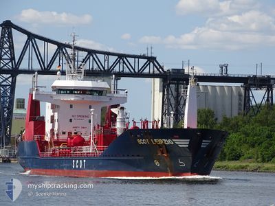
SCOT LEIPZIG
Oil/Chemical Tanker
Current Trip
JMKIN
| Time Travelled | 4 days |
|---|---|
| Remaining Time | --- |
| Distance Travelled | 6.71 nm |
| Remaining Distance | --- |
| AVG Speed | 7.4 Knots |
| MAX Speed | 7.4 Knots |
| AVG Wind | 2.5 knots |
| MAX Wind | 4 knots |
| MIN Temp | 18.8°C / 65.84°F |
| MAX Temp | 29°C / 84.2°F |
| Dybgang | 5 m |
| Position Modtaget | 1 d siden |
Current Position
| Longitude | -76.77150° |
|---|---|
| Latitude | 17.95640° |
| Status | At anchor |
| Fart | |
| Kurs | 181° |
| Område | Caribbean Sea |
| Station | T-AIS |
| Position Modtaget | 1 d siden |
Info
Information
The current position of SCOT LEIPZIG is in Caribbean Sea with coordinates 17.95640° / -76.77150° as reported on 2026-01-01 19:17 by AIS to our vessel tracker app. The vessel's current speed is 0 Knots
The vessel SCOT LEIPZIG (IMO: 9260847, MMSI: 249080000) is a Oil/Chemical Tanker that was built in 2004 ( 22 år gamle ). It's sailing under the flag of [MT] Malta.
In this page you can find informations about the vessels current position, last detected port calls, and current voyage information. If the vessels is not in coverage by AIS you will find the latest position.
The current position of SCOT LEIPZIG is detected by our AIS receivers and we are not responsible for the reliability of the data. The last position was recorded while the vessel was in Coverage by the Ais receivers of our vessel tracking app.
The current draught of SCOT LEIPZIG as reported by AIS is 5 meters
Weather
| Temperature | 27.7°C / 81.86°F |
|---|---|
| Wind Speed | 4 knots |
| Direction | 160° SSE |
| Pressure | 1014.5 hPa |
| Humidity | 56.9 % |
| Cloud Coverage | 28 % |
Featured Company
Last Port Calls
| Port | Arrival | Departure | Time In Port |
|---|---|---|---|
| 2025-12-29 18:46 | 2025-12-29 18:58 | 11 m | |
| 2025-12-23 11:03 | 2025-12-24 22:44 | 1 d | |
| 2025-12-16 17:40 | 2025-12-17 17:04 | 23 h | |
| 2025-12-12 23:07 | 2025-12-15 17:01 | 2 d | |
| 2025-12-02 08:27 | 2025-12-02 08:35 | 8 m | |
| 2025-11-20 13:07 | 2025-11-21 16:30 | 1 d | |
| 2025-11-14 10:22 | 2025-11-15 20:46 | 1 d | |
| 2025-11-08 07:50 | 2025-11-09 09:18 | 1 d |
Most Visited Ports (Last year)
| Port | Arrivals | |
|---|---|---|
| 59 | ||
| 13 |
Last Trips
| Origin | Departure | Destination | Arrival | Distance | |
|---|---|---|---|---|---|
| 2025-12-24 22:44 | 2025-12-29 18:46 | 1016.96 nm | |||
| 2025-12-17 17:04 | 2025-12-23 11:03 | 1027.15 nm | |||
| 2025-12-15 17:01 | 2025-12-16 17:40 | 6.54 nm | |||
| 2025-12-02 08:35 | 2025-12-12 23:07 | 20.48 nm | |||
| 2025-11-21 16:30 | 2025-12-02 08:27 | 1736.05 nm | |||
| 2025-11-15 20:46 | 2025-11-20 13:07 | 1017.31 nm | |||
| 2025-11-09 09:18 | 2025-11-14 10:22 | 1029.01 nm | |||
| 2025-10-31 16:50 | 2025-11-08 07:50 | 10.91 nm |
Events
| Tid | Hændelsen | Detaljer | Position / Dest | Info |
|---|---|---|---|---|
| 2026-01-01 19:20 | Status er ændret | Default At anchor |
17.95639 / -76.77155
JMKIN
|
Fart: Kurs: 181° |
| 2026-01-01 19:17 | Udenfor Dækning |
17.95640 / -76.77150
Caribbean Sea
|
Fart: Kurs: 254.4° |
|
| 2026-01-01 18:26 | Status er ændret | At anchor Default |
17.95639 / -76.77160
JMKIN
|
Fart: Kurs: 163° |
| 2026-01-01 18:17 | Indenfor Dækning |
17.95639 / -76.77160
Caribbean Sea
|
Fart: Kurs: 97.7° |
|
| 2025-12-30 19:06 | Status er ændret | Default At anchor |
17.95624 / -76.77201
JMKIN
|
Fart: Kurs: 148° |
| 2025-12-30 18:59 | Udenfor Dækning |
17.95628 / -76.77199
Caribbean Sea
|
Fart: Kurs: 316.8° |
|
| 2025-12-30 18:44 | Fundet i havområde | Jamaican part of the Caribbean Sea |
17.95622 / -76.77205
Caribbean Sea
|
Fart: Kurs: 355.3° |
| 2025-12-30 18:44 | Status er ændret | At anchor Default |
17.95622 / -76.77205
JMKIN
|
Fart: 0.1 kn Kurs: 140° |
| 2025-12-30 18:41 | Indenfor Dækning |
17.95622 / -76.77205
Caribbean Sea
|
Fart: Kurs: 355.3° |
|
| 2025-12-30 00:26 | STOP Sejllads | 2.14 nm, East of KINGSTON (JM) |
17.95561 / -76.77177
JMKIN
|
Fart: 0.2 kn Kurs: 122° |