
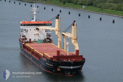
SEA EXPLORER
General Cargo
Current Trip
| Time Travelled | 1 day |
|---|---|
| Remaining Time | --- |
| Distance Travelled | 282.26 nm |
| Remaining Distance | --- |
| AVG Speed | 7.5 Knots |
| MAX Speed | 12.9 Knots |
| AVG Wind | 10.8 knots |
| MAX Wind | 20 knots |
| MIN Temp | 0.9°C / 33.62°F |
| MAX Temp | 9.1°C / 48.38°F |
| Dybgang | 8.1 m |
| Position Modtaget | 9 h, 13 m siden |
Current Position
| Longitude | 5.56023° |
|---|---|
| Latitude | 53.67127° |
| Status | Under way using engine |
| Fart | 11.9 Knots |
| Kurs | 252.1° |
| Område | North Sea |
| Station | T-AIS |
| Position Modtaget | 9 h, 13 m siden |
Info
Information
The current position of SEA EXPLORER is in North Sea with coordinates 53.67127° / 5.56023° as reported on 2025-02-21 15:08 by AIS to our vessel tracker app. The vessel's current speed is 11.9 Knots and is heading at the port of NADOR. The estimated time of arrival as calculated by MyShipTracking vessel tracking app is 2025-02-28 22:00 LT
The vessel SEA EXPLORER (IMO: 9516155, MMSI: 257223000) is a General Cargo that was built in 2012 ( 13 år gamle ). It's sailing under the flag of [NO] Norway.
In this page you can find informations about the vessels current position, last detected port calls, and current voyage information. If the vessels is not in coverage by AIS you will find the latest position.
The current position of SEA EXPLORER is detected by our AIS receivers and we are not responsible for the reliability of the data. The last position was recorded while the vessel was in Coverage by the Ais receivers of our vessel tracking app.
The current draught of SEA EXPLORER as reported by AIS is 8.1 meters
Weather
| Temperature | 8.6°C / 47.48°F |
|---|---|
| Wind Speed | 15 knots |
| Direction | 176° S |
| Pressure | 1010 hPa |
| Humidity | 93.2 % |
| Cloud Coverage | 100 % |
Featured Company
Last Port Calls
| Port | Arrival | Departure | Time In Port |
|---|---|---|---|
| 2025-02-20 16:33 | 2025-02-20 17:26 | 52 m | |
| 2025-02-16 09:41 | 2025-02-18 08:05 | 1 d | |
| 2025-02-13 01:29 | 2025-02-14 17:09 | 1 d | |
| 2025-02-07 11:47 | 2025-02-08 21:19 | 1 d | |
| 2025-01-16 09:49 | 2025-01-19 19:33 | 3 d | |
| 2025-01-04 08:15 | 2025-01-04 09:04 | 49 m | |
| 2025-01-02 04:12 | 2025-01-02 19:06 | 14 h | |
| 2024-12-27 02:29 | 2024-12-28 13:09 | 1 d | |
| 2024-12-24 17:29 | 2024-12-26 16:09 | 1 d | |
| 2024-12-15 13:39 | 2024-12-15 13:55 | 16 m |
Last Trips
| Origin | Departure | Destination | Arrival | Distance | |
|---|---|---|---|---|---|
| 2025-02-18 09:05 | 2025-02-20 17:33 | 644.82 nm | |||
| 2025-02-14 18:09 | 2025-02-16 10:41 | 269.38 nm | |||
| 2025-02-08 22:19 | 2025-02-13 02:29 | 1050.32 nm | |||
| 2025-01-19 20:33 | 2025-02-07 12:47 | 3573.78 nm | |||
| 2025-01-04 10:04 | 2025-01-16 10:49 | 2738.86 nm | |||
| 2025-01-02 20:06 | 2025-01-04 09:15 | 377.77 nm | |||
| 2024-12-28 15:09 | 2025-01-02 05:12 | 663.58 nm | |||
| 2024-12-26 18:09 | 2024-12-27 04:29 | 124.94 nm | |||
| 2024-12-15 14:55 | 2024-12-24 19:29 | 2434.87 nm | |||
| 2024-12-13 10:52 | 2024-12-15 14:39 | 4.14 nm |
Events
| Tid | Hændelsen | Detaljer | Position / Dest | Info |
|---|---|---|---|---|
| 2025-02-21 15:13 | Status er ændret | Default Under way using engine |
53.66608 / 5.53282
MANDR
|
Fart: 11.9 kn Kurs: 252.1° |
| 2025-02-21 15:08 | Udenfor Dækning |
53.67127 / 5.56023
North Sea
MANDR
|
Fart: 11.9 kn Kurs: 252.1° |
|
| 2025-02-21 14:51 | Fundet i havområde | Dutch part of the North Sea |
53.68832 / 5.65056
North Sea
MANDR
|
Fart: 11.7 kn Kurs: 252.5° |
| 2025-02-21 14:51 | Status er ændret | Under way using engine Default |
53.68832 / 5.65056
MANDR
|
Fart: 11.8 kn Kurs: 253° |
| 2025-02-21 14:37 | Indenfor Dækning |
53.68832 / 5.65056
North Sea
MANDR
|
Fart: 11.7 kn Kurs: 252.5° |
|
| 2025-02-21 05:30 | Status er ændret | Default Under way using engine |
53.95255 / 8.64089
MANDR
|
Fart: 11 kn Kurs: 330.3° |
| 2025-02-21 05:23 | Status er ændret | Under way using engine Default |
53.93570 / 8.66286
MANDR
|
Fart: 11 kn Kurs: 330° |
| 2025-02-21 05:23 | Udenfor Dækning |
53.93570 / 8.66286
North Sea
MANDR
|
Fart: 11 kn Kurs: 330.3° |
|
| 2025-02-21 05:21 | Status er ændret | Default Under way using engine |
53.93262 / 8.66570
MANDR
|
Fart: 10.5 kn Kurs: 331.7° |
| 2025-02-21 04:39 | Status er ændret | Under way using engine Default |
53.84210 / 8.79283
MANDR
|
Fart: 9.5 kn Kurs: 280° |