

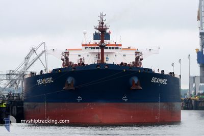
SEAMUSIC
Crude Oil Tanker

Current Trip
| Time Travelled | --- |
|---|---|
| Remaining Time | --- |
| Distance Travelled | 8176.83 nm |
| Remaining Distance | --- |
| AVG Speed | 11.3 Knots |
| MAX Speed | 14.7 Knots |
| AVG Wind | 11.9 knots |
| MAX Wind | 31.6 knots |
| MIN Temp | 14.6°C / 58.28°F |
| MAX Temp | 30.8°C / 87.44°F |
| Dybgang | 14.8 m |
| Position Modtaget | 2 m siden |
Current Position
| Longitude | 103.87982° |
|---|---|
| Latitude | 1.23962° |
| Status | At anchor |
| Fart | |
| Kurs | 64° |
| Område | Singapore Strait |
| Station | T-AIS |
| Position Modtaget | 2 m siden |
Information
The current position of SEAMUSIC is in Singapore Strait with coordinates 1.23962° / 103.87982° as reported on 2025-06-01 15:26 by AIS to our vessel tracker app. The vessel's current speed is 0 Knots
The vessel SEAMUSIC (IMO: 9407445, MMSI: 249746000) is a Crude Oil Tanker that was built in 2009 ( 16 år gamle ). It's sailing under the flag of [MT] Malta.
In this page you can find informations about the vessels current position, last detected port calls, and current voyage information. If the vessels is not in coverage by AIS you will find the latest position.
The current position of SEAMUSIC is detected by our AIS receivers and we are not responsible for the reliability of the data. The last position was recorded while the vessel was in Coverage by the Ais receivers of our vessel tracking app.
The current draught of SEAMUSIC as reported by AIS is 14.8 meters
Weather
| Temperature | 29°C / 84.2°F |
|---|---|
| Wind Speed | 11 knots |
| Direction | 165° SSE |
| Pressure | 1011.1 hPa |
| Humidity | 72.4 % |
| Cloud Coverage | 67 % |


Featured Company
Events
| Tid | Hændelsen | Detaljer | Position / Dest | Info |
|---|---|---|---|---|
| 2025-06-01 00:00 | ETA er ændret | 2026/05/31 06:00 2025/05/31 06:00 |
1.23880 / 103.88052
SGSIN
|
Fart: Kurs: 8° |
| 2025-05-31 09:08 | Status er ændret | At anchor Under way using engine |
1.24158 / 103.88353
SGSIN
|
Fart: 0.3 kn Kurs: 250° |
| 2025-05-31 09:00 | STOP Sejllads | 1.99 nm, South East of SINGAPORE |
1.24124 / 103.88348
SGSIN
|
Fart: 0.3 kn Kurs: 238° |
| 2025-05-31 07:46 | Ændre havområde | Singaporean part of the Singapore Strait Indonesian part of the Singapore Strait |
1.24192 / 103.96294
Singapore Strait
SGSIN
|
Fart: 3.8 kn Kurs: 11.1° |
| 2025-05-31 05:18 | Dybgangen er ændret | 14.8 13.2 |
1.14708 / 103.78029
SGSIN
|
Fart: 5.6 kn Kurs: 47.8° |
| 2025-05-31 05:18 | Destination er ændret | SGSIN SNDKR |
1.14708 / 103.78029
SGSIN
|
Fart: 5.6 kn Kurs: 47.8° |
| 2025-05-31 05:18 | ETA er ændret | 2025/05/31 06:00 2025/04/24 19:00 |
1.14708 / 103.78029
SGSIN
|
Fart: 5.6 kn Kurs: 47.8° |
| 2025-05-31 02:34 | Status er ændret | Under way using engine Default |
1.12140 / 103.52465
SNDKR
|
Fart: 7.1 kn Kurs: 120° |
| 2025-05-31 02:30 | Status er ændret | Default Under way using engine |
1.12486 / 103.51876
SNDKR
|
Fart: 7.1 kn Kurs: 120.5° |
| 2025-05-31 02:11 | Status er ændret | Under way using engine Default |
1.14564 / 103.48520
SNDKR
|
Fart: 8.7 kn Kurs: 123° |