
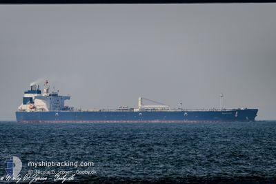
SEAVELVET
Tanker D
Current Trip
| Time Travelled | 4 days |
|---|---|
| Remaining Time | 10 h, 3 mins |
| Distance Travelled | 429.43 nm |
| Remaining Distance | 371.16 nm |
| AVG Speed | 8.6 Knots |
| MAX Speed | 13.9 Knots |
| AVG Wind | 12.5 knots |
| MAX Wind | 29 knots |
| MIN Temp | 7.6°C / 45.68°F |
| MAX Temp | 15.4°C / 59.72°F |
| Dybgang | 8.2 m |
| Position Modtaget | 1 d siden |
Current Position
| Longitude | 28.61358° |
|---|---|
| Latitude | 35.46969° |
| Status | Under way using engine |
| Fart | 11 Knots |
| Kurs | 109.2° |
| Område | Mediterranean Sea - Eastern Basin |
| Station | T-AIS |
| Position Modtaget | 1 d siden |
Info
Information
The current position of SEAVELVET is in Mediterranean Sea - Eastern Basin with coordinates 35.46969° / 28.61358° as reported on 2025-03-21 21:10 by AIS to our vessel tracker app. The vessel's current speed is 11 Knots and is heading at the port of CEYHAN. The estimated time of arrival as calculated by MyShipTracking vessel tracking app is 2025-03-23 11:36 LT
The vessel SEAVELVET (IMO: 9843211, MMSI: 215514000) is a Tanker D It's sailing under the flag of [MT] Malta.
In this page you can find informations about the vessels current position, last detected port calls, and current voyage information. If the vessels is not in coverage by AIS you will find the latest position.
The current position of SEAVELVET is detected by our AIS receivers and we are not responsible for the reliability of the data. The last position was recorded while the vessel was in Coverage by the Ais receivers of our vessel tracking app.
The current draught of SEAVELVET as reported by AIS is 8.2 meters
Weather
| Temperature | 14.3°C / 57.74°F |
|---|---|
| Wind Speed | 7 knots |
| Direction | 295° WNW |
| Pressure | 1024.4 hPa |
| Humidity | 58.4 % |
| Cloud Coverage | 30 % |
Featured Company
Last Port Calls
| Port | Arrival | Departure | Time In Port |
|---|---|---|---|
| 2025-03-01 09:32 | 2025-03-18 10:04 | 17 d | |
| 2025-02-10 23:08 | 2025-02-12 06:10 | 1 d | |
| 2025-01-16 08:44 | 2025-01-16 10:04 | 1 h |
Most Visited Ports (Last year)
| Port | Arrivals | |
|---|---|---|
| 3 | ||
| 2 | ||
| 2 | ||
| 1 | ||
| 1 | ||
| 1 |
Last Trips
| Origin | Departure | Destination | Arrival | Distance | |
|---|---|---|---|---|---|
| 2025-02-12 06:10 | 2025-03-01 09:32 | 2974.55 nm | |||
| 2025-01-16 10:04 | 2025-02-10 23:08 | 3325.62 nm | |||
| 2024-12-19 16:57 | 2025-01-16 08:44 | 2645.49 nm |
Events
| Tid | Hændelsen | Detaljer | Position / Dest | Info |
|---|---|---|---|---|
| 2025-03-21 21:24 | Status er ændret | Default Under way using engine |
35.45649 / 28.66320
TRCEY
|
Fart: 11 kn Kurs: 109.2° |
| 2025-03-21 21:10 | Udenfor Dækning |
35.46969 / 28.61358
Mediterranean Sea - Eastern Basin
TRCEY
|
Fart: 11 kn Kurs: 109.2° |
|
| 2025-03-21 16:35 | Status er ændret | Under way using engine Default |
35.77048 / 27.68919
TRCEY
|
Fart: 11 kn Kurs: 128° |
| 2025-03-21 16:27 | Status er ændret | Default Under way using engine |
35.78701 / 27.66366
TRCEY
|
Fart: 10.9 kn Kurs: 127.8° |
| 2025-03-21 16:13 | Ændre havområde | Greek part of the Mediterranean Sea - Eastern Basin Greek part of the Aegean Sea |
35.81126 / 27.62191
Mediterranean Sea - Eastern Basin
TRCEY
|
Fart: 10.8 kn Kurs: 122.4° |
| 2025-03-21 12:31 | Indenfor Dækning |
36.06958 / 26.90318
Aegean Sea
TRCEY
|
Fart: 10.2 kn Kurs: 112.2° |
|
| 2025-03-21 12:30 | Status er ændret | Under way using engine Default |
36.07091 / 26.89755
TRCEY
|
Fart: 10.2 kn Kurs: 101° |
| 2025-03-21 10:10 | Status er ændret | Default Under way using engine |
36.17291 / 26.41371
TRCEY
|
Fart: 10.2 kn Kurs: 85.7° |
| 2025-03-21 10:00 | Udenfor Dækning |
36.17500 / 26.37763
Aegean Sea
TRCEY
|
Fart: 10.2 kn Kurs: 85.7° |
|
| 2025-03-21 08:57 | Status er ændret | Under way using engine Default |
36.16240 / 26.16307
TRCEY
|
Fart: 9.7 kn Kurs: 85° |