
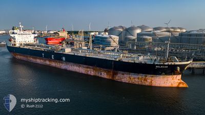
SELECAO
Crude Oil Tanker
Current Trip
| Time Travelled | 22 h, 58 mins |
|---|---|
| Remaining Time | 3 h, 27 mins |
| Distance Travelled | 157.47 nm |
| Remaining Distance | 179.15 nm |
| AVG Speed | 11.5 Knots |
| MAX Speed | 14.6 Knots |
| AVG Wind | 8.3 knots |
| MAX Wind | 15.9 knots |
| MIN Temp | 20.9°C / 69.62°F |
| MAX Temp | 28.1°C / 82.58°F |
| Dybgang | 8.2 m |
| Position Modtaget | 19 h, 39 m siden |
Current Position
| Longitude | -94.03876° |
|---|---|
| Latitude | 29.42257° |
| Status | Under way using engine |
| Fart | 11.6 Knots |
| Kurs | 226.8° |
| Område | Gulf of Mexico |
| Station | T-AIS |
| Position Modtaget | 19 h, 39 m siden |
Information
The current position of SELECAO is in Gulf of Mexico with coordinates 29.42257° / -94.03876° as reported on 2025-05-29 07:55 by AIS to our vessel tracker app. The vessel's current speed is 11.6 Knots and is heading at the port of CORPUS CHRISTI. The estimated time of arrival as calculated by MyShipTracking vessel tracking app is 2025-05-30 07:01 LT
The vessel SELECAO (IMO: 9388297, MMSI: 636013614) is a Crude Oil Tanker that was built in 2008 ( 17 år gamle ). It's sailing under the flag of [LR] Liberia.
In this page you can find informations about the vessels current position, last detected port calls, and current voyage information. If the vessels is not in coverage by AIS you will find the latest position.
The current position of SELECAO is detected by our AIS receivers and we are not responsible for the reliability of the data. The last position was recorded while the vessel was in Coverage by the Ais receivers of our vessel tracking app.
The current draught of SELECAO as reported by AIS is 8.2 meters
Weather
| Temperature | 27.7°C / 81.86°F |
|---|---|
| Wind Speed | 7 knots |
| Direction | 125° SE |
| Pressure | 1014.6 hPa |
| Humidity | 81.7 % |
| Cloud Coverage | 38 % |
Featured Company
Last Port Calls
| Port | Arrival | Departure | Time In Port |
|---|---|---|---|
| 2025-05-27 06:27 | 2025-05-29 04:36 | 1 d | |
| 2025-05-05 16:36 | 2025-05-08 17:40 | 3 d | |
| 2025-04-25 01:12 | 2025-04-25 08:48 | 7 h |
Most Visited Ports (Last year)
| Port | Arrivals | |
|---|---|---|
| 2 | ||
| 2 | ||
| 2 | ||
| 1 | ||
| 1 | ||
| 1 |
Last Trips
| Origin | Departure | Destination | Arrival | Distance | |
|---|---|---|---|---|---|
| 2025-05-08 12:40 | 2025-05-27 01:27 | 2834.49 nm | |||
| 2025-04-25 01:48 | 2025-05-05 11:36 | 1857.89 nm |
Events
| Tid | Hændelsen | Detaljer | Position / Dest | Info |
|---|---|---|---|---|
| 2025-05-29 18:07 | STOP Sejllads |
27.65226 / -94.50490
USPOA>USCRP
|
Fart: 0.3 kn Kurs: 269° |
|
| 2025-05-29 08:01 | Status er ændret | Default Under way using engine |
29.41034 / -94.05328
USPOA>USCRP
|
Fart: 11.6 kn Kurs: 226.8° |
| 2025-05-29 07:55 | Udenfor Dækning |
29.42257 / -94.03876
Gulf of Mexico
USPOA>USCRP
|
Fart: 11.6 kn Kurs: 226.8° |
|
| 2025-05-29 06:21 | Status er ændret | Under way using engine Default |
29.55778 / -93.77087
USPOA>USCRP
|
Fart: 10.6 kn Kurs: 144° |
| 2025-05-29 06:20 | Status er ændret | Default Under way using engine |
29.56022 / -93.77286
USPOA>USCRP
|
Fart: 10.6 kn Kurs: 144.3° |
| 2025-05-29 06:06 | Status er ændret | Under way using engine Default |
29.59034 / -93.79809
USPOA>USCRP
|
Fart: 7 kn Kurs: 156° |
| 2025-05-29 06:01 | Status er ændret | Default Under way using engine |
29.59901 / -93.80379
USPOA>USCRP
|
Fart: 7 kn Kurs: 156.2° |
| 2025-05-29 04:36 | Afsejlet fra sidste havn |
|
29.81438 / -93.95817
USPOA>USCRP
|
Fart: 7.3 kn Kurs: 160° |
| 2025-05-29 04:32 | START Sejllads |
29.82135 / -93.96036
[US] PORT ARTHUR
|
Fart: 3.1 kn Kurs: 165° |
|
| 2025-05-29 03:56 | Status er ændret | Under way using engine Moored |
29.82246 / -93.95591
[US] PORT ARTHUR
|
Fart: Kurs: 64° |