
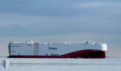
SIEM CONFUCIUS
Cargo
Current Trip
MXVER
| Time Travelled | 1 day |
|---|---|
| Remaining Time | --- |
| Distance Travelled | 644.42 nm |
| Remaining Distance | --- |
| AVG Speed | 14.9 Knots |
| MAX Speed | 15.9 Knots |
| AVG Wind | 11.4 knots |
| MAX Wind | 15 knots |
| MIN Temp | 23.9°C / 75.02°F |
| MAX Temp | 26.7°C / 80.06°F |
| Dybgang | 7.9 m |
| Position Modtaget | 6 d siden |
Current Position
| Longitude | -79.54785° |
|---|---|
| Latitude | 25.43333° |
| Status | Under way using engine |
| Fart | 13.2 Knots |
| Kurs | 179.7° |
| Område | North Atlantic Ocean |
| Station | T-AIS |
| Position Modtaget | 6 d siden |
Info
Information
The current position of SIEM CONFUCIUS is in North Atlantic Ocean with coordinates 25.43333° / -79.54785° as reported on 2025-02-01 23:58 by AIS to our vessel tracker app. The vessel's current speed is 13.2 Knots
The vessel SIEM CONFUCIUS (IMO: 9841017, MMSI: 636017540) is a Cargo It's sailing under the flag of [LR] Liberia.
In this page you can find informations about the vessels current position, last detected port calls, and current voyage information. If the vessels is not in coverage by AIS you will find the latest position.
The current position of SIEM CONFUCIUS is detected by our AIS receivers and we are not responsible for the reliability of the data. The last position was recorded while the vessel was in Coverage by the Ais receivers of our vessel tracking app.
The current draught of SIEM CONFUCIUS as reported by AIS is 7.9 meters
Weather
| Temperature | 24.8°C / 76.64°F |
|---|---|
| Wind Speed | 14 knots |
| Direction | 79° E |
| Pressure | 1018.7 hPa |
| Humidity | 77.3 % |
| Cloud Coverage | 17 % |
Featured Company
Last Port Calls
| Port | Arrival | Departure | Time In Port |
|---|---|---|---|
| 2025-02-05 10:36 | 2025-02-06 11:03 | 1 d | |
| 2025-01-29 04:21 | 2025-01-29 22:30 | 18 h | |
| 2025-01-25 16:07 | 2025-01-25 23:02 | 6 h | |
| 2024-12-17 04:59 | 2024-12-17 14:41 | 9 h | |
| 2024-12-09 09:46 | 2024-12-10 22:32 | 1 d | |
| 2024-12-03 07:35 | 2024-12-04 18:54 | 1 d |
Most Visited Ports (Last year)
| Port | Arrivals | |
|---|---|---|
| 8 | ||
| 7 | ||
| 5 | ||
| 5 | ||
| 3 | ||
| 2 |
Last Trips
| Origin | Departure | Destination | Arrival | Distance | |
|---|---|---|---|---|---|
| 2025-01-29 22:30 | 2025-02-05 10:36 | 2007.55 nm | |||
| 2025-01-25 23:02 | 2025-01-29 04:21 | 979.68 nm | |||
| 2024-12-17 14:41 | 2025-01-25 16:07 | 8789.11 nm | |||
| 2024-12-10 22:32 | 2024-12-17 04:59 | 1993.10 nm | |||
| 2024-12-04 18:54 | 2024-12-09 09:46 | 624.56 nm | |||
| 2024-11-28 21:49 | 2024-12-03 07:35 | 559.52 nm |
Events
| Tid | Hændelsen | Detaljer | Position / Dest | Info |
|---|---|---|---|---|
| 2025-02-06 17:19 | START Sejllads | 2 nm, East of VERACRUZ |
19.20242 / -96.09032
MXVER
|
Fart: 8.7 kn Kurs: 125° |
| 2025-02-06 17:03 | Afsejlet fra sidste havn |
|
19.20242 / -96.09032
MXVER
|
Fart: 2.3 kn Kurs: 103° |
| 2025-02-05 16:48 | STOP Sejllads |
19.21361 / -96.13528
[MX] VERACRUZ
|
Fart: 0.1 kn Kurs: 331° |
|
| 2025-02-05 16:36 | Skibe i havn |
|
19.21108 / -96.13438
[MX] VERACRUZ
|
Fart: 9.9 kn Kurs: 276° |
| 2025-02-05 15:47 | START Sejllads | 4.74 nm, North East of BOCA DEL RIO |
19.15640 / -96.04484
MXVER
|
Fart: 6.4 kn Kurs: 314° |
| 2025-02-04 20:13 | STOP Sejllads | 4.84 nm, North East of BOCA DEL RIO |
19.15509 / -96.04109
MXVER
|
Fart: 0.1 kn Kurs: 4° |
| 2025-02-01 23:59 | Status er ændret | Default Under way using engine |
25.43217 / -79.54783
MXVER
|
Fart: 13.2 kn Kurs: 179.7° |
| 2025-02-01 23:58 | Udenfor Dækning |
25.43333 / -79.54785
North Atlantic Ocean
MXVER
|
Fart: 13.2 kn Kurs: 179.7° |
|
| 2025-02-01 23:57 | Status er ændret | Under way using engine Default |
25.43704 / -79.54767
MXVER
|
Fart: 13.4 kn Kurs: 185° |
| 2025-02-01 23:57 | Indenfor Dækning |
25.43333 / -79.54785
North Atlantic Ocean
MXVER
|
Fart: 13.2 kn Kurs: 179.7° |