
SMOOKY
Not available
Current Trip
JEDDELOH
| Time Travelled | 1 day |
|---|---|
| Remaining Time | --- |
| Distance Travelled | 88.24 nm |
| Remaining Distance | --- |
| AVG Speed | 6.5 Knots |
| MAX Speed | 7.8 Knots |
| AVG Wind | 8.7 knots |
| MAX Wind | 11 knots |
| MIN Temp | 7°C / 44.6°F |
| MAX Temp | 12.4°C / 54.32°F |
| Dybgang | 1 m |
| Position Modtaget | 1 m siden |
Current Position
| Longitude | 4.95473° |
|---|---|
| Latitude | 52.37852° |
| Status | Under way using engine |
| Fart | |
| Kurs | --- |
| Område | North Sea |
| Station | T-AIS |
| Position Modtaget | 1 m siden |
Info
Information
The current position of SMOOKY is in North Sea with coordinates 52.37852° / 4.95473° as reported on 2025-03-26 05:22 by AIS to our vessel tracker app. The vessel's current speed is 0 Knots
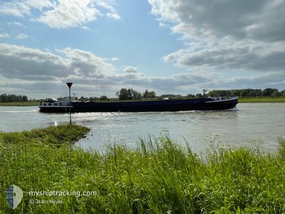
The vessel SMOOKY (IMO: 2006187, MMSI: 244740327) is a Not available It's sailing under the flag of [NL] Netherlands.
In this page you can find informations about the vessels current position, last detected port calls, and current voyage information. If the vessels is not in coverage by AIS you will find the latest position.
The current position of SMOOKY is detected by our AIS receivers and we are not responsible for the reliability of the data. The last position was recorded while the vessel was in Coverage by the Ais receivers of our vessel tracking app.
The current draught of SMOOKY as reported by AIS is 1 meters
Weather
| Temperature | 4.7°C / 40.46°F |
|---|---|
| Wind Speed | 5 knots |
| Direction | 328° NNW |
| Pressure | 1022.9 hPa |
| Humidity | 92.2 % |
| Cloud Coverage | --- |
Featured Company
Last Port Calls
| Port | Arrival | Departure | Time In Port |
|---|---|---|---|
| 2025-03-24 12:07 | 2025-03-24 13:19 | 1 h | |
| 2025-03-21 19:12 | 2025-03-24 10:14 | 2 d | |
| 2025-03-20 13:39 | 2025-03-20 21:30 | 7 h | |
| 2025-03-19 16:01 | 2025-03-20 10:27 | 18 h | |
| 2025-03-19 09:05 | 2025-03-19 10:25 | 1 h | |
| 2025-03-17 18:38 | 2025-03-18 08:47 | 14 h | |
| 2025-03-17 15:37 | 2025-03-17 16:42 | 1 h | |
| 2025-03-13 19:23 | 2025-03-14 11:57 | 16 h | |
| 2025-03-13 14:12 | 2025-03-13 14:46 | 33 m | |
| 2025-03-11 18:59 | 2025-03-13 10:29 | 1 d |
Last Trips
| Origin | Departure | Destination | Arrival | Distance | |
|---|---|---|---|---|---|
| 2025-03-24 10:14 | 2025-03-24 12:07 | 10.86 nm | |||
| 2025-03-20 21:30 | 2025-03-21 19:12 | 58.60 nm | |||
| 2025-03-20 10:27 | 2025-03-20 13:39 | 25.25 nm | |||
| 2025-03-19 10:25 | 2025-03-19 16:01 | 25.04 nm | |||
| 2025-03-18 08:47 | 2025-03-19 09:05 | 76.34 nm | |||
| 2025-03-17 16:42 | 2025-03-17 18:38 | 11.42 nm | |||
| 2025-03-14 11:57 | 2025-03-17 15:37 | 88.83 nm | |||
| 2025-03-13 14:46 | 2025-03-13 19:23 | 38.77 nm | |||
| 2025-03-13 10:29 | 2025-03-13 14:12 | 33.72 nm | |||
| 2025-03-11 14:14 | 2025-03-11 18:59 | 35.64 nm |
Events
| Tid | Hændelsen | Detaljer | Position / Dest | Info |
|---|---|---|---|---|
| 2025-03-25 20:37 | STOP Sejllads | 0.4 nm, West of SCHELLINGWOUDE |
52.37857 / 4.95461
JEDDELOH
|
Fart: 0.3 kn Kurs: 511° |
| 2025-03-25 20:29 | START Sejllads | 0.29 nm, West of SCHELLINGWOUDE |
52.38078 / 4.95673
JEDDELOH
|
Fart: 4.4 kn Kurs: 287.2° |
| 2025-03-25 20:14 | STOP Sejllads | 0.19 nm, West of SCHELLINGWOUDE |
52.38009 / 4.95976
JEDDELOH
|
Fart: 0.3 kn Kurs: 511° |
| 2025-03-25 17:24 | START Sejllads | 0.18 nm, West of LELYSTAD |
52.52642 / 5.43397
JEDDELOH
|
Fart: 4.2 kn Kurs: 185.4° |
| 2025-03-25 17:15 | STOP Sejllads | 0.21 nm, North West of LELYSTAD |
52.52827 / 5.43415
JEDDELOH
|
Fart: 0.1 kn Kurs: 511° |
| 2025-03-25 16:10 | Destination er ændret | JEDDELOH CUIJK |
52.63118 / 5.53722
JEDDELOH
|
Fart: 7.6 kn Kurs: 190.1° |
| 2025-03-25 16:03 | Destination er ændret | CUIJK JEDDELOH |
52.64460 / 5.54140
CUIJK
|
Fart: 7.6 kn Kurs: 190.4° |
| 2025-03-25 14:11 | START Sejllads | 0.9 nm, West of LEMMER |
52.85037 / 5.67583
JEDDELOH
|
Fart: 3.9 kn Kurs: 200.5° |
| 2025-03-25 13:51 | STOP Sejllads | 0.89 nm, West of LEMMER |
52.85212 / 5.67679
JEDDELOH
|
Fart: Kurs: 511° |
| 2025-03-25 11:28 | Status er ændret | Under way using engine Default |
53.06251 / 5.80235
JEDDELOH
|
Fart: 6 kn Kurs: 216° |