
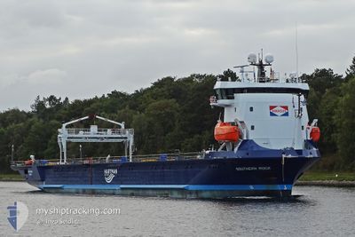
SOUTHERN ROCK
Cargo
Current Trip
| Trip Time | 3 days |
|---|---|
| Trip Distance | 720.69 nm |
| AVG Speed | 9.9 Knots |
| MAX Speed | 12.9 Knots |
| Dybgang | 4.2 m |
| AVG Wind | 16.6 knots |
| MAX Wind | 28 knots |
| MIN Temp | 3°C / 37.4°F |
| MAX Temp | 13.5°C / 56.3°F |
| Position Modtaget | 1 m siden |
Current Position
| Longitude | 0.48531° |
|---|---|
| Latitude | 49.48526° |
| Status | Under way using engine |
| Fart | |
| Kurs | 63° |
| Område | English Channel |
| Station | T-AIS |
| Position Modtaget | 1 m siden |
Info
Information
The current position of SOUTHERN ROCK is in English Channel with coordinates 49.48526° / 0.48531° as reported on 2025-02-08 14:22 by AIS to our vessel tracker app. The vessel's current speed is 0 Knots and is currently inside the port of RADICATEL.
The vessel SOUTHERN ROCK (IMO: 9965241, MMSI: 246809000) is a Cargo It's sailing under the flag of [NL] Netherlands.
In this page you can find informations about the vessels current position, last detected port calls, and current voyage information. If the vessels is not in coverage by AIS you will find the latest position.
The current position of SOUTHERN ROCK is detected by our AIS receivers and we are not responsible for the reliability of the data. The last position was recorded while the vessel was in Coverage by the Ais receivers of our vessel tracking app.
The current draught of SOUTHERN ROCK as reported by AIS is 4.2 meters
Weather
| Temperature | 6.2°C / 43.16°F |
|---|---|
| Wind Speed | 9 knots |
| Direction | 133° SE |
| Pressure | 1017.7 hPa |
| Humidity | 67.1 % |
| Cloud Coverage | 75 % |
Featured Company
Last Port Calls
| Port | Arrival | Departure | Time In Port |
|---|---|---|---|
| 2025-02-07 20:24 | |||
| 2025-02-04 02:31 | 2025-02-04 18:18 | 15 h | |
| 2025-01-26 06:29 | 2025-01-27 15:57 | 1 d | |
| 2025-01-23 23:52 | 2025-01-24 17:54 | 18 h | |
| 2025-01-21 19:44 | 2025-01-22 13:15 | 17 h | |
| 2025-01-19 01:52 | 2025-01-19 16:23 | 14 h | |
| 2025-01-12 00:59 | 2025-01-13 12:51 | 1 d | |
| 2025-01-04 14:55 | 2025-01-06 07:11 | 1 d | |
| 2024-12-25 07:43 | 2024-12-26 20:14 | 1 d | |
| 2024-12-21 08:05 | 2024-12-21 18:26 | 10 h |
Most Visited Ports (Last year)
| Port | Arrivals | |
|---|---|---|
| 5 | ||
| 3 | ||
| 3 | ||
| 3 | ||
| 2 | ||
| 2 |
Last Trips
| Origin | Departure | Destination | Arrival | Distance | |
|---|---|---|---|---|---|
| 2025-02-04 18:18 | 2025-02-07 20:24 | 720.69 nm | |||
| 2025-01-27 15:57 | 2025-02-04 02:31 | 1973.37 nm | |||
| 2025-01-24 17:54 | 2025-01-26 06:29 | 440.72 nm | |||
| 2025-01-22 13:15 | 2025-01-23 23:52 | 437.36 nm | |||
| 2025-01-19 16:23 | 2025-01-21 19:44 | 681.30 nm | |||
| 2025-01-13 12:51 | 2025-01-19 01:52 | 456.72 nm | |||
| 2025-01-06 07:11 | 2025-01-12 00:59 | 20.13 nm | |||
| 2024-12-26 20:14 | 2025-01-04 14:55 | 1822.56 nm | |||
| 2024-12-21 18:26 | 2024-12-25 07:43 | 670.95 nm | |||
| 2024-12-19 20:33 | 2024-12-21 08:05 | 355.10 nm |
Events
| Tid | Hændelsen | Detaljer | Position / Dest | Info |
|---|---|---|---|---|
| 2025-02-07 19:29 | STOP Sejllads |
49.48519 / .48532
[FR] RADICATEL
|
Fart: 0.3 kn Kurs: 62° |
|
| 2025-02-07 19:24 | Skibe i havn |
|
49.48357 / .48259
[FR] RADICATEL
|
Fart: 2.7 kn Kurs: 57° |
| 2025-02-07 17:13 | START Sejllads | 8.9 nm, West of LE HAVRE |
49.46758 / -.10514
RADICATEL
|
Fart: 3.2 kn Kurs: 167° |
| 2025-02-07 17:03 | Status er ændret | Under way using engine At anchor |
49.46867 / -.10399
RADICATEL
|
Fart: 0.9 kn Kurs: 116° |
| 2025-02-07 09:20 | Status er ændret | At anchor Default |
49.46822 / -.10574
RADICATEL
|
Fart: 0.2 kn Kurs: 74° |
| 2025-02-07 09:17 | Status er ændret | Default At anchor |
49.46835 / -.10585
RADICATEL
|
Fart: 0.1 kn Kurs: 68° |
| 2025-02-07 08:14 | Status er ændret | At anchor Under way using engine |
49.46832 / -.10566
RADICATEL
|
Fart: Kurs: 82° |
| 2025-02-07 07:51 | STOP Sejllads | 8.81 nm, West of LE HAVRE |
49.46874 / -.10298
RADICATEL
|
Fart: 0.2 kn Kurs: 57° |
| 2025-02-07 06:25 | Destination er ændret | RADICATEL MARIN |
49.54106 / -.38818
RADICATEL
|
Fart: 10.9 kn Kurs: 110.7° |
| 2025-02-07 04:20 | Status er ændret | Under way using engine Default |
49.67862 / -.90318
MARIN
|
Fart: 10.3 kn Kurs: 118° |