
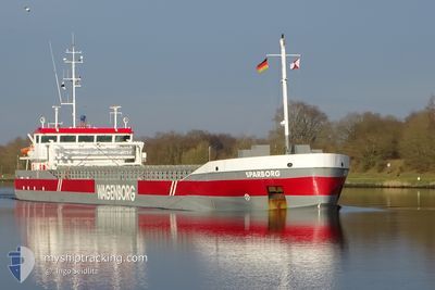
SPARBORG
General Cargo
Current Trip
| Trip Time | 22 h, 32 mins |
|---|---|
| Trip Distance | 184.62 nm |
| AVG Speed | 8.4 Knots |
| MAX Speed | 11.9 Knots |
| Dybgang | 3.5 m |
| AVG Wind | 18.3 knots |
| MAX Wind | 21.9 knots |
| MIN Temp | -0.6°C / 30.92°F |
| MAX Temp | 1.8°C / 35.24°F |
| Position Modtaget | 19 h, 3 m siden |
Current Position
| Longitude | 13.81170° |
|---|---|
| Latitude | 54.37758° |
| Status | Under way using engine |
| Fart | 6.9 Knots |
| Kurs | 165.6° |
| Område | Baltic Sea |
| Station | T-AIS |
| Position Modtaget | 19 h, 3 m siden |
Info
Information
The current position of SPARBORG is in Baltic Sea with coordinates 54.37758° / 13.81170° as reported on 2025-02-12 12:34 by AIS to our vessel tracker app. The vessel's current speed is 6.9 Knots and is currently inside the port of WOLGAST.
The vessel SPARBORG (IMO: 9279018, MMSI: 246218000) is a General Cargo that was built in 2004 ( 21 år gamle ). It's sailing under the flag of [NL] Netherlands.
In this page you can find informations about the vessels current position, last detected port calls, and current voyage information. If the vessels is not in coverage by AIS you will find the latest position.
The current position of SPARBORG is detected by our AIS receivers and we are not responsible for the reliability of the data. The last position was recorded while the vessel was in Coverage by the Ais receivers of our vessel tracking app.
The current draught of SPARBORG as reported by AIS is 3.5 meters
Weather
| Temperature | -0.5°C / 31.1°F |
|---|---|
| Wind Speed | 5 knots |
| Direction | 65° ENE |
| Pressure | 1018.3 hPa |
| Humidity | 79.8 % |
| Cloud Coverage | 100 % |
Featured Company
Last Port Calls
| Port | Arrival | Departure | Time In Port |
|---|---|---|---|
| 2025-02-12 16:38 | |||
| 2025-02-11 05:29 | 2025-02-11 18:06 | 12 h | |
| 2025-02-07 04:57 | 2025-02-07 05:58 | 1 h | |
| 2025-02-01 08:27 | 2025-02-05 10:11 | 4 d | |
| 2025-01-25 13:41 | 2025-01-28 14:28 | 3 d | |
| 2025-01-21 22:24 | 2025-01-23 10:46 | 1 d | |
| 2025-01-15 10:30 | 2025-01-17 23:44 | 2 d | |
| 2025-01-14 20:29 | 2025-01-14 22:20 | 1 h | |
| 2025-01-13 18:38 | 2025-01-14 19:16 | 1 d | |
| 2025-01-13 09:46 | 2025-01-13 18:10 | 8 h |
Most Visited Ports (Last year)
| Port | Arrivals | |
|---|---|---|
| 5 | ||
| 5 | ||
| 5 | ||
| 3 | ||
| 2 | ||
| 2 |
Last Trips
| Origin | Departure | Destination | Arrival | Distance | |
|---|---|---|---|---|---|
| 2025-02-11 19:06 | 2025-02-12 17:38 | 184.62 nm | |||
| 2025-02-07 06:58 | 2025-02-11 06:29 | 513.55 nm | |||
| 2025-02-05 11:11 | 2025-02-07 05:57 | 421.55 nm | |||
| 2025-01-28 15:28 | 2025-02-01 09:27 | 774.11 nm | |||
| 2025-01-23 11:46 | 2025-01-25 14:41 | 434.83 nm | |||
| 2025-01-18 00:44 | 2025-01-21 23:24 | 835.92 nm | |||
| 2025-01-14 23:20 | 2025-01-15 11:30 | 112.38 nm | |||
| 2025-01-14 20:16 | 2025-01-14 21:29 | 8.58 nm | |||
| 2025-01-13 19:10 | 2025-01-13 19:38 | 2.35 nm | |||
| 2025-01-10 19:21 | 2025-01-13 10:46 | 588.00 nm |
Events
| Tid | Hændelsen | Detaljer | Position / Dest | Info |
|---|---|---|---|---|
| 2025-02-12 17:56 | STOP Sejllads |
54.03533 / 13.76092
[DE] WOLGAST
|
Fart: Kurs: 56° |
|
| 2025-02-12 16:38 | Skibe i havn |
|
54.05942 / 13.78604
[DE] WOLGAST
|
Fart: 4.6 kn Kurs: 211° |
| 2025-02-12 12:41 | Status er ændret | Default Under way using engine |
54.36357 / 13.81737
DEWOL
|
Fart: 6.9 kn Kurs: 165.6° |
| 2025-02-12 12:34 | Udenfor Dækning |
54.37758 / 13.81170
Baltic Sea
DEWOL
|
Fart: 6.9 kn Kurs: 165.6° |
|
| 2025-02-12 06:26 | Ændre havområde | German part of the Baltic Sea Swedish part of the Baltic Sea |
55.01060 / 13.27046
Baltic Sea
DEWOL
|
Fart: 8 kn Kurs: 145.7° |
| 2025-02-12 03:07 | Ændre havområde | Swedish part of the Baltic Sea Danish part of the Baltic Sea |
55.30234 / 12.64761
Baltic Sea
DEWOL
|
Fart: 9.2 kn Kurs: 112.9° |
| 2025-02-12 02:58 | Ændre havområde | Danish part of the Baltic Sea Danish part of the Kattegat |
55.32431 / 12.63523
Baltic Sea
DEWOL
|
Fart: 10.1 kn Kurs: 182° |
| 2025-02-12 02:49 | Ændre havområde | Danish part of the Kattegat Swedish part of the Kattegat |
55.34882 / 12.63775
Kattegat
DEWOL
|
Fart: 9.9 kn Kurs: 183.7° |
| 2025-02-12 02:07 | Ændre havområde | Swedish part of the Kattegat Danish part of the Kattegat |
55.46858 / 12.68038
Kattegat
DEWOL
|
Fart: 10.2 kn Kurs: 190.3° |
| 2025-02-11 20:55 | Ændre havområde | Danish part of the Kattegat Swedish part of the Kattegat |
56.20566 / 12.38140
Kattegat
DEWOL
|
Fart: 8 kn Kurs: 158.5° |