
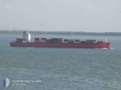
SPIRIT OF SYDNEY
Container Ship
Current Trip
| Time Travelled | 7 days |
|---|---|
| Remaining Time | --- |
| Distance Travelled | 2757.52 nm |
| Remaining Distance | --- |
| AVG Speed | 15.5 Knots |
| MAX Speed | 20.6 Knots |
| AVG Wind | 9.6 knots |
| MAX Wind | 17 knots |
| MIN Temp | 19.1°C / 66.38°F |
| MAX Temp | 28.9°C / 84.02°F |
| Dybgang | 11.3 m |
| Position Modtaget | 26 d siden |
Current Position
| Longitude | -6.04299° |
|---|---|
| Latitude | 35.83838° |
| Status | Under way using engine |
| Fart | 17.2 Knots |
| Kurs | 263.6° |
| Område | North Atlantic Ocean |
| Station | T-AIS |
| Position Modtaget | 26 d siden |
Info
Information
The current position of SPIRIT OF SYDNEY is in North Atlantic Ocean with coordinates 35.83838° / -6.04299° as reported on 2025-02-16 23:51 by AIS to our vessel tracker app. The vessel's current speed is 17.2 Knots and is heading at the port of TANGER MED.
The vessel SPIRIT OF SYDNEY (IMO: 9391672, MMSI: 232013525) is a Container Ship that was built in 2007 ( 18 år gamle ). It's sailing under the flag of [GB] United Kingdom.
In this page you can find informations about the vessels current position, last detected port calls, and current voyage information. If the vessels is not in coverage by AIS you will find the latest position.
The current position of SPIRIT OF SYDNEY is detected by our AIS receivers and we are not responsible for the reliability of the data. The last position was recorded while the vessel was in Coverage by the Ais receivers of our vessel tracking app.
The current draught of SPIRIT OF SYDNEY as reported by AIS is 11.3 meters
Weather
| Temperature | 19.3°C / 66.74°F |
|---|---|
| Wind Speed | 17 knots |
| Direction | 21° NNE |
| Pressure | 1015.8 hPa |
| Humidity | 79.9 % |
| Cloud Coverage | --- |
Featured Company
Last Port Calls
| Port | Arrival | Departure | Time In Port |
|---|---|---|---|
| 2025-03-07 06:45 | 2025-03-07 14:26 | 7 h | |
| 2025-03-04 08:32 | 2025-03-06 10:27 | 2 d | |
| 2025-03-02 05:52 | 2025-03-03 14:13 | 1 d | |
| 2025-02-10 21:46 | 2025-02-11 20:26 | 22 h | |
| 2025-02-07 08:13 | 2025-02-08 08:19 | 1 d | |
| 2025-02-05 03:13 | 2025-02-06 09:32 | 1 d | |
| 2025-02-02 16:00 | 2025-02-02 22:48 | 6 h | |
| 2025-01-16 05:08 | 2025-01-17 19:47 | 1 d | |
| 2025-01-13 03:48 | 2025-01-14 13:28 | 1 d |
Last Trips
| Origin | Departure | Destination | Arrival | Distance | |
|---|---|---|---|---|---|
| 2025-03-06 11:27 | 2025-03-07 07:45 | 7.46 nm | |||
| 2025-03-03 15:13 | 2025-03-04 09:32 | 296.05 nm | |||
| 2025-02-11 20:26 | 2025-03-02 06:52 | 4479.99 nm | |||
| 2025-02-08 09:19 | 2025-02-10 21:46 | 977.21 nm | |||
| 2025-02-06 10:32 | 2025-02-07 09:13 | 302.42 nm | |||
| 2025-02-02 23:48 | 2025-02-05 04:13 | 136.80 nm | |||
| 2025-01-17 20:47 | 2025-02-02 17:00 | 5500.07 nm | |||
| 2025-01-14 14:28 | 2025-01-16 06:08 | 314.09 nm | |||
| 2024-12-23 13:43 | 2025-01-13 04:48 | 5370.07 nm |
Events
| Tid | Hændelsen | Detaljer | Position / Dest | Info |
|---|---|---|---|---|
| 2025-03-07 14:26 | Afsejlet fra sidste havn |
|
-8.76311 / 13.27472
MAPTM
|
Fart: 7.5 kn Kurs: 37° |
| 2025-03-07 14:09 | START Sejllads |
-8.79022 / 13.25441
[AO] LUANDA
|
Fart: 6.6 kn Kurs: 39° |
|
| 2025-03-07 07:31 | STOP Sejllads |
-8.79865 / 13.25093
[AO] LUANDA
|
Fart: 0.3 kn Kurs: 85° |
|
| 2025-03-07 06:45 | Skibe i havn |
|
-8.76757 / 13.27202
[AO] LUANDA
|
Fart: 5.4 kn Kurs: 224° |
| 2025-03-07 05:48 | START Sejllads | 2.66 nm, North of LUANDA |
-8.74431 / 13.25186
MAPTM
|
Fart: 3.4 kn Kurs: 61° |
| 2025-03-06 11:19 | STOP Sejllads | 2.25 nm, North of LUANDA |
-8.75101 / 13.24734
MAPTM
|
Fart: 0.2 kn Kurs: 39° |
| 2025-03-06 10:27 | Afsejlet fra sidste havn |
|
-8.74462 / 13.26872
MAPTM
|
Fart: 5.3 kn Kurs: 29° |
| 2025-03-06 10:15 | START Sejllads |
-8.78212 / 13.26746
[AO] LUANDA
|
Fart: 3.9 kn Kurs: 354° |