
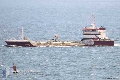
ST PIERRE
Trailing Suction Hopper Dredger
Current Trip
| Time Travelled | 21 h, 4 mins |
|---|---|
| Remaining Time | 3 h, 47 mins |
| Distance Travelled | 150.01 nm |
| Remaining Distance | 40.31 nm |
| AVG Speed | 8.9 Knots |
| MAX Speed | 14.6 Knots |
| AVG Wind | 9.5 knots |
| MAX Wind | 18.2 knots |
| MIN Temp | 3.7°C / 38.66°F |
| MAX Temp | 8.5°C / 47.3°F |
| Dybgang | 6.2 m |
| Position Modtaget | Nu |
Current Position
| Longitude | -2.86952° |
|---|---|
| Latitude | 47.21503° |
| Status | Under way using engine |
| Fart | 10.4 Knots |
| Kurs | 318.2° |
| Område | Bay of Biscay |
| Station | T-AIS |
| Position Modtaget | Nu |
Info
Information
The current position of ST PIERRE is in Bay of Biscay with coordinates 47.21503° / -2.86952° as reported on 2025-02-09 09:44 by AIS to our vessel tracker app. The vessel's current speed is 10.4 Knots and is heading at the port of LORIENT. The estimated time of arrival as calculated by MyShipTracking vessel tracking app is 2025-02-09 13:32 LT
The vessel ST PIERRE (IMO: 9598751, MMSI: 228024800) is a Trailing Suction Hopper Dredger that was built in 2012 ( 13 år gamle ). It's sailing under the flag of [FR] France.
In this page you can find informations about the vessels current position, last detected port calls, and current voyage information. If the vessels is not in coverage by AIS you will find the latest position.
The current position of ST PIERRE is detected by our AIS receivers and we are not responsible for the reliability of the data. The last position was recorded while the vessel was in Coverage by the Ais receivers of our vessel tracking app.
The current draught of ST PIERRE as reported by AIS is 6.2 meters
Weather
| Temperature | 7°C / 44.6°F |
|---|---|
| Wind Speed | 13 knots |
| Direction | 89° E |
| Pressure | 1023.3 hPa |
| Humidity | 81.8 % |
| Cloud Coverage | 100 % |
Featured Company
Last Port Calls
| Port | Arrival | Departure | Time In Port |
|---|---|---|---|
| 2025-02-08 10:47 | 2025-02-08 12:41 | 1 h | |
| 2025-02-07 11:53 | 2025-02-07 13:57 | 2 h | |
| 2025-02-07 11:40 | 2025-02-07 11:45 | 5 m | |
| 2025-02-05 16:45 | 2025-02-05 18:40 | 1 h | |
| 2025-02-03 09:55 | 2025-02-04 19:22 | 1 d | |
| 2025-02-02 20:11 | 2025-02-02 20:14 | 3 m | |
| 2025-02-01 04:41 | 2025-02-01 06:52 | 2 h | |
| 2025-01-31 03:44 | 2025-01-31 05:52 | 2 h | |
| 2025-01-26 03:59 | 2025-01-30 11:26 | 4 d | |
| 2025-01-22 10:22 | 2025-01-23 11:00 | 1 d |
Most Visited Ports (Last year)
| Port | Arrivals | |
|---|---|---|
| 93 | ||
| 78 | ||
| 60 | ||
| 39 | ||
| 2 |
Last Trips
| Origin | Departure | Destination | Arrival | Distance | |
|---|---|---|---|---|---|
| 2025-02-07 14:57 | 2025-02-08 11:47 | 155.02 nm | |||
| 2025-02-07 12:45 | 2025-02-07 12:53 | 0.34 nm | |||
| 2025-02-05 19:40 | 2025-02-07 12:40 | 263.11 nm | |||
| 2025-02-04 20:22 | 2025-02-05 17:45 | 165.08 nm | |||
| 2025-02-02 21:14 | 2025-02-03 10:55 | 128.75 nm | |||
| 2025-02-01 07:52 | 2025-02-02 21:11 | 299.57 nm | |||
| 2025-01-31 06:52 | 2025-02-01 05:41 | 274.14 nm | |||
| 2025-01-30 12:26 | 2025-01-31 04:44 | 166.35 nm | |||
| 2025-01-23 12:00 | 2025-01-26 04:59 | 202.89 nm | |||
| 2025-01-21 12:03 | 2025-01-22 11:22 | 156.86 nm |
Events
| Tid | Hændelsen | Detaljer | Position / Dest | Info |
|---|---|---|---|---|
| 2025-02-09 08:03 | Status er ændret | Under way using engine Restricted manoeuverability |
47.02719 / -2.56542
LORIENT
|
Fart: 9.9 kn Kurs: 315.6° |
| 2025-02-09 06:14 | Status er ændret | Restricted manoeuverability Under way using engine |
46.99979 / -2.56352
LORIENT
|
Fart: 12.1 kn Kurs: 234.5° |
| 2025-02-09 04:41 | ETA er ændret | 2025/02/09 13:30 2025/02/08 21:15 |
47.23377 / -2.25868
LORIENT
|
Fart: 13.1 kn Kurs: 229.1° |
| 2025-02-09 04:34 | Destination er ændret | LORIENT NANTES |
47.24703 / -2.23141
LORIENT
|
Fart: 13.6 kn Kurs: 235.2° |
| 2025-02-09 02:17 | START Sejllads | 3.8 nm, West of NANTES |
47.19225 / -1.63650
NANTES
|
Fart: 6.4 kn Kurs: 263.1° |
| 2025-02-09 00:30 | STOP Sejllads | 3.7 nm, West of NANTES |
47.19172 / -1.63383
NANTES
|
Fart: 0.2 kn Kurs: 80° |
| 2025-02-08 19:28 | ETA er ændret | 2025/02/08 21:15 2025/02/08 00:30 |
47.05302 / -2.43829
NANTES
|
Fart: 3.8 kn Kurs: 36° |
| 2025-02-08 19:22 | ETA er ændret | 2025/02/08 00:30 2025/02/09 00:30 |
47.04808 / -2.44445
NANTES
|
Fart: 3.7 kn Kurs: 38° |
| 2025-02-08 18:18 | Status er ændret | Under way using engine Restricted manoeuverability |
47.00318 / -2.52574
NANTES
|
Fart: 2.8 kn Kurs: 82° |
| 2025-02-08 16:22 | Status er ændret | Restricted manoeuverability Under way using engine |
46.98021 / -2.59743
NANTES
|
Fart: 1.6 kn Kurs: 49° |