

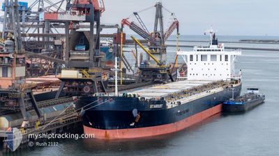
STARDUST
Cargo

Current Trip
| Time Travelled | 34 days |
|---|---|
| Remaining Time | 11 days |
| Distance Travelled | 2881.43 nm |
| Remaining Distance | 3284.93 nm |
| AVG Speed | 11.3 Knots |
| MAX Speed | 15.6 Knots |
| AVG Wind | 14.9 knots |
| MAX Wind | 36 knots |
| MIN Temp | -2.8°C / 26.96°F |
| MAX Temp | 19°C / 66.2°F |
| Dybgang | 6.7 m |
| Position Modtaget | 3 d siden |
Current Position
| Longitude | 142.06497° |
|---|---|
| Latitude | 41.63962° |
| Status | Under way using engine |
| Fart | 13 Knots |
| Kurs | 87.9° |
| Område | North Pacific Ocean |
| Station | T-AIS |
| Position Modtaget | 3 d siden |
Information
The current position of STARDUST is in North Pacific Ocean with coordinates 41.63962° / 142.06497° as reported on 2025-03-26 01:29 by AIS to our vessel tracker app. The vessel's current speed is 13 Knots and is heading at the port of VANCOUVER. The estimated time of arrival as calculated by MyShipTracking vessel tracking app is 2025-04-09 19:17 LT
The vessel STARDUST (IMO: 9591959, MMSI: 636020594) is a Cargo It's sailing under the flag of [LR] Liberia.
In this page you can find informations about the vessels current position, last detected port calls, and current voyage information. If the vessels is not in coverage by AIS you will find the latest position.
The current position of STARDUST is detected by our AIS receivers and we are not responsible for the reliability of the data. The last position was recorded while the vessel was in Coverage by the Ais receivers of our vessel tracking app.
The current draught of STARDUST as reported by AIS is 6.7 meters
Weather
| Temperature | 4.7°C / 40.46°F |
|---|---|
| Wind Speed | 24 knots |
| Direction | 156° SSE |
| Pressure | 1021.4 hPa |
| Humidity | 93.2 % |
| Cloud Coverage | 100 % |


Featured Company
Last Trips
| Origin | Departure | Destination | Arrival | Distance | |
|---|---|---|---|---|---|
| 2024-12-04 08:30 | 2025-02-18 10:05 | 11287.37 nm |
Events
| Tid | Hændelsen | Detaljer | Position / Dest | Info |
|---|---|---|---|---|
| 2025-03-26 01:31 | Status er ændret | Default Under way using engine |
41.63981 / 142.07651
CAVAN
|
Fart: 13 kn Kurs: 87.9° |
| 2025-03-26 01:29 | Status er ændret | Under way using engine Default |
41.63962 / 142.06497
CAVAN
|
Fart: 13.1 kn Kurs: 87° |
| 2025-03-26 01:29 | Udenfor Dækning |
41.63962 / 142.06497
North Pacific Ocean
CAVAN
|
Fart: 13 kn Kurs: 87.9° |
|
| 2025-03-26 01:26 | Status er ændret | Default Under way using engine |
41.63935 / 142.04956
CAVAN
|
Fart: 13 kn Kurs: 86.1° |
| 2025-03-25 22:56 | Ændre havområde | Japanese part of the North Pacific Ocean Japanese part of the Japan Sea |
41.62297 / 141.31069
North Pacific Ocean
CAVAN
|
Fart: 12.4 kn Kurs: 84° |
| 2025-03-25 19:13 | Status er ændret | Under way using engine Default |
41.29525 / 140.27975
CAVAN
|
Fart: 14.1 kn Kurs: 60° |
| 2025-03-25 18:46 | Status er ændret | Default Under way using engine |
41.24211 / 140.15771
CAVAN
|
Fart: 13 kn Kurs: 60.6° |
| 2025-03-25 17:48 | Destination er ændret | CAVAN VANCOUVER |
41.12314 / 139.92957
CAVAN
|
Fart: 12.2 kn Kurs: 49.3° |
| 2025-03-25 17:48 | ETA er ændret | 2025/04/09 16:00 2025/04/09 07:32 |
41.12314 / 139.92957
CAVAN
|
Fart: 12.2 kn Kurs: 49.3° |
| 2025-03-25 17:26 | Status er ændret | Under way using engine Default |
41.08170 / 139.84449
VANCOUVER
|
Fart: 13.4 kn Kurs: 58° |