
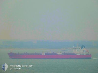
STI FULHAM
Tanker
Current Trip
| Time Travelled | 18 h, 12 mins |
|---|---|
| Remaining Time | 18 h, 22 mins |
| Distance Travelled | 223.24 nm |
| Remaining Distance | 234.76 nm |
| AVG Speed | 12 Knots |
| MAX Speed | 13.1 Knots |
| AVG Wind | 14.8 knots |
| MAX Wind | 19 knots |
| MIN Temp | -2.7°C / 27.14°F |
| MAX Temp | 0.9°C / 33.62°F |
| Dybgang | 11.3 m |
| Position Modtaget | 8 h, 41 m siden |
Current Position
| Longitude | 22.52291° |
|---|---|
| Latitude | 59.49643° |
| Status | Under way using engine |
| Fart | 12 Knots |
| Kurs | 238.7° |
| Område | Baltic Sea |
| Station | T-AIS |
| Position Modtaget | 8 h, 41 m siden |
Info
Information
The current position of STI FULHAM is in Baltic Sea with coordinates 59.49643° / 22.52291° as reported on 2025-02-18 23:17 by AIS to our vessel tracker app. The vessel's current speed is 12 Knots and is heading at the port of GDYNIA. The estimated time of arrival as calculated by MyShipTracking vessel tracking app is 2025-02-20 02:21 LT
The vessel STI FULHAM (IMO: 9688374, MMSI: 538005400) is a Tanker It's sailing under the flag of [MH] Marshall Is.
In this page you can find informations about the vessels current position, last detected port calls, and current voyage information. If the vessels is not in coverage by AIS you will find the latest position.
The current position of STI FULHAM is detected by our AIS receivers and we are not responsible for the reliability of the data. The last position was recorded while the vessel was in Coverage by the Ais receivers of our vessel tracking app.
The current draught of STI FULHAM as reported by AIS is 11.3 meters
Weather
| Temperature | 0.8°C / 33.44°F |
|---|---|
| Wind Speed | 9 knots |
| Direction | 331° NNW |
| Pressure | 1028.9 hPa |
| Humidity | 64.1 % |
| Cloud Coverage | 19 % |
Featured Company
Last Port Calls
| Port | Arrival | Departure | Time In Port |
|---|---|---|---|
| 2025-02-16 20:28 | 2025-02-18 13:47 | 1 d | |
| 2025-02-13 23:26 | 2025-02-15 07:47 | 1 d | |
| 2025-02-10 13:51 | 2025-02-12 10:28 | 1 d | |
| 2025-02-07 19:01 | 2025-02-07 20:00 | 59 m | |
| 2025-02-05 19:18 | 2025-02-07 17:30 | 1 d | |
| 2025-01-31 12:10 | 2025-02-02 09:02 | 1 d | |
| 2025-01-22 21:18 | 2025-01-25 08:08 | 2 d | |
| 2025-01-17 17:48 | 2025-01-19 04:19 | 1 d | |
| 2024-12-30 09:15 | 2025-01-04 12:58 | 5 d | |
| 2024-12-27 06:12 | 2024-12-29 20:27 | 2 d |
Last Trips
| Origin | Departure | Destination | Arrival | Distance | |
|---|---|---|---|---|---|
| 2025-02-15 08:47 | 2025-02-16 22:28 | 459.12 nm | |||
| 2025-02-12 11:28 | 2025-02-14 00:26 | 434.58 nm | |||
| 2025-02-07 21:00 | 2025-02-10 14:51 | 766.26 nm | |||
| 2025-02-07 18:30 | 2025-02-07 20:01 | 9.18 nm | |||
| 2025-02-02 10:02 | 2025-02-05 20:18 | 772.05 nm | |||
| 2025-01-25 09:08 | 2025-01-31 13:10 | 624.76 nm | |||
| 2025-01-19 05:19 | 2025-01-22 22:18 | 676.44 nm | |||
| 2025-01-04 13:58 | 2025-01-17 18:48 | 1526.85 nm | |||
| 2024-12-29 21:27 | 2024-12-30 10:15 | 133.30 nm | |||
| 2024-12-20 19:29 | 2024-12-27 07:12 | 1435.51 nm |
Events
| Tid | Hændelsen | Detaljer | Position / Dest | Info |
|---|---|---|---|---|
| 2025-02-18 23:32 | Status er ændret | Default Under way using engine |
59.46713 / 22.44624
FISKV>PLGDY
|
Fart: 12 kn Kurs: 238.7° |
| 2025-02-18 23:17 | Udenfor Dækning |
59.49643 / 22.52291
Baltic Sea
FISKV>PLGDY
|
Fart: 12 kn Kurs: 238.7° |
|
| 2025-02-18 21:46 | Fundet i havområde | Finnish part of the Baltic Sea |
59.60070 / 23.08723
Baltic Sea
FISKV>PLGDY
|
Fart: 12.1 kn Kurs: 254.5° |
| 2025-02-18 19:25 | Status er ændret | Under way using engine Default |
59.73120 / 24.00207
FISKV>PLGDY
|
Fart: 12.8 kn Kurs: 254° |
| 2025-02-18 19:14 | Status er ændret | Default Under way using engine |
59.74212 / 24.08132
FISKV>PLGDY
|
Fart: 12.7 kn Kurs: 254.6° |
| 2025-02-18 18:47 | Status er ændret | Under way using engine Default |
59.76802 / 24.26382
FISKV>PLGDY
|
Fart: 12.9 kn Kurs: 257° |
| 2025-02-18 18:33 | Status er ændret | Default Under way using engine |
59.77890 / 24.35416
FISKV>PLGDY
|
Fart: 12.8 kn Kurs: 256° |
| 2025-02-18 18:07 | Status er ændret | Under way using engine Default |
59.80127 / 24.53711
FISKV>PLGDY
|
Fart: 13 kn Kurs: 256° |
| 2025-02-18 18:05 | Status er ændret | Default Under way using engine |
59.80247 / 24.54741
FISKV>PLGDY
|
Fart: 13.1 kn Kurs: 256° |
| 2025-02-18 17:32 | Ændre havområde | Finnish part of the Gulf of Finland Estonian part of the Gulf of Finland |
59.83405 / 24.78295
Gulf of Finland
FISKV>PLGDY
|
Fart: 13.1 kn Kurs: 255.7° |