

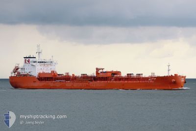
STOLT APAL
Tanker B

Current Trip
IN HZR
| Time Travelled | 20 days |
|---|---|
| Remaining Time | --- |
| Distance Travelled | 4856.46 nm |
| Remaining Distance | --- |
| AVG Speed | 12.4 Knots |
| MAX Speed | 15.7 Knots |
| AVG Wind | 10.9 knots |
| MAX Wind | 27.1 knots |
| MIN Temp | 25.3°C / 77.54°F |
| MAX Temp | 30.4°C / 86.72°F |
| Dybgang | 9.1 m |
| Position Modtaget | 8 d siden |
Current Position
| Longitude | 76.96937° |
|---|---|
| Latitude | 7.02232° |
| Status | Under way using engine |
| Fart | 11.7 Knots |
| Kurs | 291.6° |
| Område | Malacca Strait |
| Station | T-AIS |
| Position Modtaget | 8 d siden |
Information
The current position of STOLT APAL is in Malacca Strait with coordinates 7.02232° / 76.96937° as reported on 2025-05-25 12:24 by AIS to our vessel tracker app. The vessel's current speed is 11.7 Knots
The vessel STOLT APAL (IMO: 9719240, MMSI: 255806419) is a Tanker B It's sailing under the flag of [PT] Portugal.
In this page you can find informations about the vessels current position, last detected port calls, and current voyage information. If the vessels is not in coverage by AIS you will find the latest position.
The current position of STOLT APAL is detected by our AIS receivers and we are not responsible for the reliability of the data. The last position was recorded while the vessel was in Coverage by the Ais receivers of our vessel tracking app.
The current draught of STOLT APAL as reported by AIS is 9.1 meters
Weather
| Temperature | 28.4°C / 83.12°F |
|---|---|
| Wind Speed | 19 knots |
| Direction | 242° WSW |
| Pressure | 1003.2 hPa |
| Humidity | 86 % |
| Cloud Coverage | 85 % |


Featured Company
Last Port Calls
| Port | Arrival | Departure | Time In Port |
|---|---|---|---|
| 2025-05-13 18:59 | 2025-05-14 14:09 | 19 h | |
| 2025-05-06 09:22 | 2025-05-07 20:46 | 1 d | |
| 2025-05-04 09:10 | 2025-05-05 16:50 | 1 d | |
| 2025-04-30 11:24 | 2025-05-01 08:58 | 21 h | |
| 2025-04-28 09:02 | 2025-04-30 10:30 | 2 d | |
| 2025-04-25 13:24 | 2025-04-27 20:27 | 2 d |
Last Trips
| Origin | Departure | Destination | Arrival | Distance | |
|---|---|---|---|---|---|
| 2025-05-07 20:46 | 2025-05-13 18:59 | 1224.32 nm | |||
| 2025-05-05 16:50 | 2025-05-06 09:22 | 20.35 nm | |||
| 2025-05-01 08:58 | 2025-05-04 09:10 | 789.60 nm | |||
| 2025-04-30 10:30 | 2025-04-30 11:24 | 1.68 nm | |||
| 2025-04-27 20:27 | 2025-04-28 09:02 | 12.56 nm | |||
| 2025-03-13 04:42 | 2025-04-25 13:24 | 11452.42 nm |
Events
| Tid | Hændelsen | Detaljer | Position / Dest | Info |
|---|---|---|---|---|
| 2025-06-01 13:24 | START Sejllads |
21.07625 / 72.59692
IN HZR
|
Fart: 7.3 kn Kurs: 227° |
|
| 2025-05-30 17:05 | STOP Sejllads |
21.08160 / 72.62849
IN HZR
|
Fart: 0.1 kn Kurs: 133° |
|
| 2025-05-30 15:02 | START Sejllads |
20.88035 / 72.62073
IN HZR
|
Fart: 8.3 kn Kurs: 8° |
|
| 2025-05-28 21:41 | STOP Sejllads |
20.86864 / 72.62561
IN HZR
|
Fart: 0.2 kn Kurs: 190° |
|
| 2025-05-25 12:25 | Status er ændret | Default Under way using engine |
7.02386 / 76.96585
IN HZR
|
Fart: 11.7 kn Kurs: 291.6° |
| 2025-05-25 12:24 | Status er ændret | Under way using engine Default |
7.02232 / 76.96937
IN HZR
|
Fart: 11.7 kn Kurs: 292° |
| 2025-05-25 12:24 | Indenfor Dækning |
7.02232 / 76.96937
Malacca Strait
IN HZR
|
Fart: 11.7 kn Kurs: 291.6° |
|
| 2025-05-25 12:24 | Udenfor Dækning |
7.02232 / 76.96937
Malacca Strait
IN HZR
|
Fart: 11.7 kn Kurs: 291.6° |