

STORNES
Pipe Burying Vessel

Current Trip
| Trip Time | 23 days |
|---|---|
| Trip Distance | 2972.27 nm |
| AVG Speed | 10.8 Knots |
| MAX Speed | 15.2 Knots |
| Dybgang | 6.3 m |
| AVG Wind | 16.9 knots |
| MAX Wind | 42.8 knots |
| MIN Temp | -3.3°C / 26.06°F |
| MAX Temp | 9°C / 48.2°F |
| Position Modtaget | 4 m siden |
Current Position
| Longitude | 5.03319° |
|---|---|
| Latitude | 60.85881° |
| Status | Moored |
| Fart | |
| Kurs | 157° |
| Område | North Sea |
| Station | T-AIS |
| Position Modtaget | 4 m siden |
Information
The current position of STORNES is in North Sea with coordinates 60.85881° / 5.03319° as reported on 2025-03-16 01:58 by AIS to our vessel tracker app. The vessel's current speed is 0 Knots and is currently inside the port of SKIPAVIK-GULEN.
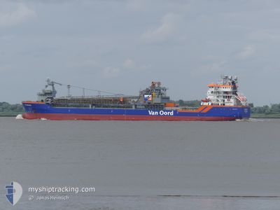
The vessel STORNES (IMO: 9549035, MMSI: 246695000) is a Pipe Burying Vessel that was built in 2011 ( 14 år gamle ). It's sailing under the flag of [NL] Netherlands.
In this page you can find informations about the vessels current position, last detected port calls, and current voyage information. If the vessels is not in coverage by AIS you will find the latest position.
The current position of STORNES is detected by our AIS receivers and we are not responsible for the reliability of the data. The last position was recorded while the vessel was in Coverage by the Ais receivers of our vessel tracking app.
The current draught of STORNES as reported by AIS is 6.3 meters
Weather
| Temperature | 4.1°C / 39.38°F |
|---|---|
| Wind Speed | 12 knots |
| Direction | 341° NNW |
| Pressure | 1018.6 hPa |
| Humidity | 79.9 % |
| Cloud Coverage | 96 % |


Featured Company
Last Port Calls
| Port | Arrival | Departure | Time In Port |
|---|---|---|---|
| 2025-03-12 07:33 | |||
| 2025-02-16 05:34 | 2025-02-16 19:23 | 13 h | |
| 2025-02-10 14:05 | 2025-02-11 05:16 | 15 h | |
| 2025-02-05 00:17 | 2025-02-05 15:16 | 14 h | |
| 2025-02-04 18:37 | 2025-02-05 00:05 | 5 h | |
| 2025-01-21 18:55 | 2025-01-22 12:45 | 17 h |
Most Visited Ports (Last year)
| Port | Arrivals | |
|---|---|---|
| 20 | ||
| 2 | ||
| 1 | ||
| 1 |
Last Trips
| Origin | Departure | Destination | Arrival | Distance | |
|---|---|---|---|---|---|
| 2025-02-16 20:23 | 2025-03-12 08:33 | 2972.27 nm | |||
| 2025-02-11 06:16 | 2025-02-16 06:34 | 329.84 nm | |||
| 2025-02-05 16:16 | 2025-02-10 15:05 | 848.24 nm | |||
| 2025-02-05 01:05 | 2025-02-05 01:17 | 0.17 nm | |||
| 2025-01-22 13:45 | 2025-02-04 19:37 | 1577.61 nm | |||
| 2024-12-20 04:12 | 2025-01-21 19:55 | 1874.44 nm |
Events
| Tid | Hændelsen | Detaljer | Position / Dest | Info |
|---|---|---|---|---|
| 2025-03-12 22:31 | Status er ændret | Moored Under way using engine |
60.85880 / 5.03320
[NO] SKIPAVIK-GULEN
|
Fart: Kurs: 157° |
| 2025-03-12 07:33 | Skibe i havn |
|
60.85736 / 5.03538
[NO] SKIPAVIK-GULEN
|
Fart: 0.2 kn Kurs: 152° |
| 2025-03-12 07:22 | STOP Sejllads | 0.05 nm, South East of SKIPAVIK-GULEN |
60.85581 / 5.03677
SKIPAVIKA
|
Fart: 0.3 kn Kurs: 191° |
| 2025-03-12 00:49 | ETA er ændret | 2025/03/12 07:00 2025/03/12 01:00 |
60.46267 / 3.82836
SKIPAVIKA
|
Fart: 7.7 kn Kurs: 15.3° |
| 2025-03-11 15:53 | Fundet i havområde | Norwegian part of the North Sea |
58.82941 / 3.22399
North Sea
SKIPAVIKA
|
Fart: 12.1 kn Kurs: 12.4° |
| 2025-03-11 15:53 | Indenfor Dækning |
58.82941 / 3.22399
North Sea
SKIPAVIKA
|
Fart: 12.1 kn Kurs: 12.4° |
|
| 2025-03-10 13:21 | Dybgangen er ændret | 6.3 6.9 |
54.85136 / 1.68989
SKIPAVIKA
|
Fart: 4.3 kn Kurs: 89° |
| 2025-03-10 13:21 | Destination er ændret | SKIPAVIKA DOGGERBANK C |
54.85136 / 1.68989
SKIPAVIKA
|
Fart: 4.3 kn Kurs: 89° |
| 2025-03-10 13:21 | ETA er ændret | 2025/03/12 01:00 2025/03/10 03:00 |
54.85136 / 1.68989
SKIPAVIKA
|
Fart: 4.3 kn Kurs: 89° |
| 2025-03-10 12:18 | Udenfor Dækning |
54.85185 / 1.68503
North Sea
|
Fart: Kurs: 179.5° |