

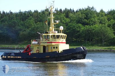
THOR
Tug

Current Trip
SOGNESJOEN NO
| Time Travelled | 4 days |
|---|---|
| Remaining Time | --- |
| Distance Travelled | 727.01 nm |
| Remaining Distance | --- |
| AVG Speed | 9 Knots |
| MAX Speed | 12.3 Knots |
| AVG Wind | 13.7 knots |
| MAX Wind | 23.5 knots |
| MIN Temp | 4.2°C / 39.56°F |
| MAX Temp | 10.3°C / 50.54°F |
| Dybgang | 3.4 m |
| Position Modtaget | 1 m siden |
Current Position
| Longitude | 24.49433° |
|---|---|
| Latitude | 59.68519° |
| Status | Under way using engine |
| Fart | 5.5 Knots |
| Kurs | 245.5° |
| Område | Gulf of Finland |
| Station | T-AIS |
| Position Modtaget | 1 m siden |
Information
The current position of THOR is in Gulf of Finland with coordinates 59.68519° / 24.49433° as reported on 2025-04-15 23:38 by AIS to our vessel tracker app. The vessel's current speed is 5.5 Knots
The vessel THOR (IMO: 8942826, MMSI: 219996000) is a Tug that was built in 1998 ( 27 år gamle ). It's sailing under the flag of [DK] Denmark.
In this page you can find informations about the vessels current position, last detected port calls, and current voyage information. If the vessels is not in coverage by AIS you will find the latest position.
The current position of THOR is detected by our AIS receivers and we are not responsible for the reliability of the data. The last position was recorded while the vessel was in Coverage by the Ais receivers of our vessel tracking app.
The current draught of THOR as reported by AIS is 3.4 meters
Weather
| Temperature | 6.1°C / 42.98°F |
|---|---|
| Wind Speed | 12 knots |
| Direction | 123° ESE |
| Pressure | 1020.6 hPa |
| Humidity | 81.9 % |
| Cloud Coverage | 42 % |


Featured Company
Last Port Calls
| Port | Arrival | Departure | Time In Port |
|---|---|---|---|
| 2025-04-07 16:56 | 2025-04-11 07:55 | 3 d | |
| 2025-04-07 00:14 | 2025-04-07 08:51 | 8 h | |
| 2025-04-05 16:32 | 2025-04-06 18:03 | 1 d | |
| 2025-04-05 02:08 | 2025-04-05 03:50 | 1 h | |
| 2025-04-04 07:37 | 2025-04-04 18:50 | 11 h | |
| 2025-04-03 06:18 | 2025-04-03 19:03 | 12 h | |
| 2025-03-22 21:06 | 2025-03-31 12:48 | 8 d | |
| 2025-03-19 10:56 | 2025-03-19 13:24 | 2 h | |
| 2025-03-10 18:39 | 2025-03-18 13:07 | 7 d | |
| 2025-03-02 02:27 | 2025-03-07 15:20 | 5 d |
Last Trips
| Origin | Departure | Destination | Arrival | Distance | |
|---|---|---|---|---|---|
| 2025-04-07 08:51 | 2025-04-07 16:56 | 11.24 nm | |||
| 2025-04-06 18:03 | 2025-04-07 00:14 | 11.04 nm | |||
| 2025-04-05 03:50 | 2025-04-05 16:32 | 100.71 nm | |||
| 2025-04-04 18:50 | 2025-04-05 02:08 | 51.23 nm | |||
| 2025-04-03 19:03 | 2025-04-04 07:37 | 87.54 nm | |||
| 2025-03-31 12:48 | 2025-04-03 06:18 | 637.30 nm | |||
| 2025-03-19 13:24 | 2025-03-22 21:06 | 188.26 nm | |||
| 2025-03-18 13:07 | 2025-03-19 10:56 | 39.69 nm | |||
| 2025-03-07 15:20 | 2025-03-10 18:39 | 647.75 nm | |||
| 2025-03-01 15:31 | 2025-03-02 02:27 | 90.94 nm |
Events
| Tid | Hændelsen | Detaljer | Position / Dest | Info |
|---|---|---|---|---|
| 2025-04-15 18:42 | Destination er ændret | SOGNESJOEN NO LOKSA |
59.69451 / 25.33442
SOGNESJOEN NO
|
Fart: 5.3 kn Kurs: 278.3° |
| 2025-04-15 18:42 | ETA er ændret | 2025/04/23 12:00 2025/04/14 12:00 |
59.69451 / 25.33442
SOGNESJOEN NO
|
Fart: 5.3 kn Kurs: 278.3° |
| 2025-04-15 17:46 | Indenfor Dækning |
59.67143 / 25.49703
Gulf of Finland
|
Fart: 5.7 kn Kurs: 314.2° |
|
| 2025-04-14 06:53 | Udenfor Dækning |
59.71771 / 25.07929
Gulf of Finland
LOKSA
|
Fart: 9.2 kn Kurs: 95° |
|
| 2025-04-14 02:52 | Fundet i havområde | Estonian part of the Gulf of Finland |
59.52980 / 23.94091
Gulf of Finland
LOKSA
|
Fart: 9.6 kn Kurs: 61.6° |
| 2025-04-14 02:52 | Indenfor Dækning |
59.52980 / 23.94091
Gulf of Finland
LOKSA
|
Fart: 9.6 kn Kurs: 61.6° |
|
| 2025-04-13 14:58 | Udenfor Dækning |
58.48973 / 21.13232
Baltic Sea
LOKSA
|
Fart: 9 kn Kurs: 38.9° |
|
| 2025-04-13 14:27 | ETA er ændret | 2025/04/14 12:00 2025/04/14 15:00 |
58.42817 / 21.03384
LOKSA
|
Fart: 9 kn Kurs: 39.9° |
| 2025-04-13 13:18 | Indenfor Dækning |
58.29580 / 20.82270
Baltic Sea
LOKSA
|
Fart: 9.2 kn Kurs: 38.4° |
|
| 2025-04-13 11:54 | Udenfor Dækning |
58.12856 / 20.56100
Baltic Sea
LOKSA
|
Fart: 9.2 kn Kurs: 43.4° |