
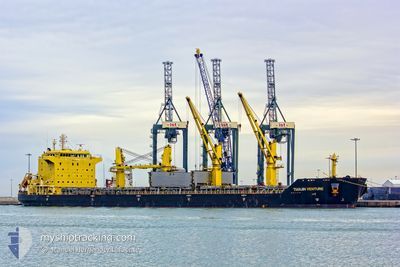
TIANJIN VENTURE
Bulk Carrier
Current Trip
| Trip Time | 17 days |
|---|---|
| Trip Distance | 3488.93 nm |
| AVG Speed | 10.5 Knots |
| MAX Speed | 14 Knots |
| Dybgang | 11.8 m |
| AVG Wind | 14 knots |
| MAX Wind | 24.2 knots |
| MIN Temp | 22°C / 71.6°F |
| MAX Temp | 30.3°C / 86.54°F |
| Position Modtaget | 9 d siden |
Current Position
| Longitude | -61.36948° |
|---|---|
| Latitude | 15.73782° |
| Status | Under way using engine |
| Fart | 10.5 Knots |
| Kurs | 99° |
| Område | Caribbean Sea |
| Station | T-AIS |
| Position Modtaget | 9 d siden |
Info
Information
The current position of TIANJIN VENTURE is in Caribbean Sea with coordinates 15.73782° / -61.36948° as reported on 2025-01-22 22:49 by AIS to our vessel tracker app. The vessel's current speed is 10.5 Knots and is currently inside the port of VILA DO CONDE.
The vessel TIANJIN VENTURE (IMO: 9457294, MMSI: 477559900) is a Bulk Carrier that was built in 2009 ( 16 år gamle ). It's sailing under the flag of [HK] Hong Kong.
In this page you can find informations about the vessels current position, last detected port calls, and current voyage information. If the vessels is not in coverage by AIS you will find the latest position.
The current position of TIANJIN VENTURE is detected by our AIS receivers and we are not responsible for the reliability of the data. The last position was recorded while the vessel was in Coverage by the Ais receivers of our vessel tracking app.
The current draught of TIANJIN VENTURE as reported by AIS is 11.8 meters
Weather
| Temperature | 25.1°C / 77.18°F |
|---|---|
| Wind Speed | 9 knots |
| Direction | 42° NE |
| Pressure | 1010.3 hPa |
| Humidity | 90.3 % |
| Cloud Coverage | 92 % |
Featured Company
Last Port Calls
| Port | Arrival | Departure | Time In Port |
|---|---|---|---|
| 2025-02-01 13:42 | |||
| 2025-01-09 19:50 | 2025-01-15 02:58 | 5 d |
Most Visited Ports (Last year)
| Port | Arrivals | |
|---|---|---|
| 2 | ||
| 1 | ||
| 1 | ||
| 1 | ||
| 1 | ||
| 1 |
Last Trips
| Origin | Departure | Destination | Arrival | Distance | |
|---|---|---|---|---|---|
| 2025-01-14 20:58 | 2025-02-01 10:42 | 3488.93 nm |
Events
| Tid | Hændelsen | Detaljer | Position / Dest | Info |
|---|---|---|---|---|
| 2025-02-01 13:42 | STOP Sejllads |
-1.53547 / -48.75045
[BR] VILA DO CONDE
|
Fart: 0.2 kn Kurs: 39° |
|
| 2025-02-01 13:42 | Skibe i havn |
|
-1.53547 / -48.75045
[BR] VILA DO CONDE
|
Fart: 0.7 kn Kurs: 37° |
| 2025-02-01 12:46 | START Sejllads | 1.96 nm, North of VILA DO CONDE |
-1.49963 / -48.76125
MX VER
|
Fart: 5.9 kn Kurs: 193° |
| 2025-01-28 18:58 | STOP Sejllads | 2.39 nm, North of VILA DO CONDE |
-1.49228 / -48.76048
MX VER
|
Fart: 0.3 kn Kurs: 230° |
| 2025-01-22 22:54 | Status er ændret | Default Under way using engine |
15.73545 / -61.35478
MX VER
|
Fart: 10.5 kn Kurs: 99° |
| 2025-01-22 22:49 | Udenfor Dækning |
15.73782 / -61.36948
Caribbean Sea
|
Fart: 10.5 kn Kurs: 99° |
|
| 2025-01-22 22:11 | Ændre havområde | Dominican part of the Caribbean Sea Guadeloupe and Martinique part of the Caribbean Sea |
15.75333 / -61.49093
Caribbean Sea
|
Fart: 10.9 kn Kurs: 96° |
| 2025-01-22 19:00 | Status er ændret | Under way using engine Default |
15.79866 / -62.09725
MX VER
|
Fart: 12.3 kn Kurs: 94° |
| 2025-01-22 18:50 | Status er ændret | Default Under way using engine |
15.80160 / -62.13558
MX VER
|
Fart: 12.1 kn Kurs: 95° |
| 2025-01-22 18:34 | Status er ændret | Under way using engine Default |
15.80744 / -62.19096
MX VER
|
Fart: 11.1 kn Kurs: 97° |