
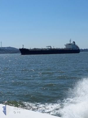
TORM DIANA
Tanker
Current Trip
| Trip Time | 5 days |
|---|---|
| Trip Distance | 761.07 nm |
| AVG Speed | 9.9 Knots |
| MAX Speed | 13 Knots |
| Dybgang | 10 m |
| AVG Wind | 10.7 knots |
| MAX Wind | 17 knots |
| MIN Temp | 20.1°C / 68.18°F |
| MAX Temp | 24°C / 75.2°F |
| Position Modtaget | 2025-01-08 18:13 |
Current Position
| Longitude | 76.28079° |
|---|---|
| Latitude | 8.34025° |
| Status | Under way using engine |
| Fart | 11.2 Knots |
| Kurs | 326.1° |
| Område | Laccadive Sea |
| Station | T-AIS |
| Position Modtaget | 2025-01-08 18:13 |
Info
Information
The current position of TORM DIANA is in Laccadive Sea with coordinates 8.34025° / 76.28079° as reported on 2025-01-08 18:13 by AIS to our vessel tracker app. The vessel's current speed is 11.2 Knots and is currently inside the port of SIKKA.
The vessel TORM DIANA (IMO: 9702223, MMSI: 563212100) is a Tanker It's sailing under the flag of [SG] Singapore.
In this page you can find informations about the vessels current position, last detected port calls, and current voyage information. If the vessels is not in coverage by AIS you will find the latest position.
The current position of TORM DIANA is detected by our AIS receivers and we are not responsible for the reliability of the data. The last position was recorded while the vessel was in Coverage by the Ais receivers of our vessel tracking app.
The current draught of TORM DIANA as reported by AIS is 10 meters
Weather
| Temperature | 21.1°C / 69.98°F |
|---|---|
| Wind Speed | 7 knots |
| Direction | 292° WNW |
| Pressure | 1012.8 hPa |
| Humidity | 55.8 % |
| Cloud Coverage | 24 % |
Featured Company
Last Port Calls
| Port | Arrival | Departure | Time In Port |
|---|---|---|---|
| 2025-02-08 11:16 | |||
| 2025-02-01 13:12 | 2025-02-03 05:48 | 1 d | |
| 2024-12-25 06:13 | 2024-12-27 08:54 | 2 d | |
| 2024-12-13 03:29 | 2024-12-14 20:20 | 1 d | |
| 2024-12-10 08:12 | 2024-12-10 08:22 | 10 m | |
| 2024-12-08 17:23 | 2024-12-10 07:25 | 1 d | |
| 2024-12-05 08:19 | 2024-12-06 08:49 | 1 d |
Most Visited Ports (Last year)
| Port | Arrivals | |
|---|---|---|
| 5 | ||
| 2 | ||
| 2 | ||
| 2 | ||
| 2 | ||
| 1 |
Last Trips
| Origin | Departure | Destination | Arrival | Distance | |
|---|---|---|---|---|---|
| 2025-02-03 10:48 | 2025-02-08 16:46 | 761.07 nm | |||
| 2024-12-27 16:54 | 2025-02-01 18:12 | 3023.09 nm | |||
| 2024-12-15 04:20 | 2024-12-25 14:13 | 2161.37 nm | |||
| 2024-12-10 16:22 | 2024-12-13 11:29 | 37.72 nm | |||
| 2024-12-10 15:25 | 2024-12-10 16:12 | 7.45 nm | |||
| 2024-12-06 16:49 | 2024-12-09 01:23 | 15.52 nm | |||
| 2024-11-17 11:28 | 2024-12-05 16:19 | 3092.56 nm |
Events
| Tid | Hændelsen | Detaljer | Position / Dest | Info |
|---|---|---|---|---|
| 2025-02-08 11:47 | STOP Sejllads |
22.49496 / 69.84264
[IN] SIKKA
|
Fart: 0.1 kn Kurs: 310° |
|
| 2025-02-08 11:16 | Skibe i havn |
|
22.50180 / 69.83594
[IN] SIKKA
|
Fart: 2.1 kn Kurs: 299° |
| 2025-02-08 10:17 | START Sejllads | 5.01 nm, North West of SIKKA |
22.53509 / 69.76047
PORT QASIM
|
Fart: 3.4 kn Kurs: 74° |
| 2025-02-08 06:16 | STOP Sejllads | 5.77 nm, North West of SIKKA |
22.53402 / 69.74445
PORT QASIM
|
Fart: 0.3 kn Kurs: 79° |
| 2025-02-03 05:48 | Afsejlet fra sidste havn |
|
24.77904 / 67.29289
PORT QASIM
|
Fart: 10 kn Kurs: 310° |
| 2025-02-03 05:33 | START Sejllads |
24.76177 / 67.32722
[PK] PORT QASIM
|
Fart: 7.3 kn Kurs: 269° |
|
| 2025-02-01 13:29 | STOP Sejllads |
24.77288 / 67.34086
[PK] PORT QASIM
|
Fart: 0.3 kn Kurs: 32° |
|
| 2025-02-01 13:12 | Skibe i havn |
|
24.77061 / 67.33958
[PK] PORT QASIM
|
Fart: 5.1 kn Kurs: 57° |
| 2025-02-01 10:25 | START Sejllads | 16.1 nm, South of SALEHAABAD ISLAND |
24.54052 / 67.02498
PORT QASIM
|
Fart: 5.9 kn Kurs: 57° |
| 2025-02-01 09:50 | STOP Sejllads | 16.23 nm, South of SALEHAABAD ISLAND |
24.53805 / 67.02308
PORT QASIM
|
Fart: 0.2 kn Kurs: 8° |