

TOTAL ENERGY
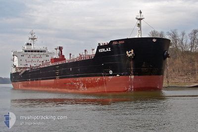
Oil/Chemical Tanker

Current Trip
| Time Travelled | 2 days |
|---|---|
| Remaining Time | 6 h, 31 mins |
| Distance Travelled | 795.01 nm |
| Remaining Distance | 96.36 nm |
| AVG Speed | 12.5 Knots |
| MAX Speed | 14.2 Knots |
| AVG Wind | 5.5 knots |
| MAX Wind | 13 knots |
| MIN Temp | 23.7°C / 74.66°F |
| MAX Temp | 29.1°C / 84.38°F |
| Dybgang | 9.3 m |
| Position Modtaget | 2 h, 22 m siden |
Current Position
| Longitude | 110.80508° |
|---|---|
| Latitude | -8.30870° |
| Status | Under way using engine |
| Fart | 12.6 Knots |
| Kurs | 280.7° |
| Område | Indian Ocean |
| Station | T-AIS |
| Position Modtaget | 2 h, 22 m siden |
Information
The current position of TOTAL ENERGY is in Indian Ocean with coordinates -8.30870° / 110.80508° as reported on 2025-04-16 15:52 by AIS to our vessel tracker app. The vessel's current speed is 12.6 Knots and is heading at the port of CILACAP. The estimated time of arrival as calculated by MyShipTracking vessel tracking app is 2025-04-17 07:46 LT
The vessel TOTAL ENERGY (IMO: 9302657, MMSI: 525119146) is a Oil/Chemical Tanker that was built in 2004 ( 21 år gamle ). It's sailing under the flag of [ID] Indonesia.
In this page you can find informations about the vessels current position, last detected port calls, and current voyage information. If the vessels is not in coverage by AIS you will find the latest position.
The current position of TOTAL ENERGY is detected by our AIS receivers and we are not responsible for the reliability of the data. The last position was recorded while the vessel was in Coverage by the Ais receivers of our vessel tracking app.
The current draught of TOTAL ENERGY as reported by AIS is 9.3 meters
Weather
| Temperature | 28.2°C / 82.76°F |
|---|---|
| Wind Speed | 6 knots |
| Direction | 117° ESE |
| Pressure | 1008.4 hPa |
| Humidity | 76.4 % |
| Cloud Coverage | 77 % |


Featured Company
Last Port Calls
| Port | Arrival | Departure | Time In Port |
|---|---|---|---|
| 2025-04-11 19:19 | 2025-04-14 10:45 | 2 d | |
| 2025-03-30 05:25 | 2025-03-31 13:26 | 1 d | |
| 2025-02-08 12:20 | 2025-02-10 03:00 | 1 d | |
| 2025-02-01 21:32 |
Most Visited Ports (Last year)
| Port | Arrivals | |
|---|---|---|
| 6 | ||
| 4 | ||
| 3 | ||
| 2 | ||
| 1 | ||
| 1 |
Last Trips
| Origin | Departure | Destination | Arrival | Distance | |
|---|---|---|---|---|---|
| 2025-03-31 13:26 | 2025-04-11 19:19 | 1504.28 nm | |||
| 2025-02-10 03:00 | 2025-03-30 05:25 | 497.63 nm | |||
| 2025-02-01 21:32 | 2025-02-08 12:20 | 1121.44 nm |
Events
| Tid | Hændelsen | Detaljer | Position / Dest | Info |
|---|---|---|---|---|
| 2025-04-16 16:02 | Status er ændret | Default Under way using engine |
-8.30288 / 110.77350
CILACAP ID
|
Fart: 12.6 kn Kurs: 280.7° |
| 2025-04-16 15:52 | Status er ændret | Under way using engine Default |
-8.30870 / 110.80508
CILACAP ID
|
Fart: 12.5 kn Kurs: 281° |
| 2025-04-16 15:52 | Udenfor Dækning |
-8.30870 / 110.80508
Indian Ocean
CILACAP ID
|
Fart: 12.6 kn Kurs: 280.7° |
|
| 2025-04-16 15:46 | Indenfor Dækning |
-8.30870 / 110.80508
Indian Ocean
CILACAP ID
|
Fart: 12.6 kn Kurs: 280.7° |
|
| 2025-04-16 09:36 | Status er ændret | Default Under way using engine |
-8.52257 / 112.09821
CILACAP ID
|
Fart: 12.4 kn Kurs: 275.2° |
| 2025-04-16 09:32 | Udenfor Dækning |
-8.52385 / 112.11033
Indian Ocean
CILACAP ID
|
Fart: 12.4 kn Kurs: 275.2° |
|
| 2025-04-16 09:27 | Dybgangen er ændret | 9.3 7.5 |
-8.52640 / 112.13240
CILACAP ID
|
Fart: 12.5 kn Kurs: 275.6° |
| 2025-04-16 09:27 | Destination er ændret | CILACAP ID TUBAN ID |
-8.52640 / 112.13240
CILACAP ID
|
Fart: 12.5 kn Kurs: 275.6° |
| 2025-04-16 09:27 | ETA er ændret | 2025/04/17 11:30 2025/04/06 11:00 |
-8.52640 / 112.13240
CILACAP ID
|
Fart: 12.5 kn Kurs: 275.6° |
| 2025-04-16 09:26 | Status er ændret | Under way using engine Default |
-8.52640 / 112.13240
TUBAN ID
|
Fart: 12.6 kn Kurs: 273° |