
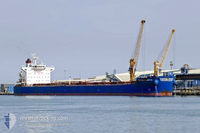
TRANSATLANTIC
Bulk Carrier
Current Trip
| Time Travelled | 7 days |
|---|---|
| Remaining Time | --- |
| Distance Travelled | 1646.03 nm |
| Remaining Distance | --- |
| AVG Speed | 9.3 Knots |
| MAX Speed | 12.3 Knots |
| AVG Wind | 8.5 knots |
| MAX Wind | 20 knots |
| MIN Temp | 18.9°C / 66.02°F |
| MAX Temp | 26.8°C / 80.24°F |
| Dybgang | 12.9 m |
| Position Modtaget | 5 d siden |
Current Position
| Longitude | 57.12311° |
|---|---|
| Latitude | 24.87605° |
| Status | Under way using engine |
| Fart | 9.8 Knots |
| Kurs | 128.8° |
| Område | Gulf of Oman |
| Station | T-AIS |
| Position Modtaget | 5 d siden |
Info
Information
The current position of TRANSATLANTIC is in Gulf of Oman with coordinates 24.87605° / 57.12311° as reported on 2025-02-06 01:05 by AIS to our vessel tracker app. The vessel's current speed is 9.8 Knots and is heading at the port of JORF LASFAR. The estimated time of arrival as calculated by MyShipTracking vessel tracking app is 2025-03-13 22:00 LT
The vessel TRANSATLANTIC (IMO: 9597238, MMSI: 229125000) is a Bulk Carrier that was built in 2012 ( 13 år gamle ). It's sailing under the flag of [MT] Malta.
In this page you can find informations about the vessels current position, last detected port calls, and current voyage information. If the vessels is not in coverage by AIS you will find the latest position.
The current position of TRANSATLANTIC is detected by our AIS receivers and we are not responsible for the reliability of the data. The last position was recorded while the vessel was in Coverage by the Ais receivers of our vessel tracking app.
The current draught of TRANSATLANTIC as reported by AIS is 12.9 meters
Weather
| Temperature | 26.3°C / 79.34°F |
|---|---|
| Wind Speed | 15 knots |
| Direction | 64° ENE |
| Pressure | 1011.4 hPa |
| Humidity | 75.1 % |
| Cloud Coverage | 100 % |
Featured Company
Last Trips
| Origin | Departure | Destination | Arrival | Distance | |
|---|---|---|---|---|---|
| 2025-01-28 01:28 | 2025-02-01 01:41 | 1111.87 nm | |||
| 2025-01-08 09:08 | 2025-01-26 12:13 | 3875.53 nm | |||
| 2025-01-04 22:56 | 2025-01-06 19:08 | 297.95 nm | |||
| 2024-12-07 16:37 | 2024-12-28 06:38 | 4408.77 nm | |||
| 2024-10-14 10:36 | 2024-12-03 10:49 | 6032.26 nm |
Events
| Tid | Hændelsen | Detaljer | Position / Dest | Info |
|---|---|---|---|---|
| 2025-02-06 01:10 | Status er ændret | Default Under way using engine |
24.86748 / 57.13486
MA JFL
|
Fart: 9.8 kn Kurs: 128.8° |
| 2025-02-06 01:05 | Fundet i havområde | Omani part of the Gulf of Oman |
24.87605 / 57.12311
Gulf of Oman
|
Fart: 9.8 kn Kurs: 128.8° |
| 2025-02-06 01:05 | Status er ændret | Under way using engine Default |
24.87605 / 57.12311
MA JFL
|
Fart: 9.8 kn Kurs: 128° |
| 2025-02-06 01:05 | Udenfor Dækning |
24.87605 / 57.12311
Gulf of Oman
|
Fart: 9.8 kn Kurs: 128.8° |
|
| 2025-02-06 00:55 | Indenfor Dækning |
24.87605 / 57.12311
Gulf of Oman
|
Fart: 9.8 kn Kurs: 128.8° |
|
| 2025-02-05 23:22 | Status er ændret | Default Under way using engine |
25.05523 / 56.88810
MA JFL
|
Fart: 9.8 kn Kurs: 143.2° |
| 2025-02-05 23:13 | Status er ændret | Under way using engine Default |
25.07501 / 56.87221
MA JFL
|
Fart: 9.8 kn Kurs: 141° |
| 2025-02-05 23:13 | Udenfor Dækning |
25.07501 / 56.87221
Gulf of Oman
|
Fart: 9.8 kn Kurs: 143.2° |
|
| 2025-02-05 23:08 | Status er ændret | Default Under way using engine |
25.08599 / 56.86266
MA JFL
|
Fart: 9.9 kn Kurs: 142° |
| 2025-02-05 23:01 | Status er ændret | Under way using engine Default |
25.10047 / 56.84963
MA JFL
|
Fart: 10 kn Kurs: 138° |