

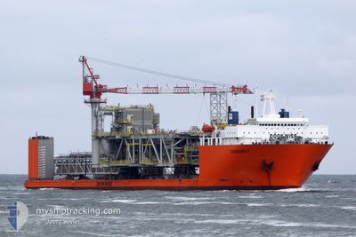
TRANSSHELF
Heavy Lift Vessel

Current Trip
| Time Travelled | --- |
|---|---|
| Remaining Time | 4 days |
| Distance Travelled | 5099.17 nm |
| Remaining Distance | 1568.71 nm |
| AVG Speed | 10.4 Knots |
| MAX Speed | 15 Knots |
| AVG Wind | 13.3 knots |
| MAX Wind | 28 knots |
| MIN Temp | 14.2°C / 57.56°F |
| MAX Temp | 34.2°C / 93.56°F |
| Dybgang | 8 m |
| Position Modtaget | 3 h, 47 m siden |
Current Position
| Longitude | 17.93127° |
|---|---|
| Latitude | -34.19990° |
| Status | Under way using engine |
| Fart | 13.9 Knots |
| Kurs | 308.7° |
| Område | South Atlantic Ocean |
| Station | T-AIS |
| Position Modtaget | 3 h, 47 m siden |
Information
The current position of TRANSSHELF is in South Atlantic Ocean with coordinates -34.19990° / 17.93127° as reported on 2025-06-04 04:06 by AIS to our vessel tracker app. The vessel's current speed is 13.9 Knots and is heading at the port of LUANDA. The estimated time of arrival as calculated by MyShipTracking vessel tracking app is 2025-06-09 06:04 LT
The vessel TRANSSHELF (IMO: 8512279, MMSI: 306704000) is a Heavy Lift Vessel that was built in 1987 ( 38 år gamle ). It's sailing under the flag of [CW] Curacao.
In this page you can find informations about the vessels current position, last detected port calls, and current voyage information. If the vessels is not in coverage by AIS you will find the latest position.
The current position of TRANSSHELF is detected by our AIS receivers and we are not responsible for the reliability of the data. The last position was recorded while the vessel was in Coverage by the Ais receivers of our vessel tracking app.
The current draught of TRANSSHELF as reported by AIS is 8 meters
Weather
| Temperature | 15.1°C / 59.18°F |
|---|---|
| Wind Speed | 27 knots |
| Direction | 141° SE |
| Pressure | 1025.4 hPa |
| Humidity | 61.6 % |
| Cloud Coverage | 3 % |


Featured Company
Last Port Calls
Most Visited Ports (Last year)
| Port | Arrivals | |
|---|---|---|
| 3 | ||
| 1 | ||
| 1 | ||
| 1 | ||
| 1 | ||
| 1 |
Last Trips
| Origin | Departure | Destination | Arrival | Distance |
|---|
Events
| Tid | Hændelsen | Detaljer | Position / Dest | Info |
|---|---|---|---|---|
| 2025-06-04 04:13 | Status er ændret | Default Under way using engine |
-34.18277 / 17.90620
AOLAD
|
Fart: 13.9 kn Kurs: 308.7° |
| 2025-06-04 04:06 | Udenfor Dækning |
-34.19990 / 17.93127
South Atlantic Ocean
|
Fart: 13.9 kn Kurs: 308.7° |
|
| 2025-06-04 03:24 | Status er ændret | Under way using engine Default |
-34.30436 / 18.07777
AOLAD
|
Fart: 13.5 kn Kurs: 311° |
| 2025-06-04 03:21 | Status er ændret | Default Under way using engine |
-34.31283 / 18.08964
AOLAD
|
Fart: 13.3 kn Kurs: 311.6° |
| 2025-06-04 03:12 | Status er ændret | Under way using engine Default |
-34.33489 / 18.11970
AOLAD
|
Fart: 13.4 kn Kurs: 312° |
| 2025-06-04 02:44 | Status er ændret | Default Under way using engine |
-34.40368 / 18.21199
AOLAD
|
Fart: 13.3 kn Kurs: 312° |
| 2025-06-04 01:55 | Status er ændret | Under way using engine Default |
-34.50776 / 18.38249
AOLAD
|
Fart: 12.4 kn Kurs: 299° |
| 2025-06-04 01:08 | Status er ændret | Default Under way using engine |
-34.58107 / 18.55961
AOLAD
|
Fart: 12.3 kn Kurs: 295.3° |
| 2025-06-04 01:02 | Ændre havområde | South African part of the South Atlantic Ocean South African part of the Indian Ocean |
-34.59011 / 18.58184
South Atlantic Ocean
|
Fart: 12.3 kn Kurs: 295.3° |
| 2025-06-04 01:02 | Status er ændret | Under way using engine Default |
-34.59129 / 18.58477
AOLAD
|
Fart: 12.3 kn Kurs: 302° |