
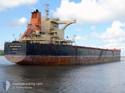
TRUE CRUSADER
Cargo
Current Trip
| Time Travelled | 44 days |
|---|---|
| Remaining Time | 11 days |
| Distance Travelled | 10654.07 nm |
| Remaining Distance | 3376.13 nm |
| AVG Speed | 11.2 Knots |
| MAX Speed | 15.5 Knots |
| AVG Wind | 13.3 knots |
| MAX Wind | 39 knots |
| MIN Temp | 9.6°C / 49.28°F |
| MAX Temp | 29.9°C / 85.82°F |
| Dybgang | 9.6 m |
| Position Modtaget | 12 h, 50 m siden |
Current Position
| Longitude | 24.35983° |
|---|---|
| Latitude | -34.54135° |
| Status | Under way using engine |
| Fart | 11.2 Knots |
| Kurs | 261.1° |
| Område | Indian Ocean |
| Station | T-AIS |
| Position Modtaget | 12 h, 50 m siden |
Info
Information
The current position of TRUE CRUSADER is in Indian Ocean with coordinates -34.54135° / 24.35983° as reported on 2025-12-14 09:37 by AIS to our vessel tracker app. The vessel's current speed is 11.2 Knots and is heading at the port of PONTA UBU. The estimated time of arrival as calculated by MyShipTracking vessel tracking app is 2025-12-26 18:30 LT
The vessel TRUE CRUSADER (IMO: 9693587, MMSI: 636022070) is a Cargo It's sailing under the flag of [LR] Liberia.
In this page you can find informations about the vessels current position, last detected port calls, and current voyage information. If the vessels is not in coverage by AIS you will find the latest position.
The current position of TRUE CRUSADER is detected by our AIS receivers and we are not responsible for the reliability of the data. The last position was recorded while the vessel was in Coverage by the Ais receivers of our vessel tracking app.
The current draught of TRUE CRUSADER as reported by AIS is 9.6 meters
Weather
| Temperature | 18.7°C / 65.66°F |
|---|---|
| Wind Speed | 4 knots |
| Direction | 3° N |
| Pressure | 1016.3 hPa |
| Humidity | 63.1 % |
| Cloud Coverage | 100 % |
Featured Company
Last Port Calls
| Port | Arrival | Departure | Time In Port |
|---|---|---|---|
| 2025-10-30 09:50 | 2025-10-31 16:38 | 1 d | |
| 2025-10-07 10:59 | 2025-10-11 06:52 | 3 d |
Most Visited Ports (Last year)
| Port | Arrivals | |
|---|---|---|
| 1 | ||
| 1 | ||
| 1 | ||
| 1 | ||
| 1 | ||
| 1 |
Last Trips
| Origin | Departure | Destination | Arrival | Distance | |
|---|---|---|---|---|---|
| 2025-10-11 06:52 | 2025-10-30 09:50 | 3056.70 nm | |||
| 2025-08-19 00:22 | 2025-10-07 10:59 | 7295.01 nm |
Events
| Tid | Hændelsen | Detaljer | Position / Dest | Info |
|---|---|---|---|---|
| 2025-12-14 09:42 | Status er ændret | Default Under way using engine |
-34.54362 / 24.34176
PONTA UBU
|
Fart: 11.2 kn Kurs: 261.1° |
| 2025-12-14 09:37 | Udenfor Dækning |
-34.54135 / 24.35983
Indian Ocean
PONTA UBU
|
Fart: 11.2 kn Kurs: 261.1° |
|
| 2025-12-14 09:14 | Status er ændret | Under way using engine Default |
-34.53259 / 24.44726
PONTA UBU
|
Fart: 11 kn Kurs: 260° |
| 2025-12-14 08:55 | Status er ændret | Default Under way using engine |
-34.52503 / 24.51838
PONTA UBU
|
Fart: 11.2 kn Kurs: 263.1° |
| 2025-12-14 06:49 | Status er ændret | Under way using engine Default |
-34.40783 / 24.97574
PONTA UBU
|
Fart: 11 kn Kurs: 316° |
| 2025-12-14 06:47 | Status er ændret | Default Under way using engine |
-34.41253 / 24.98411
PONTA UBU
|
Fart: 10 kn Kurs: 274.2° |
| 2025-12-14 06:01 | Status er ændret | Under way using engine Default |
-34.40024 / 25.13632
PONTA UBU
|
Fart: 10.5 kn Kurs: 261° |
| 2025-12-14 05:48 | Status er ændret | Default Under way using engine |
-34.39395 / 25.18292
PONTA UBU
|
Fart: 10.5 kn Kurs: 259.3° |
| 2025-12-14 05:48 | Status er ændret | Under way using engine Default |
-34.39386 / 25.18352
PONTA UBU
|
Fart: 10.2 kn Kurs: 259° |
| 2025-12-14 05:39 | Status er ændret | Default Under way using engine |
-34.38946 / 25.21369
PONTA UBU
|
Fart: 10 kn Kurs: 258.4° |