
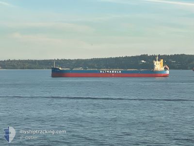
ULTRA LEOPARD
Cargo
Current Trip
| Time Travelled | 2 days |
|---|---|
| Remaining Time | --- |
| Distance Travelled | 538.91 nm |
| Remaining Distance | --- |
| AVG Speed | 10.3 Knots |
| MAX Speed | 13.5 Knots |
| AVG Wind | 6.9 knots |
| MAX Wind | 16 knots |
| MIN Temp | 19°C / 66.2°F |
| MAX Temp | 22.2°C / 71.96°F |
| Dybgang | 7.4 m |
| Position Modtaget | 1 d siden |
Current Position
| Longitude | 56.87992° |
|---|---|
| Latitude | 25.00137° |
| Status | Under way using engine |
| Fart | 12.4 Knots |
| Kurs | 145.8° |
| Område | Gulf of Oman |
| Station | T-AIS |
| Position Modtaget | 1 d siden |
Info
Information
The current position of ULTRA LEOPARD is in Gulf of Oman with coordinates 25.00137° / 56.87992° as reported on 2025-02-06 00:37 by AIS to our vessel tracker app. The vessel's current speed is 12.4 Knots and is heading at the port of TERNEUZEN.
The vessel ULTRA LEOPARD (IMO: 9758428, MMSI: 352468000) is a Cargo It's sailing under the flag of [PA] Panama.
In this page you can find informations about the vessels current position, last detected port calls, and current voyage information. If the vessels is not in coverage by AIS you will find the latest position.
The current position of ULTRA LEOPARD is detected by our AIS receivers and we are not responsible for the reliability of the data. The last position was recorded while the vessel was in Coverage by the Ais receivers of our vessel tracking app.
The current draught of ULTRA LEOPARD as reported by AIS is 7.4 meters
Weather
| Temperature | 22.7°C / 72.86°F |
|---|---|
| Wind Speed | 9 knots |
| Direction | 95° E |
| Pressure | 1014.8 hPa |
| Humidity | 62.6 % |
| Cloud Coverage | 8 % |
Featured Company
Events
| Tid | Hændelsen | Detaljer | Position / Dest | Info |
|---|---|---|---|---|
| 2025-02-06 00:42 | Status er ændret | Default Under way using engine |
24.98584 / 56.89151
FOR ORDER
|
Fart: 12.4 kn Kurs: 145.8° |
| 2025-02-06 00:37 | Status er ændret | Under way using engine Default |
25.00137 / 56.87992
FOR ORDER
|
Fart: 12.7 kn Kurs: 155° |
| 2025-02-06 00:37 | Udenfor Dækning |
25.00137 / 56.87992
Gulf of Oman
|
Fart: 12.4 kn Kurs: 145.8° |
|
| 2025-02-06 00:25 | Status er ændret | Default Under way using engine |
25.03781 / 56.85896
FOR ORDER
|
Fart: 13 kn Kurs: 145.1° |
| 2025-02-06 00:23 | Ændre havområde | Omani part of the Gulf of Oman United Arab Emirates part of the Gulf of Oman |
25.04505 / 56.85417
Gulf of Oman
|
Fart: 13 kn Kurs: 145.1° |
| 2025-02-06 00:23 | Status er ændret | Under way using engine Default |
25.04505 / 56.85417
FOR ORDER
|
Fart: 13 kn Kurs: 152° |
| 2025-02-06 00:17 | Status er ændret | Default Under way using engine |
25.06129 / 56.84273
FOR ORDER
|
Fart: 12.9 kn Kurs: 146.8° |
| 2025-02-05 23:52 | Status er ændret | Under way using engine Default |
25.13568 / 56.78475
FOR ORDER
|
Fart: 13.1 kn Kurs: 116° |
| 2025-02-05 23:49 | Status er ændret | Default Under way using engine |
25.14072 / 56.77406
FOR ORDER
|
Fart: 13.1 kn Kurs: 115.4° |
| 2025-02-05 22:42 | START Sejllads | 11.8 nm, North East of FUJAIRAH |
25.24621 / 56.55287
FOR ORDER
|
Fart: 3.2 kn Kurs: 109° |