
URANUS III
Pallet Carrier
Current Trip
| Time Travelled | 21 days |
|---|---|
| Remaining Time | --- |
| Distance Travelled | 3662.55 nm |
| Remaining Distance | --- |
| AVG Speed | 7.9 Knots |
| MAX Speed | 10.8 Knots |
| AVG Wind | 12.8 knots |
| MAX Wind | 34 knots |
| MIN Temp | 0.5°C / 32.9°F |
| MAX Temp | 18.4°C / 65.12°F |
| Dybgang | 5.3 m |
| Position Modtaget | 13 m siden |
Current Position
| Longitude | -8.91087° |
|---|---|
| Latitude | 37.83505° |
| Status | Under way using engine |
| Fart | 5.3 Knots |
| Kurs | 284.9° |
| Område | North Atlantic Ocean |
| Station | T-AIS |
| Position Modtaget | 13 m siden |
Info
Information
The current position of URANUS III is in North Atlantic Ocean with coordinates 37.83505° / -8.91087° as reported on 2026-01-07 19:37 by AIS to our vessel tracker app. The vessel's current speed is 5.3 Knots
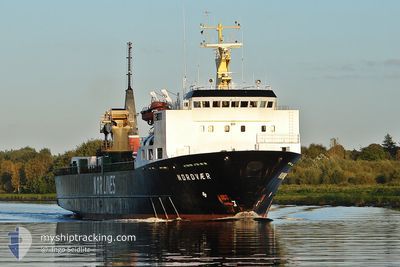
The vessel URANUS III (IMO: 8601680, MMSI: 352002212) is a Pallet Carrier that was built in 1986 ( 40 år gamle ). It's sailing under the flag of [PA] Panama.
In this page you can find informations about the vessels current position, last detected port calls, and current voyage information. If the vessels is not in coverage by AIS you will find the latest position.
The current position of URANUS III is detected by our AIS receivers and we are not responsible for the reliability of the data. The last position was recorded while the vessel was in Coverage by the Ais receivers of our vessel tracking app.
The current draught of URANUS III as reported by AIS is 5.3 meters
Weather
| Temperature | 14.1°C / 57.38°F |
|---|---|
| Wind Speed | 16 knots |
| Direction | 6° N |
| Pressure | 1028.9 hPa |
| Humidity | 68.1 % |
| Cloud Coverage | 2 % |
Featured Company
Events
| Tid | Hændelsen | Detaljer | Position / Dest | Info |
|---|---|---|---|---|
| 2026-01-07 19:43 | Status er ændret | Default Under way using engine |
37.83873 / -8.92019
SINES PORTUGAL
|
Fart: 5.3 kn Kurs: 284.9° |
| 2026-01-07 19:37 | Status er ændret | Under way using engine Default |
37.83505 / -8.91087
SINES PORTUGAL
|
Fart: 5 kn Kurs: 251° |
| 2026-01-07 19:35 | Indenfor Dækning |
37.83505 / -8.91087
North Atlantic Ocean
|
Fart: 5.3 kn Kurs: 284.9° |
|
| 2026-01-07 16:23 | Status er ændret | Default Under way using engine |
37.82967 / -8.93472
SINES PORTUGAL
|
Fart: 7.7 kn Kurs: 29.6° |
| 2026-01-07 16:16 | Udenfor Dækning |
37.81741 / -8.94229
North Atlantic Ocean
|
Fart: 7.7 kn Kurs: 29.6° |
|
| 2026-01-07 15:16 | Status er ændret | Under way using engine Default |
37.69993 / -8.99715
SINES PORTUGAL
|
Fart: 6.9 kn Kurs: 28° |
| 2026-01-07 15:11 | Status er ændret | Default Under way using engine |
37.69061 / -9.00180
SINES PORTUGAL
|
Fart: 7.2 kn Kurs: 31.9° |
| 2026-01-07 11:56 | Status er ændret | Under way using engine Default |
37.32630 / -9.16740
SINES PORTUGAL
|
Fart: 6.9 kn Kurs: 15° |
| 2026-01-07 11:35 | Status er ændret | Default Under way using engine |
37.28721 / -9.18554
SINES PORTUGAL
|
Fart: 7.1 kn Kurs: 24.1° |
| 2026-01-07 10:57 | Status er ændret | Under way using engine Default |
37.21109 / -9.22017
SINES PORTUGAL
|
Fart: 7.8 kn Kurs: 25° |