
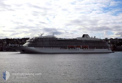
VIKING MARS
Passenger
Current Trip
| Trip Time | 13 h, 36 mins |
|---|---|
| Trip Distance | 124.53 nm |
| AVG Speed | 9.7 Knots |
| MAX Speed | 11.8 Knots |
| Dybgang | 6.6 m |
| AVG Wind | 15.7 knots |
| MAX Wind | 21 knots |
| MIN Temp | 27.2°C / 80.96°F |
| MAX Temp | 27.6°C / 81.68°F |
| Position Modtaget | 3 m siden |
Current Position
| Longitude | -88.14240° |
|---|---|
| Latitude | 17.44145° |
| Status | At anchor |
| Fart | 0.5 Knots |
| Kurs | 103° |
| Område | Caribbean Sea |
| Station | T-AIS |
| Position Modtaget | 3 m siden |
Info
Information
The current position of VIKING MARS is in Caribbean Sea with coordinates 17.44145° / -88.14240° as reported on 2025-03-09 13:52 by AIS to our vessel tracker app. The vessel's current speed is 0.5 Knots and is currently inside the port of BELIZE CITY.
The vessel VIKING MARS (IMO: 9833187, MMSI: 257800000) is a Passenger It's sailing under the flag of [NO] Norway.
In this page you can find informations about the vessels current position, last detected port calls, and current voyage information. If the vessels is not in coverage by AIS you will find the latest position.
The current position of VIKING MARS is detected by our AIS receivers and we are not responsible for the reliability of the data. The last position was recorded while the vessel was in Coverage by the Ais receivers of our vessel tracking app.
The current draught of VIKING MARS as reported by AIS is 6.6 meters
Weather
| Temperature | 27.6°C / 81.68°F |
|---|---|
| Wind Speed | 10 knots |
| Direction | 112° ESE |
| Pressure | 1011.7 hPa |
| Humidity | 74.1 % |
| Cloud Coverage | 100 % |
Featured Company
Last Port Calls
| Port | Arrival | Departure | Time In Port |
|---|---|---|---|
| 2025-03-09 12:35 | |||
| 2025-03-08 12:57 | 2025-03-08 22:59 | 10 h | |
| 2025-03-06 13:11 | 2025-03-06 23:11 | 10 h | |
| 2025-03-05 01:43 | 2025-03-05 22:26 | 20 h | |
| 2025-03-02 11:19 | 2025-03-02 19:38 | 8 h | |
| 2025-02-27 10:19 | 2025-02-27 22:17 | 11 h | |
| 2025-02-24 12:08 | 2025-02-25 02:34 | 14 h | |
| 2025-02-23 12:15 | 2025-02-23 22:59 | 10 h | |
| 2025-02-22 14:33 | 2025-02-22 23:47 | 9 h | |
| 2025-02-20 19:38 | 2025-02-20 23:07 | 3 h |
Most Visited Ports (Last year)
| Port | Arrivals | |
|---|---|---|
| 12 | ||
| 12 | ||
| 12 | ||
| 11 | ||
| 10 | ||
| 9 |
Last Trips
| Origin | Departure | Destination | Arrival | Distance | |
|---|---|---|---|---|---|
| 2025-03-08 16:59 | 2025-03-09 06:35 | 124.53 nm | |||
| 2025-03-06 17:11 | 2025-03-08 06:57 | 593.32 nm | |||
| 2025-03-05 17:26 | 2025-03-06 07:11 | 204.93 nm | |||
| 2025-03-02 14:38 | 2025-03-04 20:43 | 656.84 nm | |||
| 2025-02-27 17:17 | 2025-03-02 06:19 | 813.72 nm | |||
| 2025-02-24 21:34 | 2025-02-27 05:19 | 583.56 nm | |||
| 2025-02-23 16:59 | 2025-02-24 07:08 | 208.57 nm | |||
| 2025-02-22 17:47 | 2025-02-23 06:15 | 124.17 nm | |||
| 2025-02-20 17:07 | 2025-02-22 08:33 | 590.82 nm | |||
| 2025-02-19 17:31 | 2025-02-20 13:38 | 202.87 nm |
Events
| Tid | Hændelsen | Detaljer | Position / Dest | Info |
|---|---|---|---|---|
| 2025-03-09 13:52 | Status er ændret | At anchor Default |
17.44145 / -88.14240
[BZ] BELIZE CITY
|
Fart: 0.5 kn Kurs: 94° |
| 2025-03-09 13:28 | Status er ændret | Default At anchor |
17.44176 / -88.14205
[BZ] BELIZE CITY
|
Fart: 0.5 kn Kurs: 94° |
| 2025-03-09 13:28 | Status er ændret | At anchor Default |
17.44176 / -88.14205
[BZ] BELIZE CITY
|
Fart: 0.4 kn Kurs: 147° |
| 2025-03-09 13:10 | Indenfor Dækning |
17.44176 / -88.14205
Caribbean Sea
[BZ] BELIZE CITY
|
Fart: 0.5 kn Kurs: 72.4° |
|
| 2025-03-09 12:35 | Skibe i havn |
|
17.43125 / -88.14945
[BZ] BELIZE CITY
|
Fart: 10.4 kn Kurs: 38° |
| 2025-03-09 12:31 | Status er ændret | Default Under way using engine |
17.42388 / -88.15527
MONTEGO BAY
|
Fart: 11.8 kn Kurs: 49° |
| 2025-03-09 12:25 | Udenfor Dækning |
17.40711 / -88.17078
Caribbean Sea
[BZ] BELIZE CITY
|
Fart: 11.8 kn Kurs: 49° |
|
| 2025-03-09 12:15 | Ændre havområde | Belizean part of the Caribbean Sea Panamanian part of the Caribbean Sea |
17.38397 / -88.17740
Caribbean Sea
|
Fart: 11.3 kn Kurs: 316.5° |
| 2025-03-09 12:15 | Status er ændret | Under way using engine Default |
17.38397 / -88.17740
MONTEGO BAY
|
Fart: 10.7 kn Kurs: 321° |
| 2025-03-09 12:15 | Indenfor Dækning |
17.38397 / -88.17740
Caribbean Sea
|
Fart: 11.3 kn Kurs: 316.5° |