
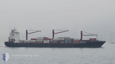
VIVALDI
Container Ship
Current Trip
| Time Travelled | 6 days |
|---|---|
| Remaining Time | --- |
| Distance Travelled | 2350.88 nm |
| Remaining Distance | --- |
| AVG Speed | 14.5 Knots |
| MAX Speed | 18 Knots |
| AVG Wind | 11.8 knots |
| MAX Wind | 17.7 knots |
| MIN Temp | 22.5°C / 72.5°F |
| MAX Temp | 32.5°C / 90.5°F |
| Dybgang | 9.3 m |
| Position Modtaget | 4 d siden |
Current Position
| Longitude | -69.72644° |
|---|---|
| Latitude | 12.86180° |
| Status | Under way using engine |
| Fart | 16.1 Knots |
| Kurs | 103.2° |
| Område | Caribbean Sea |
| Station | T-AIS |
| Position Modtaget | 4 d siden |
Info
Information
The current position of VIVALDI is in Caribbean Sea with coordinates 12.86180° / -69.72644° as reported on 2026-01-05 16:54 by AIS to our vessel tracker app. The vessel's current speed is 16.1 Knots and is heading at the port of MACAPA. The estimated time of arrival as calculated by MyShipTracking vessel tracking app is 2026-01-10 15:00 LT
The vessel VIVALDI (IMO: 9429326, MMSI: 636019606) is a Container Ship that was built in 2010 ( 16 år gamle ). It's sailing under the flag of [LR] Liberia.
In this page you can find informations about the vessels current position, last detected port calls, and current voyage information. If the vessels is not in coverage by AIS you will find the latest position.
The current position of VIVALDI is detected by our AIS receivers and we are not responsible for the reliability of the data. The last position was recorded while the vessel was in Coverage by the Ais receivers of our vessel tracking app.
The current draught of VIVALDI as reported by AIS is 9.3 meters
Weather
| Temperature | 33.1°C / 91.58°F |
|---|---|
| Wind Speed | 6 knots |
| Direction | 58° ENE |
| Pressure | 1011 hPa |
| Humidity | 43.9 % |
| Cloud Coverage | 43 % |
Featured Company
Last Port Calls
| Port | Arrival | Departure | Time In Port |
|---|---|---|---|
| 2026-01-02 17:55 | 2026-01-03 18:35 | 1 d | |
| 2026-01-01 12:58 | 2026-01-02 05:22 | 16 h | |
| 2025-12-21 00:27 | 2025-12-23 05:34 | 2 d | |
| 2025-12-14 18:39 | 2025-12-17 01:06 | 2 d | |
| 2025-12-07 18:27 | 2025-12-08 18:23 | 23 h | |
| 2025-12-02 15:50 | 2025-12-04 13:07 | 1 d | |
| 2025-11-28 19:19 | 2025-11-29 18:42 | 23 h | |
| 2025-11-19 11:33 | 2025-11-21 19:29 | 2 d | |
| 2025-11-13 13:33 | 2025-11-16 08:00 | 2 d | |
| 2025-11-06 13:46 | 2025-11-07 13:50 | 1 d |
Most Visited Ports (Last year)
| Port | Arrivals | |
|---|---|---|
| 13 | ||
| 12 | ||
| 12 | ||
| 11 | ||
| 8 | ||
| 5 |
Last Trips
| Origin | Departure | Destination | Arrival | Distance | |
|---|---|---|---|---|---|
| 2026-01-02 05:22 | 2026-01-02 17:55 | 43.47 nm | |||
| 2025-12-23 05:34 | 2026-01-01 12:58 | 2369.09 nm | |||
| 2025-12-17 01:06 | 2025-12-21 00:27 | 1136.17 nm | |||
| 2025-12-08 18:23 | 2025-12-14 18:39 | 1909.45 nm | |||
| 2025-12-04 13:07 | 2025-12-07 18:27 | 1159.15 nm | |||
| 2025-11-29 18:42 | 2025-12-02 15:50 | 71.97 nm | |||
| 2025-11-21 19:29 | 2025-11-28 19:19 | 2351.88 nm | |||
| 2025-11-16 08:00 | 2025-11-19 11:33 | 1126.03 nm | |||
| 2025-11-07 13:50 | 2025-11-13 13:33 | 1908.70 nm | |||
| 2025-11-02 19:01 | 2025-11-06 13:46 | 1149.81 nm |
Events
| Tid | Hændelsen | Detaljer | Position / Dest | Info |
|---|---|---|---|---|
| 2026-01-05 17:02 | Status er ændret | Default Under way using engine |
12.85301 / -69.68795
BRMCP
|
Fart: 16.1 kn Kurs: 103.2° |
| 2026-01-05 16:54 | Status er ændret | Under way using engine Default |
12.86180 / -69.72644
BRMCP
|
Fart: 16.1 kn Kurs: 103° |
| 2026-01-05 16:54 | Indenfor Dækning |
12.86180 / -69.72644
Caribbean Sea
BRMCP
|
Fart: 16.1 kn Kurs: 103.2° |
|
| 2026-01-05 16:54 | Udenfor Dækning |
12.86180 / -69.72644
Caribbean Sea
BRMCP
|
Fart: 16.1 kn Kurs: 103.2° |
|
| 2026-01-05 15:55 | Status er ændret | Default Under way using engine |
12.91258 / -69.99259
BRMCP
|
Fart: 16.3 kn Kurs: 91° |
| 2026-01-05 15:52 | Status er ændret | Under way using engine Default |
12.91287 / -70.00845
BRMCP
|
Fart: 16.3 kn Kurs: 91° |
| 2026-01-05 15:52 | Udenfor Dækning |
12.91287 / -70.00845
Caribbean Sea
BRMCP
|
Fart: 16.3 kn Kurs: 91° |
|
| 2026-01-05 15:46 | Status er ændret | Default Under way using engine |
12.91328 / -70.03225
BRMCP
|
Fart: 16.3 kn Kurs: 91.6° |
| 2026-01-05 15:38 | Status er ændret | Under way using engine Default |
12.91426 / -70.07135
BRMCP
|
Fart: 16.3 kn Kurs: 92° |
| 2026-01-05 15:34 | Status er ændret | Default Under way using engine |
12.91485 / -70.09000
BRMCP
|
Fart: 16.4 kn Kurs: 91.5° |