
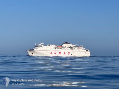
VOLCAN DE TIMANFAYA
Ro-Ro/Passenger Ship
Current Trip
| Trip Time | 10 h, 3 mins |
|---|---|
| Trip Distance | 187.27 nm |
| AVG Speed | 16.3 Knots |
| MAX Speed | 20.5 Knots |
| Dybgang | 5.4 m |
| AVG Wind | 5.5 knots |
| MAX Wind | 8.8 knots |
| MIN Temp | 9.3°C / 48.74°F |
| MAX Temp | 14.5°C / 58.1°F |
| Position Modtaget | 15 h, 31 m siden |
Current Position
| Longitude | -6.28396° |
|---|---|
| Latitude | 36.52811° |
| Status | Moored |
| Fart | |
| Kurs | --- |
| Område | North Atlantic Ocean |
| Station | T-AIS |
| Position Modtaget | 15 h, 31 m siden |
Info
Information
The current position of VOLCAN DE TIMANFAYA is in North Atlantic Ocean with coordinates 36.52811° / -6.28396° as reported on 2025-02-07 10:47 by AIS to our vessel tracker app. The vessel's current speed is 0 Knots and is currently inside the port of CADIZ.
The vessel VOLCAN DE TIMANFAYA (IMO: 9281334, MMSI: 224145000) is a Ro-Ro/Passenger Ship that was built in 2005 ( 20 år gamle ). It's sailing under the flag of [ES] Spain.
In this page you can find informations about the vessels current position, last detected port calls, and current voyage information. If the vessels is not in coverage by AIS you will find the latest position.
The current position of VOLCAN DE TIMANFAYA is detected by our AIS receivers and we are not responsible for the reliability of the data. The last position was recorded while the vessel was in Coverage by the Ais receivers of our vessel tracking app.
The current draught of VOLCAN DE TIMANFAYA as reported by AIS is 5.4 meters
Weather
| Temperature | 12.5°C / 54.5°F |
|---|---|
| Wind Speed | 3 knots |
| Direction | 107° ESE |
| Pressure | 1024 hPa |
| Humidity | 70.3 % |
| Cloud Coverage | 36 % |
Featured Company
Last Port Calls
| Port | Arrival | Departure | Time In Port |
|---|---|---|---|
| 2025-02-07 08:46 | |||
| 2025-02-06 20:17 | 2025-02-06 22:43 | 2 h | |
| 2025-02-06 06:49 | 2025-02-06 15:40 | 8 h | |
| 2025-02-05 20:19 | 2025-02-06 00:14 | 3 h | |
| 2025-02-05 06:50 | 2025-02-05 15:42 | 8 h | |
| 2025-02-04 20:31 | 2025-02-05 00:14 | 3 h | |
| 2025-02-04 06:54 | 2025-02-04 15:43 | 8 h | |
| 2025-02-03 20:43 | 2025-02-04 00:19 | 3 h | |
| 2025-02-03 06:47 | 2025-02-03 15:47 | 9 h | |
| 2025-02-02 21:41 | 2025-02-03 00:03 | 2 h |
Last Trips
| Origin | Departure | Destination | Arrival | Distance | |
|---|---|---|---|---|---|
| 2025-02-06 22:43 | 2025-02-07 08:46 | 187.27 nm | |||
| 2025-02-06 15:40 | 2025-02-06 20:17 | 91.14 nm | |||
| 2025-02-06 00:14 | 2025-02-06 06:49 | 94.71 nm | |||
| 2025-02-05 15:42 | 2025-02-05 20:19 | 94.69 nm | |||
| 2025-02-05 00:14 | 2025-02-05 06:50 | 94.31 nm | |||
| 2025-02-04 15:43 | 2025-02-04 20:31 | 94.62 nm | |||
| 2025-02-04 00:19 | 2025-02-04 06:54 | 94.69 nm | |||
| 2025-02-03 15:47 | 2025-02-03 20:43 | 94.78 nm | |||
| 2025-02-03 00:03 | 2025-02-03 06:47 | 91.42 nm | |||
| 2025-02-02 17:15 | 2025-02-02 21:41 | 91.18 nm |
Events
| Tid | Hændelsen | Detaljer | Position / Dest | Info |
|---|---|---|---|---|
| 2025-02-07 10:47 | Udenfor Dækning |
36.52811 / -6.28396
North Atlantic Ocean
[ES] CADIZ
|
Fart: Kurs: 279.1° |
|
| 2025-02-07 08:20 | Status er ændret | Moored Under way using engine |
36.52827 / -6.28409
[ES] CADIZ
|
Fart: Kurs: 220° |
| 2025-02-07 08:14 | STOP Sejllads |
36.52832 / -6.28407
[ES] CADIZ
|
Fart: 0.3 kn Kurs: 220° |
|
| 2025-02-07 07:46 | Skibe i havn |
|
36.54409 / -6.27703
[ES] CADIZ
|
Fart: 7.3 kn Kurs: 187.4° |
| 2025-02-07 06:02 | Status er ændret | Under way using engine Default |
36.17691 / -6.39672
CADIZ
|
Fart: 19.4 kn Kurs: 353° |
| 2025-02-07 06:02 | Indenfor Dækning |
36.18435 / -6.39824
North Atlantic Ocean
CADIZ
|
Fart: 19.2 kn Kurs: 350.9° |
|
| 2025-02-07 05:00 | Status er ændret | Default Under way using engine |
35.96720 / -6.13722
CADIZ
|
Fart: 19.9 kn Kurs: 268.8° |
| 2025-02-07 04:49 | Udenfor Dækning |
35.96961 / -6.06463
North Atlantic Ocean
CADIZ
|
Fart: 19.9 kn Kurs: 268.8° |
|
| 2025-02-07 04:49 | Status er ændret | Under way using engine Default |
35.96968 / -6.06111
CADIZ
|
Fart: 19.7 kn Kurs: 271° |
| 2025-02-07 04:43 | Status er ændret | Default Under way using engine |
35.96987 / -6.02203
CADIZ
|
Fart: 19.7 kn Kurs: 270° |