
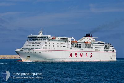
VOLCAN DE TINAMAR
Ro-Ro/Passenger Ship
Current Trip
Current Position
| Longitude | -6.28140° |
|---|---|
| Latitude | 36.53581° |
| Status | Under way using engine |
| Fart | |
| Kurs | 337° |
| Område | North Atlantic Ocean |
| Station | T-AIS |
| Position Modtaget | Nu |
Info
Information
The current position of VOLCAN DE TINAMAR is in North Atlantic Ocean with coordinates 36.53581° / -6.28140° as reported on 2025-02-08 02:02 by AIS to our vessel tracker app. The vessel's current speed is 0 Knots and is currently inside the port of CADIZ.
The vessel VOLCAN DE TINAMAR (IMO: 9506291, MMSI: 225423000) is a Ro-Ro/Passenger Ship that was built in 2011 ( 14 år gamle ). It's sailing under the flag of [ES] Spain.
In this page you can find informations about the vessels current position, last detected port calls, and current voyage information. If the vessels is not in coverage by AIS you will find the latest position.
The current position of VOLCAN DE TINAMAR is detected by our AIS receivers and we are not responsible for the reliability of the data. The last position was recorded while the vessel was in Coverage by the Ais receivers of our vessel tracking app.
The current draught of VOLCAN DE TINAMAR as reported by AIS is 6.5 meters
Weather
| Temperature | 15.3°C / 59.54°F |
|---|---|
| Wind Speed | 14 knots |
| Direction | 255° WSW |
| Pressure | 1021.5 hPa |
| Humidity | 88.5 % |
| Cloud Coverage | 83 % |
Featured Company
Last Port Calls
| Port | Arrival | Departure | Time In Port |
|---|---|---|---|
| 2025-02-07 21:56 | |||
| 2025-02-06 15:23 | 2025-02-06 16:27 | 1 h | |
| 2025-02-05 17:10 | 2025-02-06 10:17 | 17 h | |
| 2025-02-05 04:51 | 2025-02-05 11:14 | 6 h | |
| 2025-02-04 17:07 | 2025-02-04 23:30 | 6 h | |
| 2025-02-04 04:52 | 2025-02-04 11:11 | 6 h | |
| 2025-02-03 18:07 | 2025-02-03 23:27 | 5 h | |
| 2025-02-03 03:02 | 2025-02-03 15:38 | 12 h | |
| 2025-02-02 21:57 | 2025-02-03 00:31 | 2 h | |
| 2025-02-02 15:07 | 2025-02-02 16:58 | 1 h |
Most Visited Ports (Last year)
| Port | Arrivals | |
|---|---|---|
| 235 | ||
| 193 | ||
| 91 | ||
| 44 | ||
| 10 |
Last Trips
| Origin | Departure | Destination | Arrival | Distance | |
|---|---|---|---|---|---|
| 2025-02-06 16:27 | 2025-02-07 21:56 | 585.61 nm | |||
| 2025-02-06 10:17 | 2025-02-06 15:23 | 109.77 nm | |||
| 2025-02-05 11:14 | 2025-02-05 17:10 | 110.18 nm | |||
| 2025-02-04 23:30 | 2025-02-05 04:51 | 110.40 nm | |||
| 2025-02-04 11:11 | 2025-02-04 17:07 | 110.54 nm | |||
| 2025-02-03 23:27 | 2025-02-04 04:52 | 110.65 nm | |||
| 2025-02-03 15:38 | 2025-02-03 18:07 | 51.15 nm | |||
| 2025-02-03 00:31 | 2025-02-03 03:02 | 51.23 nm | |||
| 2025-02-02 16:58 | 2025-02-02 21:57 | 110.51 nm | |||
| 2025-02-01 18:04 | 2025-02-02 15:07 | 586.01 nm |
Events
| Tid | Hændelsen | Detaljer | Position / Dest | Info |
|---|---|---|---|---|
| 2025-02-07 21:04 | STOP Sejllads |
36.53599 / -6.28118
[ES] CADIZ
|
Fart: 0.2 kn Kurs: 320° |
|
| 2025-02-07 20:56 | Skibe i havn |
|
36.54341 / -6.27652
[ES] CADIZ
|
Fart: 8.8 kn Kurs: 193.5° |
| 2025-02-07 19:23 | Ændre havområde | Spanish part of the North Atlantic Ocean Spanish (Canary Islands) part of the North Atlantic Ocean |
36.25606 / -6.63646
North Atlantic Ocean
CADIZ
|
Fart: 18.5 kn Kurs: 39.1° |
| 2025-02-07 19:21 | Status er ændret | Under way using engine Default |
36.24882 / -6.64359
CADIZ
|
Fart: 18.7 kn Kurs: 38° |
| 2025-02-07 19:12 | Indenfor Dækning |
36.25606 / -6.63646
North Atlantic Ocean
CADIZ
|
Fart: 18.5 kn Kurs: 39.1° |
|
| 2025-02-06 20:05 | Status er ændret | Default Under way using engine |
30.01938 / -12.52611
CADIZ
|
Fart: 22.4 kn Kurs: 38.9° |
| 2025-02-06 20:02 | Udenfor Dækning |
30.00261 / -12.54121
North Atlantic Ocean
CADIZ
|
Fart: 22.4 kn Kurs: 38.9° |
|
| 2025-02-06 19:54 | Status er ændret | Under way using engine Default |
29.96272 / -12.57737
CADIZ
|
Fart: 22.2 kn Kurs: 38° |
| 2025-02-06 19:51 | Status er ændret | Default Under way using engine |
29.94745 / -12.59065
CADIZ
|
Fart: 22.3 kn Kurs: 37.6° |
| 2025-02-06 19:28 | Destination er ændret | CADIZ ARRECIFE |
29.83215 / -12.69476
CADIZ
|
Fart: 22.2 kn Kurs: 40.1° |