
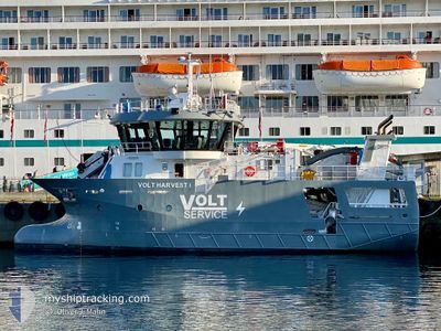
VOLT HARVEST I
Cargo
Current Trip
MOEN VERFT
| Time Travelled | 1 day |
|---|---|
| Remaining Time | --- |
| Distance Travelled | 0.76 nm |
| Remaining Distance | --- |
| AVG Speed | --- |
| MAX Speed | --- |
| AVG Wind | 24.8 knots |
| MAX Wind | 25.5 knots |
| MIN Temp | 4.5°C / 40.1°F |
| MAX Temp | 4.7°C / 40.46°F |
| Dybgang | 4.4 m |
| Position Modtaget | Nu |
Current Position
| Longitude | 11.28031° |
|---|---|
| Latitude | 64.86045° |
| Status | Moored |
| Fart | |
| Kurs | 83° |
| Område | Norwegian Sea |
| Station | T-AIS |
| Position Modtaget | Nu |
Info
Information
The current position of VOLT HARVEST I is in Norwegian Sea with coordinates 64.86045° / 11.28031° as reported on 2025-03-18 21:58 by AIS to our vessel tracker app. The vessel's current speed is 0 Knots
The vessel VOLT HARVEST I (IMO: 9923322, MMSI: 259080000) is a Cargo It's sailing under the flag of [NO] Norway.
In this page you can find informations about the vessels current position, last detected port calls, and current voyage information. If the vessels is not in coverage by AIS you will find the latest position.
The current position of VOLT HARVEST I is detected by our AIS receivers and we are not responsible for the reliability of the data. The last position was recorded while the vessel was in Coverage by the Ais receivers of our vessel tracking app.
The current draught of VOLT HARVEST I as reported by AIS is 4.4 meters
Weather
| Temperature | 4.4°C / 39.92°F |
|---|---|
| Wind Speed | 25 knots |
| Direction | 301° WNW |
| Pressure | 1013.4 hPa |
| Humidity | 68.5 % |
| Cloud Coverage | 100 % |
Featured Company
Last Port Calls
| Port | Arrival | Departure | Time In Port |
|---|---|---|---|
| 2025-03-17 04:31 | 2025-03-17 09:27 | 4 h | |
| 2025-03-15 07:55 | 2025-03-15 17:46 | 9 h | |
| 2025-03-14 14:20 | 2025-03-14 14:35 | 14 m | |
| 2025-03-10 14:11 | 2025-03-10 14:39 | 28 m | |
| 2025-03-07 06:04 | 2025-03-08 06:22 | 1 d | |
| 2025-03-07 01:17 | |||
| 2025-03-03 11:11 | 2025-03-04 05:25 | 18 h | |
| 2025-03-01 01:07 | 2025-03-03 10:42 | 2 d | |
| 2025-02-25 12:40 | 2025-02-25 15:10 | 2 h | |
| 2025-02-21 14:14 | 2025-02-21 14:53 | 38 m |
Most Visited Ports (Last year)
| Port | Arrivals | |
|---|---|---|
| 24 | ||
| 11 | ||
| 7 | ||
| 6 | ||
| 5 | ||
| 4 |
Last Trips
| Origin | Departure | Destination | Arrival | Distance | |
|---|---|---|---|---|---|
| 2025-03-15 17:46 | 2025-03-17 04:31 | 105.89 nm | |||
| 2025-03-14 14:35 | 2025-03-15 07:55 | 121.98 nm | |||
| 2025-03-10 14:39 | 2025-03-14 14:20 | 464.65 nm | |||
| 2025-03-08 06:22 | 2025-03-10 14:11 | 267.96 nm | |||
| 2025-03-07 01:17 | 2025-03-07 06:04 | 39.78 nm | |||
| 2025-03-03 10:42 | 2025-03-03 11:11 | 1.01 nm | |||
| 2025-02-25 15:10 | 2025-03-01 01:07 | 433.19 nm | |||
| 2025-02-21 14:53 | 2025-02-25 12:40 | 464.41 nm | |||
| 2025-02-17 06:00 | 2025-02-21 14:14 | 501.58 nm | |||
| 2025-02-15 18:45 | 2025-02-16 18:45 | 215.73 nm |
Events
| Tid | Hændelsen | Detaljer | Position / Dest | Info |
|---|---|---|---|---|
| 2025-03-17 08:51 | ETA er ændret | 2025/03/17 09:45 2025/03/17 10:00 |
64.86048 / 11.28019
MOEN VERFT
|
Fart: Kurs: 83° |
| 2025-03-17 08:40 | STOP Sejllads | 0.16 nm, North West of OTTERSOYA |
64.86049 / 11.27998
MOEN VERFT
|
Fart: 0.2 kn Kurs: 95° |
| 2025-03-17 08:28 | Destination er ændret | MOEN VERFT RORVIK |
64.85940 / 11.25080
MOEN VERFT
|
Fart: 5.8 kn Kurs: 96° |
| 2025-03-17 08:28 | ETA er ændret | 2025/03/17 10:00 2025/03/17 04:15 |
64.85940 / 11.25080
MOEN VERFT
|
Fart: 5.8 kn Kurs: 96° |
| 2025-03-17 08:27 | START Sejllads | 0.42 nm, East of ROERVIK |
64.85940 / 11.25080
RORVIK
|
Fart: 5.8 kn Kurs: 96° |
| 2025-03-17 08:27 | Afsejlet fra sidste havn |
|
64.85940 / 11.25080
RORVIK
|
Fart: 4.6 kn Kurs: 121° |
| 2025-03-17 04:05 | Status er ændret | Moored Under way using engine |
64.86135 / 11.24150
[NO] ROERVIK
|
Fart: Kurs: 224° |
| 2025-03-17 03:31 | Skibe i havn |
|
64.86097 / 11.24216
[NO] ROERVIK
|
Fart: 0.2 kn Kurs: 304° |
| 2025-03-17 03:27 | STOP Sejllads | 0.25 nm, North East of ROERVIK |
64.86073 / 11.24274
RORVIK
|
Fart: 0.3 kn Kurs: 316° |
| 2025-03-17 02:53 | Destination er ændret | RORVIK HELLERFLESA |
64.82016 / 11.15651
RORVIK
|
Fart: 9.4 kn Kurs: 42.2° |