
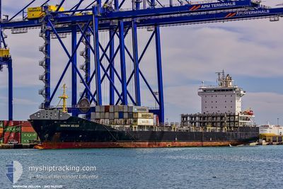
WARNOW BELUGA
Container Ship
Current Trip
| Time Travelled | 2 days |
|---|---|
| Remaining Time | 17 h, 4 mins |
| Distance Travelled | 1012.81 nm |
| Remaining Distance | 268.47 nm |
| AVG Speed | 13.8 Knots |
| MAX Speed | 17.6 Knots |
| AVG Wind | 12.4 knots |
| MAX Wind | 20 knots |
| MIN Temp | 21.8°C / 71.24°F |
| MAX Temp | 26.9°C / 80.42°F |
| Dybgang | 8.7 m |
| Position Modtaget | 2 d siden |
Current Position
| Longitude | -79.65180° |
|---|---|
| Latitude | 25.37999° |
| Status | Under way using engine |
| Fart | 14.1 Knots |
| Kurs | 180.2° |
| Område | North Atlantic Ocean |
| Station | T-AIS |
| Position Modtaget | 2 d siden |
Info
Information
The current position of WARNOW BELUGA is in North Atlantic Ocean with coordinates 25.37999° / -79.65180° as reported on 2025-02-08 17:25 by AIS to our vessel tracker app. The vessel's current speed is 14.1 Knots and is heading at the port of MOIN. The estimated time of arrival as calculated by MyShipTracking vessel tracking app is 2025-02-12 02:21 LT
The vessel WARNOW BELUGA (IMO: 9437127, MMSI: 305258000) is a Container Ship that was built in 2008 ( 17 år gamle ). It's sailing under the flag of [AG] Antigua Barbuda.
In this page you can find informations about the vessels current position, last detected port calls, and current voyage information. If the vessels is not in coverage by AIS you will find the latest position.
The current position of WARNOW BELUGA is detected by our AIS receivers and we are not responsible for the reliability of the data. The last position was recorded while the vessel was in Coverage by the Ais receivers of our vessel tracking app.
The current draught of WARNOW BELUGA as reported by AIS is 8.7 meters
Weather
| Temperature | 26.2°C / 79.16°F |
|---|---|
| Wind Speed | 20 knots |
| Direction | 69° ENE |
| Pressure | 1011.8 hPa |
| Humidity | 79.7 % |
| Cloud Coverage | 100 % |
Featured Company
Last Port Calls
| Port | Arrival | Departure | Time In Port |
|---|---|---|---|
| 2025-02-07 06:15 | 2025-02-08 12:45 | 1 d | |
| 2025-02-07 05:50 | 2025-02-07 05:59 | 9 m | |
| 2025-01-31 23:52 | 2025-02-01 14:26 | 14 h | |
| 2025-01-25 00:24 | 2025-01-25 08:57 | 8 h | |
| 2025-01-24 15:02 | 2025-01-25 00:19 | 9 h | |
| 2025-01-24 08:43 | |||
| 2025-01-24 08:20 | 2025-01-24 08:27 | 7 m | |
| 2025-01-22 22:27 | 2025-01-23 05:39 | 7 h | |
| 2025-01-21 12:14 | 2025-01-21 22:39 | 10 h | |
| 2025-01-21 11:49 | 2025-01-21 11:57 | 8 m |
Most Visited Ports (Last year)
| Port | Arrivals | |
|---|---|---|
| 53 | ||
| 51 | ||
| 26 | ||
| 23 |
Last Trips
| Origin | Departure | Destination | Arrival | Distance | |
|---|---|---|---|---|---|
| 2025-02-07 00:59 | 2025-02-07 01:15 | 1.03 nm | |||
| 2025-02-01 09:26 | 2025-02-07 00:50 | 1477.50 nm | |||
| 2025-01-25 03:57 | 2025-01-31 18:52 | 1489.81 nm | |||
| 2025-01-24 19:19 | 2025-01-24 19:24 | 0.85 nm | |||
| 2025-01-24 03:27 | 2025-01-24 10:02 | 2.57 nm | |||
| 2025-01-24 03:27 | 2025-01-24 03:43 | 1.06 nm | |||
| 2025-01-23 00:39 | 2025-01-24 03:20 | 307.16 nm | |||
| 2025-01-21 17:39 | 2025-01-22 17:27 | 302.32 nm | |||
| 2025-01-21 06:57 | 2025-01-21 07:14 | 1.05 nm | |||
| 2025-01-16 12:31 | 2025-01-21 06:49 | 1476.61 nm |
Events
| Tid | Hændelsen | Detaljer | Position / Dest | Info |
|---|---|---|---|---|
| 2025-02-08 17:28 | Status er ændret | Default Under way using engine |
25.36933 / -79.65189
CRMOB
|
Fart: 14.1 kn Kurs: 180.2° |
| 2025-02-08 17:25 | Status er ændret | Under way using engine Default |
25.37999 / -79.65180
CRMOB
|
Fart: 13.8 kn Kurs: 181° |
| 2025-02-08 17:25 | Udenfor Dækning |
25.37999 / -79.65180
North Atlantic Ocean
CRMOB
|
Fart: 14.1 kn Kurs: 180.2° |
|
| 2025-02-08 17:12 | Status er ændret | Default Under way using engine |
25.42851 / -79.65099
CRMOB
|
Fart: 13.8 kn Kurs: 179.9° |
| 2025-02-08 15:16 | Status er ændret | Under way using engine Default |
25.81857 / -79.66189
CRMOB
|
Fart: 9.7 kn Kurs: 176° |
| 2025-02-08 15:12 | Status er ændret | Default Under way using engine |
25.82890 / -79.66255
CRMOB
|
Fart: 9.7 kn Kurs: 174.3° |
| 2025-02-08 14:56 | Ændre havområde | Bahamas part of the North Atlantic Ocean United States part of the North Atlantic Ocean |
25.86970 / -79.69151
North Atlantic Ocean
CRMOB
|
Fart: 14 kn Kurs: 122.2° |
| 2025-02-08 12:45 | Afsejlet fra sidste havn |
|
26.08759 / -80.11364
CRMOB
|
Fart: 5.3 kn Kurs: 345° |
| 2025-02-08 12:36 | START Sejllads |
26.07422 / -80.11468
[US] FORT LAUDERDALE
|
Fart: 3.1 kn Kurs: 8° |
|
| 2025-02-08 12:03 | Status er ændret | Under way using engine Moored |
26.06700 / -80.11560
[US] FORT LAUDERDALE
|
Fart: Kurs: 205° |