

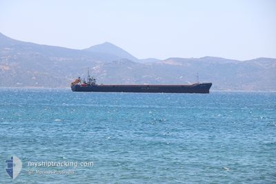
WHARFE RIVER
General Cargo

Current Trip
| Trip Time | 9 days |
|---|---|
| Trip Distance | 1433.77 nm |
| AVG Speed | 7.8 Knots |
| MAX Speed | 10.6 Knots |
| Dybgang | 5 m |
| AVG Wind | 9.4 knots |
| MAX Wind | 20 knots |
| MIN Temp | 16.2°C / 61.16°F |
| MAX Temp | 25.2°C / 77.36°F |
| Position Modtaget | 2 d siden |
Current Position
| Longitude | 7.96198° |
|---|---|
| Latitude | 37.48607° |
| Status | Under way using engine |
| Fart | 8.4 Knots |
| Kurs | 246.1° |
| Område | Mediterranean Sea - Western Basin |
| Station | T-AIS |
| Position Modtaget | 2 d siden |
Information
The current position of WHARFE RIVER is in Mediterranean Sea - Western Basin with coordinates 37.48607° / 7.96198° as reported on 2025-06-06 05:12 by AIS to our vessel tracker app. The vessel's current speed is 8.4 Knots and is currently inside the port of SKIKDA.
The vessel WHARFE RIVER (IMO: 8903052, MMSI: 370804000) is a General Cargo that was built in 1991 ( 34 år gamle ). It's sailing under the flag of [PA] Panama.
In this page you can find informations about the vessels current position, last detected port calls, and current voyage information. If the vessels is not in coverage by AIS you will find the latest position.
The current position of WHARFE RIVER is detected by our AIS receivers and we are not responsible for the reliability of the data. The last position was recorded while the vessel was in Coverage by the Ais receivers of our vessel tracking app.
The current draught of WHARFE RIVER as reported by AIS is 5 meters
Weather
| Temperature | 22.4°C / 72.32°F |
|---|---|
| Wind Speed | 4 knots |
| Direction | 61° ENE |
| Pressure | 1018.5 hPa |
| Humidity | 82.1 % |
| Cloud Coverage | 5 % |


Featured Company
Events
| Tid | Hændelsen | Detaljer | Position / Dest | Info |
|---|---|---|---|---|
| 2025-06-07 11:30 | STOP Sejllads |
36.88653 / 6.90893
[DZ] SKIKDA
|
Fart: 0.3 kn Kurs: 132° |
|
| 2025-06-07 11:23 | Skibe i havn |
|
36.88703 / 6.90919
[DZ] SKIKDA
|
Fart: 5.5 kn Kurs: 232° |
| 2025-06-07 11:07 | START Sejllads | 0.89 nm, East of STORA |
36.89777 / 6.89767
DZSKI
|
Fart: 5.5 kn Kurs: 232° |
| 2025-06-06 13:57 | STOP Sejllads | 1.73 nm, North of SKIKDA |
36.91911 / 6.92061
DZSKI
|
Fart: 0.1 kn Kurs: 91° |
| 2025-06-06 05:17 | Status er ændret | Default Under way using engine |
37.48152 / 7.94879
DZSKI
|
Fart: 8.4 kn Kurs: 246.1° |
| 2025-06-06 05:12 | Fundet i havområde | Algerian part of the Mediterranean Sea - Western Basin |
37.48607 / 7.96198
Mediterranean Sea - Western Basin
|
Fart: 8.4 kn Kurs: 246.1° |
| 2025-06-06 05:12 | Status er ændret | Under way using engine Default |
37.48607 / 7.96198
DZSKI
|
Fart: 8.5 kn Kurs: 246° |
| 2025-06-06 05:12 | Indenfor Dækning |
37.48607 / 7.96198
Mediterranean Sea - Western Basin
|
Fart: 8.4 kn Kurs: 246.1° |
|
| 2025-06-06 05:12 | Udenfor Dækning |
37.48607 / 7.96198
Mediterranean Sea - Western Basin
|
Fart: 8.4 kn Kurs: 246.1° |
|
| 2025-06-06 02:47 | Udenfor Dækning |
37.61694 / 8.35948
Mediterranean Sea - Western Basin
|
Fart: 7.8 kn Kurs: 235.7° |