
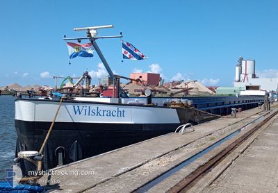
WILSKRACHT
Other Type
Current Trip
| Time Travelled | 23 h, 15 mins |
|---|---|
| Remaining Time | 1 h, 41 mins |
| Distance Travelled | 88.69 nm |
| Remaining Distance | 14.79 nm |
| AVG Speed | 7.1 Knots |
| MAX Speed | 8.7 Knots |
| AVG Wind | 13.4 knots |
| MAX Wind | 18.6 knots |
| MIN Temp | 0.6°C / 33.08°F |
| MAX Temp | 3.4°C / 38.12°F |
| Dybgang | 1.7 m |
| Position Modtaget | 1 m siden |
Current Position
| Longitude | 5.00612° |
|---|---|
| Latitude | 52.33788° |
| Status | Under way using engine |
| Fart | 8.2 Knots |
| Kurs | 127.9° |
| Område | North Sea |
| Station | T-AIS |
| Position Modtaget | 1 m siden |
Info
Information
The current position of WILSKRACHT is in North Sea with coordinates 52.33788° / 5.00612° as reported on 2025-02-11 17:04 by AIS to our vessel tracker app. The vessel's current speed is 8.2 Knots and is heading at the port of UTRECHT. The estimated time of arrival as calculated by MyShipTracking vessel tracking app is 2025-02-11 18:46 LT
The vessel WILSKRACHT (MMSI: 244630112) is a Other Type It's sailing under the flag of [NL] Netherlands.
In this page you can find informations about the vessels current position, last detected port calls, and current voyage information. If the vessels is not in coverage by AIS you will find the latest position.
The current position of WILSKRACHT is detected by our AIS receivers and we are not responsible for the reliability of the data. The last position was recorded while the vessel was in Coverage by the Ais receivers of our vessel tracking app.
The current draught of WILSKRACHT as reported by AIS is 1.7 meters
Weather
| Temperature | 2.7°C / 36.86°F |
|---|---|
| Wind Speed | 6 knots |
| Direction | 156° SSE |
| Pressure | 1017.4 hPa |
| Humidity | 97.2 % |
| Cloud Coverage | 100 % |
Featured Company
Last Port Calls
| Port | Arrival | Departure | Time In Port |
|---|---|---|---|
| 2025-02-07 12:39 | 2025-02-10 17:50 | 3 d | |
| 2025-02-07 05:52 | 2025-02-07 12:18 | 6 h | |
| 2025-02-07 03:48 | 2025-02-07 05:11 | 1 h | |
| 2025-02-05 22:38 | 2025-02-06 10:56 | 12 h | |
| 2025-02-05 21:42 | 2025-02-05 22:12 | 29 m | |
| 2025-02-05 17:17 | 2025-02-05 17:55 | 37 m | |
| 2025-02-04 16:10 | 2025-02-05 15:07 | 22 h | |
| 2025-02-04 12:09 | 2025-02-04 13:07 | 57 m | |
| 2025-02-04 10:20 | 2025-02-04 10:22 | 1 m | |
| 2025-02-03 20:44 | 2025-02-04 06:50 | 10 h |
Most Visited Ports (Last year)
| Port | Arrivals | |
|---|---|---|
| 35 | ||
| 14 | ||
| 7 | ||
| 7 | ||
| 6 | ||
| 6 |
Last Trips
| Origin | Departure | Destination | Arrival | Distance | |
|---|---|---|---|---|---|
| 2025-02-07 13:18 | 2025-02-07 13:39 | 1.49 nm | |||
| 2025-02-07 06:11 | 2025-02-07 06:52 | 2.43 nm | |||
| 2025-02-06 11:56 | 2025-02-07 04:48 | 90.95 nm | |||
| 2025-02-05 23:12 | 2025-02-05 23:38 | 3.86 nm | |||
| 2025-02-05 18:55 | 2025-02-05 22:42 | 29.35 nm | |||
| 2025-02-05 16:07 | 2025-02-05 18:17 | 13.45 nm | |||
| 2025-02-04 14:07 | 2025-02-04 17:10 | 12.18 nm | |||
| 2025-02-04 11:22 | 2025-02-04 13:09 | 9.39 nm | |||
| 2025-02-04 11:22 | 2025-02-04 11:20 | 9.39 nm | |||
| 2025-02-03 10:45 | 2025-02-03 21:44 | 74.65 nm |
Events
| Tid | Hændelsen | Detaljer | Position / Dest | Info |
|---|---|---|---|---|
| 2025-02-11 16:37 | START Sejllads | 0.24 nm, West of SCHELLINGWOUDE |
52.38041 / 4.95821
VAN A NAAR BETER
|
Fart: 4.6 kn Kurs: 286° |
| 2025-02-11 16:28 | STOP Sejllads | 0.16 nm, South West of SCHELLINGWOUDE |
52.37962 / 4.96107
VAN A NAAR BETER
|
Fart: Kurs: 511° |
| 2025-02-11 13:51 | START Sejllads | 0.16 nm, West of LELYSTAD |
52.52572 / 5.43454
VAN A NAAR BETER
|
Fart: 4.8 kn Kurs: 185.1° |
| 2025-02-11 13:41 | STOP Sejllads | 0.17 nm, North West of LELYSTAD |
52.52763 / 5.43476
VAN A NAAR BETER
|
Fart: Kurs: 511° |
| 2025-02-11 13:37 | START Sejllads | 0.31 nm, North West of LELYSTAD |
52.53081 / 5.43475
VAN A NAAR BETER
|
Fart: 3.3 kn Kurs: 174.6° |
| 2025-02-11 13:24 | STOP Sejllads | 0.43 nm, North of LELYSTAD |
52.53312 / 5.43582
VAN A NAAR BETER
|
Fart: Kurs: 511° |
| 2025-02-11 10:41 | START Sejllads | 1.01 nm, West of LEMMER |
52.84616 / 5.67318
VAN A NAAR BETER
|
Fart: 6.6 kn Kurs: 196.5° |
| 2025-02-11 10:33 | Indenfor Dækning |
52.85246 / 5.67704
North Sea
|
Fart: Kurs: 0° |
|
| 2025-02-11 09:22 | Udenfor Dækning |
52.97117 / 5.69050
North Sea
|
Fart: 6 kn Kurs: 179.3° |
|
| 2025-02-11 08:06 | Indenfor Dækning |
53.06190 / 5.80139
North Sea
|
Fart: 5.7 kn Kurs: 225.4° |