
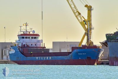
WILSON HOLLA
General Cargo
Current Trip
NORMV
| Time Travelled | 22 h, 35 mins |
|---|---|
| Remaining Time | --- |
| Distance Travelled | 42.61 nm |
| Remaining Distance | --- |
| AVG Speed | 11.2 Knots |
| MAX Speed | 11.9 Knots |
| AVG Wind | 3.7 knots |
| MAX Wind | 4.8 knots |
| MIN Temp | -10.4°C / 13.28°F |
| MAX Temp | -2.6°C / 27.32°F |
| Dybgang | 4.3 m |
| Position Modtaget | 2 m siden |
Current Position
| Longitude | 7.40410° |
|---|---|
| Latitude | 62.95727° |
| Status | Moored |
| Fart | |
| Kurs | 107° |
| Område | Norwegian Sea |
| Station | T-AIS |
| Position Modtaget | 2 m siden |
Info
Information
The current position of WILSON HOLLA is in Norwegian Sea with coordinates 62.95727° / 7.40410° as reported on 2025-02-14 12:44 by AIS to our vessel tracker app. The vessel's current speed is 0 Knots
The vessel WILSON HOLLA (IMO: 9229130, MMSI: 314455000) is a General Cargo that was built in 2002 ( 23 år gamle ). It's sailing under the flag of [BB] Barbados.
In this page you can find informations about the vessels current position, last detected port calls, and current voyage information. If the vessels is not in coverage by AIS you will find the latest position.
The current position of WILSON HOLLA is detected by our AIS receivers and we are not responsible for the reliability of the data. The last position was recorded while the vessel was in Coverage by the Ais receivers of our vessel tracking app.
The current draught of WILSON HOLLA as reported by AIS is 4.3 meters
Weather
| Temperature | -1.1°C / 30.02°F |
|---|---|
| Wind Speed | 3 knots |
| Direction | 237° WSW |
| Pressure | 1028 hPa |
| Humidity | 80.7 % |
| Cloud Coverage | 98 % |
Featured Company
Last Port Calls
| Port | Arrival | Departure | Time In Port |
|---|---|---|---|
| 2025-02-11 08:48 | 2025-02-13 14:11 | 2 d | |
| 2025-02-06 20:52 | 2025-02-07 16:09 | 19 h | |
| 2025-02-02 01:29 | 2025-02-04 12:02 | 2 d | |
| 2025-01-30 16:05 | 2025-01-31 15:18 | 23 h | |
| 2025-01-28 18:24 | 2025-01-29 13:00 | 18 h | |
| 2025-01-26 22:29 | 2025-01-28 07:36 | 1 d | |
| 2025-01-19 11:46 | 2025-01-22 17:12 | 3 d | |
| 2025-01-13 18:32 | 2025-01-14 12:01 | 17 h | |
| 2025-01-12 14:28 | 2025-01-13 17:22 | 1 d | |
| 2025-01-10 04:25 | 2025-01-12 13:49 | 2 d |
Last Trips
| Origin | Departure | Destination | Arrival | Distance | |
|---|---|---|---|---|---|
| 2025-02-07 17:09 | 2025-02-11 09:48 | 251.82 nm | |||
| 2025-02-04 13:02 | 2025-02-06 21:52 | 498.82 nm | |||
| 2025-01-31 16:18 | 2025-02-02 02:29 | 341.73 nm | |||
| 2025-01-29 14:00 | 2025-01-30 17:05 | 269.22 nm | |||
| 2025-01-28 08:36 | 2025-01-28 19:24 | 101.76 nm | |||
| 2025-01-22 18:12 | 2025-01-26 23:29 | 490.34 nm | |||
| 2025-01-14 13:01 | 2025-01-19 12:46 | 1018.23 nm | |||
| 2025-01-13 18:22 | 2025-01-13 19:32 | 12.04 nm | |||
| 2025-01-12 14:49 | 2025-01-12 15:28 | 4.98 nm | |||
| 2025-01-10 02:59 | 2025-01-10 05:25 | 18.33 nm |
Events
| Tid | Hændelsen | Detaljer | Position / Dest | Info |
|---|---|---|---|---|
| 2025-02-14 12:35 | Status er ændret | Moored Default |
62.95727 / 7.40411
NORMV
|
Fart: Kurs: 107° |
| 2025-02-14 11:44 | Status er ændret | Default Moored |
62.95730 / 7.40409
NORMV
|
Fart: Kurs: 107° |
| 2025-02-14 11:14 | Status er ændret | Moored Default |
62.95731 / 7.40414
NORMV
|
Fart: Kurs: 107° |
| 2025-02-14 10:35 | Status er ændret | Default Moored |
62.95731 / 7.40411
NORMV
|
Fart: Kurs: 107° |
| 2025-02-14 09:26 | Status er ændret | Moored Default |
62.95732 / 7.40412
NORMV
|
Fart: Kurs: 107° |
| 2025-02-14 09:20 | Status er ændret | Default Moored |
62.95731 / 7.40409
NORMV
|
Fart: Kurs: 107° |
| 2025-02-13 18:38 | Status er ændret | Moored Under way using engine |
62.95731 / 7.40416
NORMV
|
Fart: Kurs: 107° |
| 2025-02-13 18:13 | STOP Sejllads | 1.49 nm, South East of LYNGSTAD |
62.95737 / 7.40408
NORMV
|
Fart: 0.2 kn Kurs: 111° |
| 2025-02-13 14:18 | Status er ændret | Under way using engine Moored |
62.70983 / 8.52650
NORMV
|
Fart: 11.1 kn Kurs: 338.2° |
| 2025-02-13 14:11 | Afsejlet fra sidste havn |
|
62.69203 / 8.54290
NORMV
|
Fart: 8.6 kn Kurs: 341° |